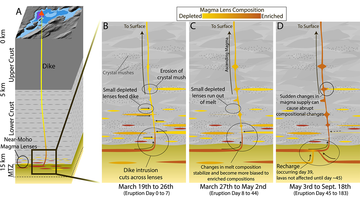
Iceland’s recent basalt eruptions originated at the crust-mantle boundary and show chemical variability over remarkably short timescales of weeks, suggesting exchanges between diverse magma sources.
Editors’ Highlights

Posted inEditors' Highlights
Past Fracture Damage Can Inhibit Earthquake Slip
Around the surface rupture of the 2008 Wenchuan earthquake, a new study documents an anti-correlation between pre-existing fracture damage and earthquake slip – implying that damage inhibited slip.
Posted inEditors' Highlights
Diverse Seismic Response in Hectometer-Scale Fracture System
An underground experiment with multi-stage stimulations reveals diverse seismic responses within a complex hectometer-scale fracture network, shedding light on induced seismicity behaviors at field scale.

Posted inEditors' Highlights
Logjams Promote Floodplain Complexity and Hydraulic Resistance
Using a new model, scientists compare logjam hydraulic impact across 37 reaches observed over 11 years in the Colorado Rockies.

Posted inEditors' Highlights
What Research Supports Climate Resilience? Ask the Community!
Co-production of research activities to support the Philadelphia region in climate resiliency was developed through a Climate Resilience Research Agenda involving over 60 community organizations.

Posted inEditors' Highlights
120 Years of Geodetic Data on Kīlauea’s Décollement
A new study explores the deformation and stress changes of Kīlauea’s décollement from 1898 to 2018 by collating an unprecedented 120 years of geodetic data.
Posted inEditors' Highlights
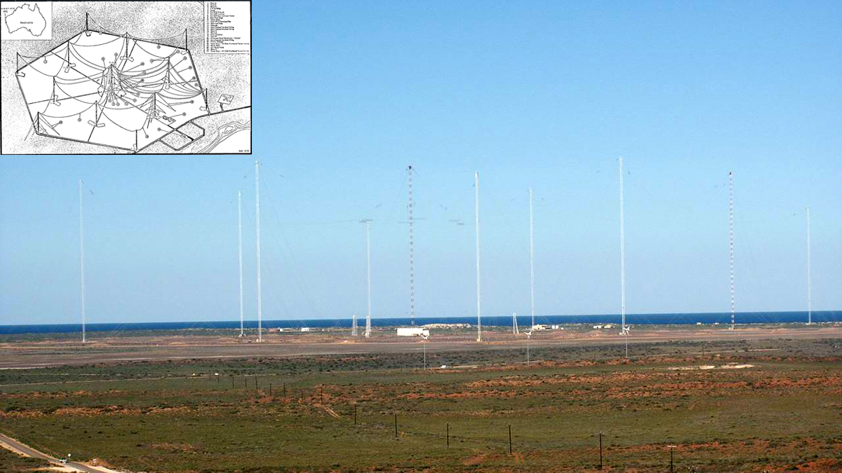
Ground-based Transmitters Cause Radiation Belt Electron Loss
A U.S. Navy transmitter in Australia produces wisps of electron loss as observed by the Colorado Inner Radiation Belt Experiment (CIRBE) CubeSat in Low Earth Orbit.
Posted inEditors' Highlights
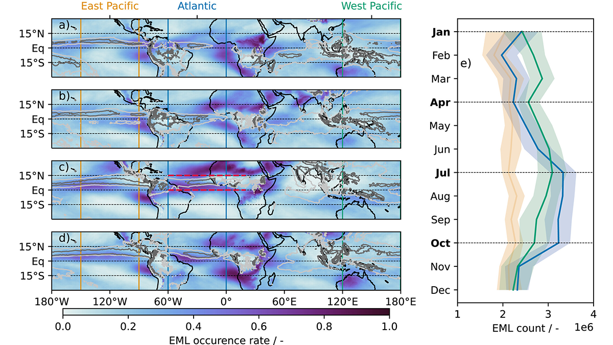
Characteristics of Moist Layers over the Tropical Atlantic
In a new study, characteristics of elevated moist layers, their seasonality, spatial distribution, structure, and the coupling of mid-tropospheric circulation and convection are examined over the tropical Atlantic.
Posted inEditors' Highlights
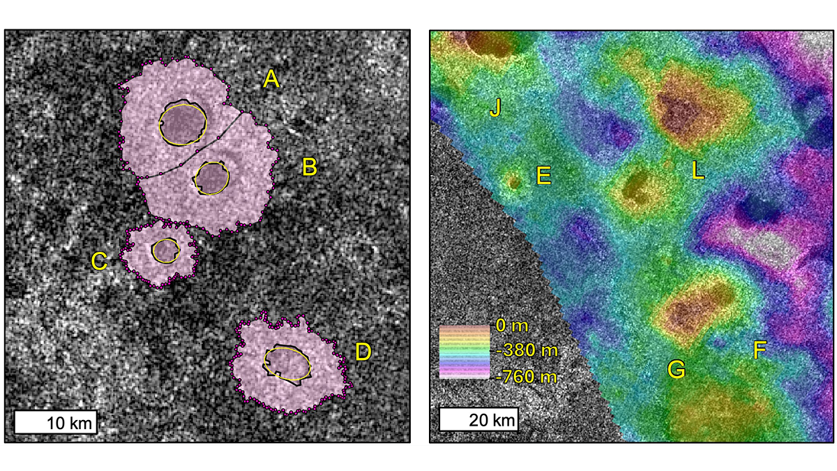
The Explosive Origins of Titan’s Rampart Craters
In a new study, volcanic explosions are explored and modeled to understand the possible origins of rampart craters on Titan and determine whether their formation can source atmospheric methane.
Posted inEditors' Highlights
Compositional Anomalies Complicate Our Model of Mantle Convection
A new study expands on recent research which suggests that oceanic crust accumulates in the mid-mantle. The new seismological constraints advance our understanding of thermo-chemical planetary evolution.