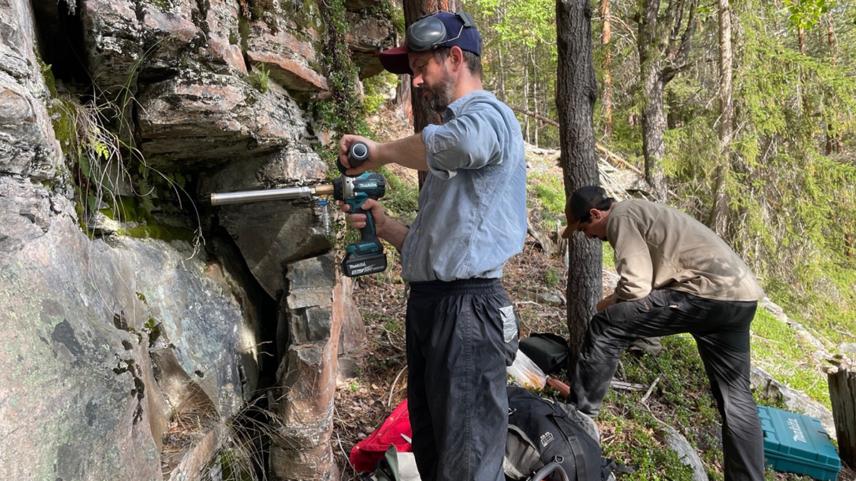
When collecting a finite number of paleomagnetic samples, having more sites, each with only one sample, achieves superior results compared to sites with multiple samples.
Editors’ Highlights
Posted inEditors' Highlights
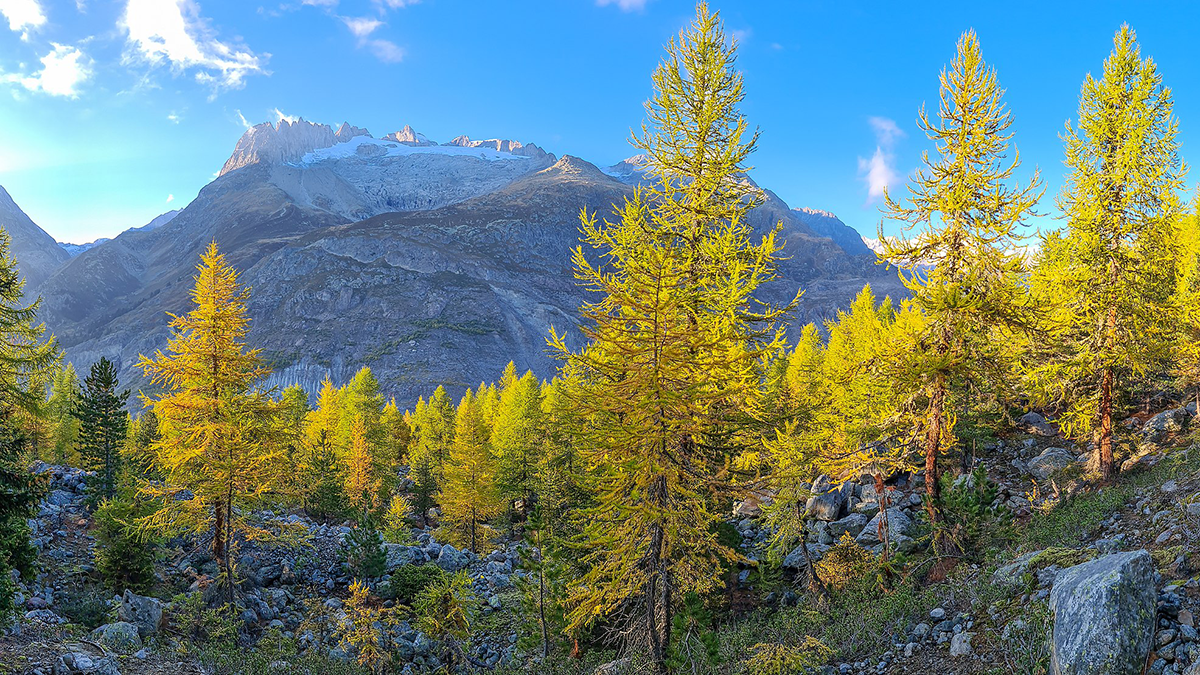
Grow-Fast-Die-Young Strategy Increases Swiss Forest Biomass
Climate change and CO2 fertilization can increase both growth and mortality of trees. The net effect on forest biomass depends on that trade-off, which long-term studies in Switzerland reveal.
Posted inEditors' Highlights
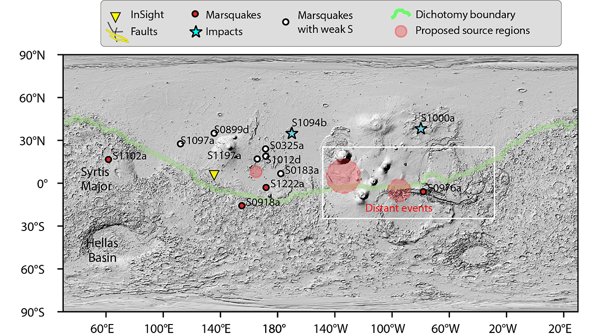
Where the Wild Marsquakes Are
A new analysis of the seismic data gathered by the InSight lander reveals that marsquakes occur across a much larger area of the planet than previously believed.
Posted inEditors' Highlights
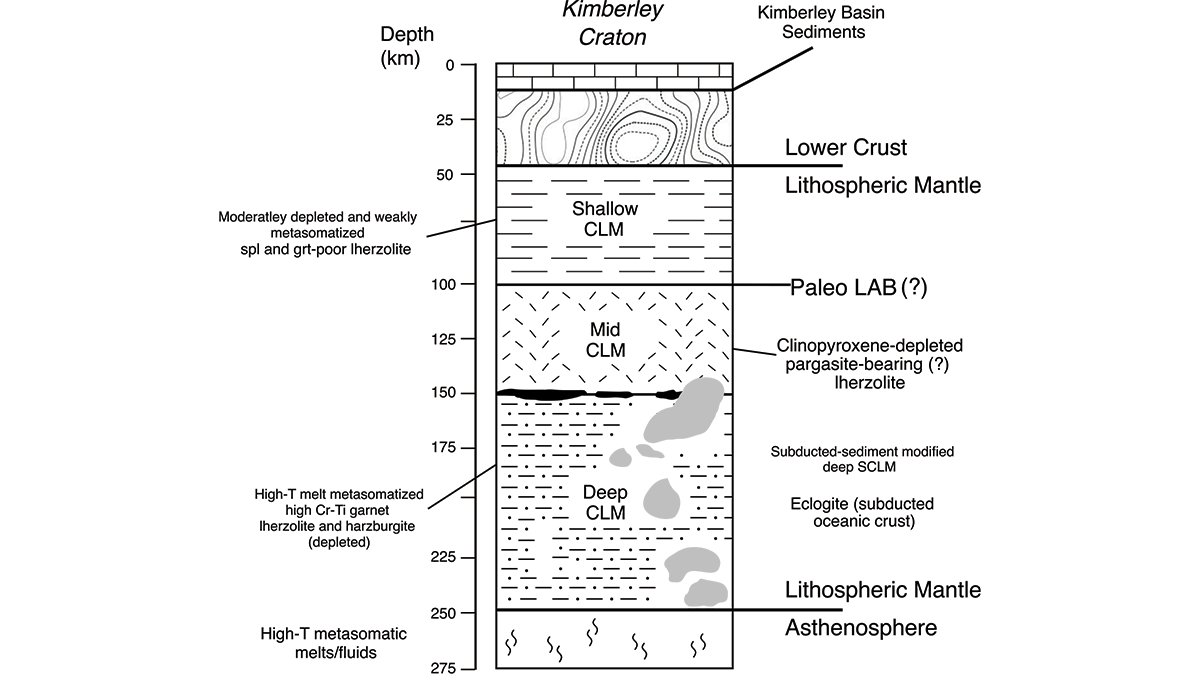
Piecing Together the Roots of the Ancient Australian Continent
Mineral compositions from numerous volcanic rocks that sample the mantle keel beneath Western Australia’s Kimberley Craton reveal the temperature and mineralogy that explain its long-lived stability.

Posted inEditors' Highlights
New Aerosol Model Better Represents Black Carbon Properties
An improved representation for black carbon microphysical and optical properties alleviates overestimations of aerosol absorption efficiency in global climate models.

Posted inEditors' Highlights
Rift-to-Ridge: Mid-Atlantic Ridge Segments Imprinted During Rifting
A new seismic study shows that magmatism along the eastern North American rift margin was segmented, and that rift discontinuities influence formation of fracture zones along the Mid-Atlantic Ridge.
Posted inEditors' Highlights
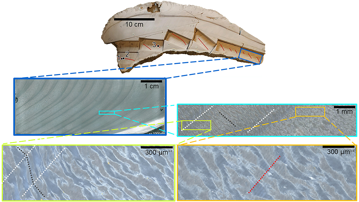
Ultra-High-Resolution Age Model in Clams Yields Daily Paleo-Data
Using geochemical techniques, scientists identify daily cycles in fossilized giant clams, which permits climate reconstructions at the weather timescale.

Posted inEditors' Highlights
Melting Glaciers as a Source of Lead in Coastal Waters
New experiments show how lead circulates through glaciers, meltwater, and sediments in polar environments.

Posted inEditors' Highlights
Desert Landscape Evolution Controlled by Storm Intensity
A new study in the Negev Desert finds that long-term erosion of a desert escarpment occurs in drier areas where intense storms are most frequent.

Posted inEditors' Highlights
Warming Reduces Relative Humidity Through Soil Moisture
Relative humidity over land decreases in a warmer climate as a result of interactive soil moisture response.