Source: Paleoceanography and Paleoclimatology
The concentration of carbon dioxide in Earth’s atmosphere as of June 2020 exceeds 416 parts per million, a level not seen since the mid-Pliocene warm period approximately 3 million years ago. Indeed, the entire Pliocene (5.33–2.58 million years ago) serves as a potential analogue for our present and future climate.
Scientists often turn to the stratigraphic record to understand Earth’s history. Geological proxies like fossilized flora and fauna indicate that temperatures during the Pliocene were about 3°F–5°F (2.7°C–4.0°C) hotter than those in the preindustrial era. Coastal rocks and sediments can also help identify the Pliocene’s elevated sea levels from a time when polar ice extents were drastically smaller than today.
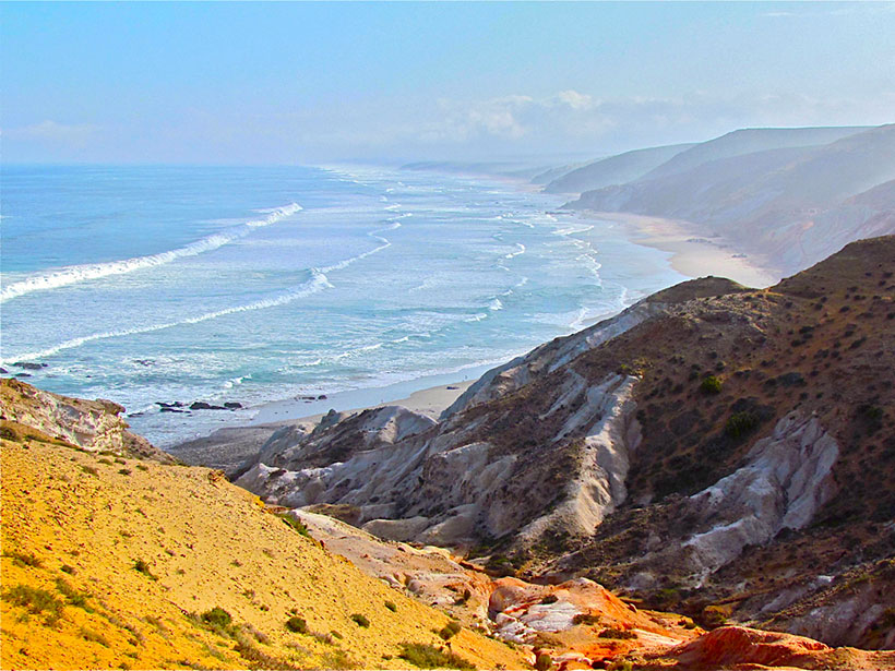
In a new study, Hearty et al. delved into the stratigraphic record to determine how high the ocean rose the last time carbon dioxide levels eclipsed 400 parts per million, investigating ancient coastal deposits along the western and southern coastlines of the Republic of South Africa. The South African coast was comparatively stable during the Pliocene and subsequent Pleistocene, so the unjostled rocks there offer optimal marine exposures and clear indicators of past sea levels. However, elevations measured in the field must be corrected to account for past vertical land motion.
The authors scoured the coastlines for sites where geologic records of past sea levels have been preserved, and marine shells collected from these deposits were analyzed using strontium dating. Once the team identified optimal exposures, they collected high-accuracy GPS data to measure the 3D coordinates of key geological features to within a few centimeters.
Three of the 17 surveyed sites provided reliable age data, establishing that average sea levels during the Pliocene were between 15 and 30 meters higher than the present waterline. The results revealed two prominent topographic zones. The first zone is about 25–35 meters above current sea level and corresponds to conditions from approximately 4.5 million to 3 million years ago. The second zone is 15–20 meters above modern sea level and represents sea level about 1 million years ago, during the Pleistocene.
The authors note that ice sheets are highly vulnerable during warming climates. Their findings suggest that global sea levels are likely to undergo dynamic changes in the future because of rising carbon dioxide concentrations. The researchers also point out that their data set can serve as a baseline against which to compare future studies of global mean sea level. (Paleoceanography and Paleoclimatology, https://doi.org/10.1029/2019PA003835, 2020)
—Aaron Sidder, Science Writer
Citation:
Sidder, A. (2020), Ancient sea levels in South Africa may offer modern analogues, Eos, 101, https://doi.org/10.1029/2020EO147001. Published on 14 July 2020.
Text © 2020. AGU. CC BY-NC-ND 3.0
Except where otherwise noted, images are subject to copyright. Any reuse without express permission from the copyright owner is prohibited.