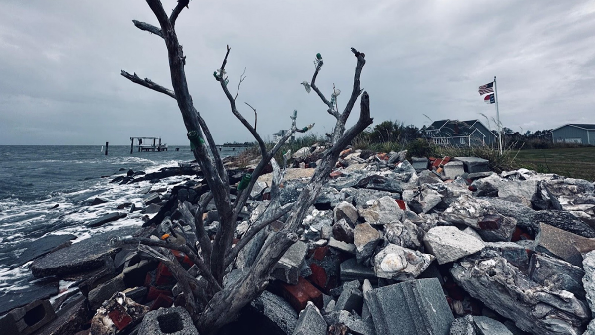
An interdisciplinary network of scientists and stakeholders is working to understand how saltwater intrusion and sea level rise are affecting rural communities and to help address the consequences.
sea level change
Posted inResearch Spotlights
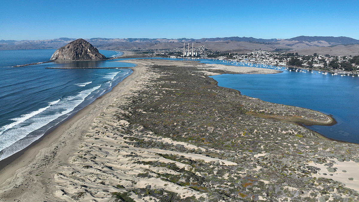
Extensive Sand Dune Loss Threatens California Coast
Aerial photos combined with lidar data show the extent of the problem.
Posted inResearch & Developments
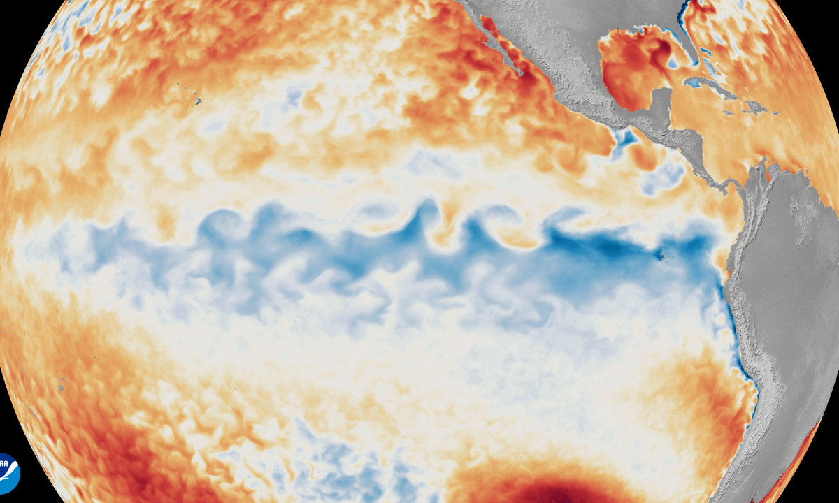
6 Ways This Year’s “Super El Niño” Could Affect Climate, Humans, and Marine Creatures
The key word here is “could.” Experts emphasize that no two El Niños are alike.
Posted inResearch Spotlights
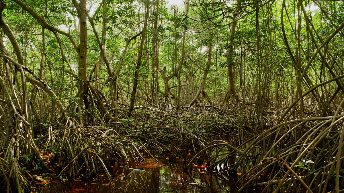
Mangroves May Be Losing Their Grip on Carbon Storage as Sea Levels Rise
Locally, mangroves can sometimes adapt to rising seas, but global trends look troubling.
Posted inResearch Spotlights
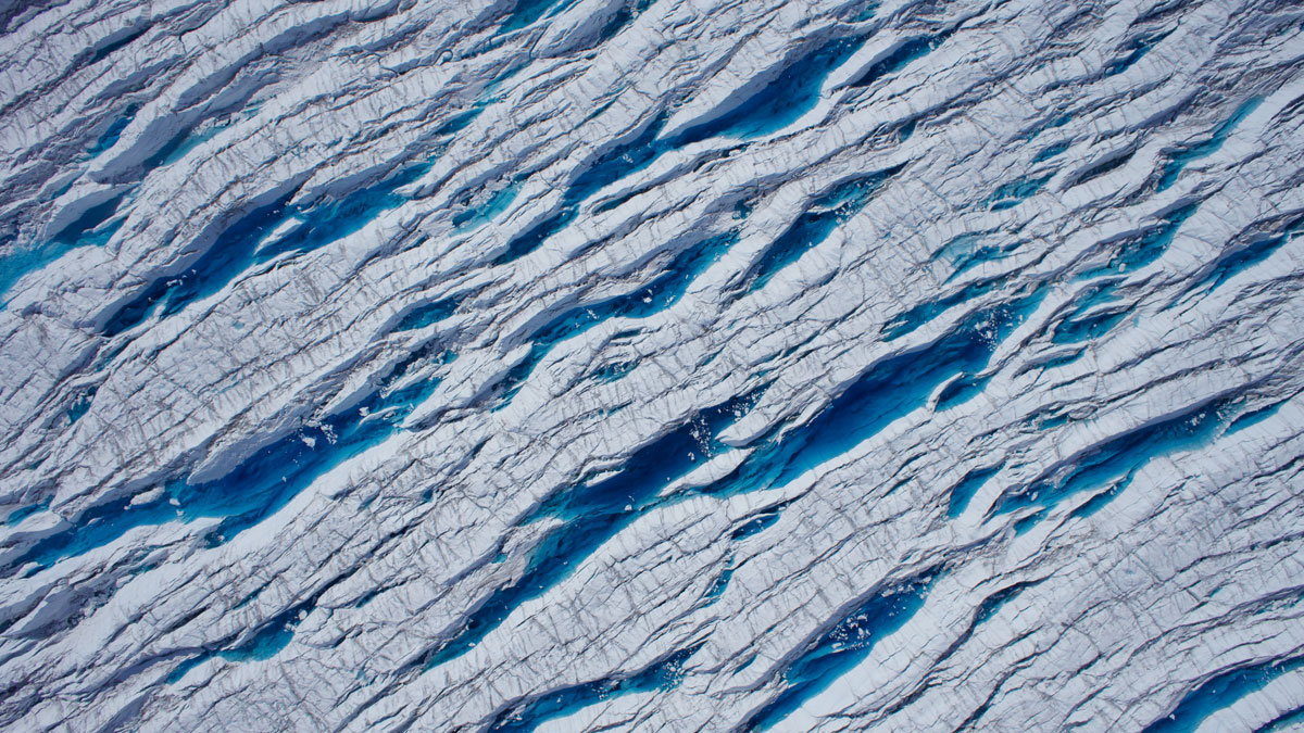
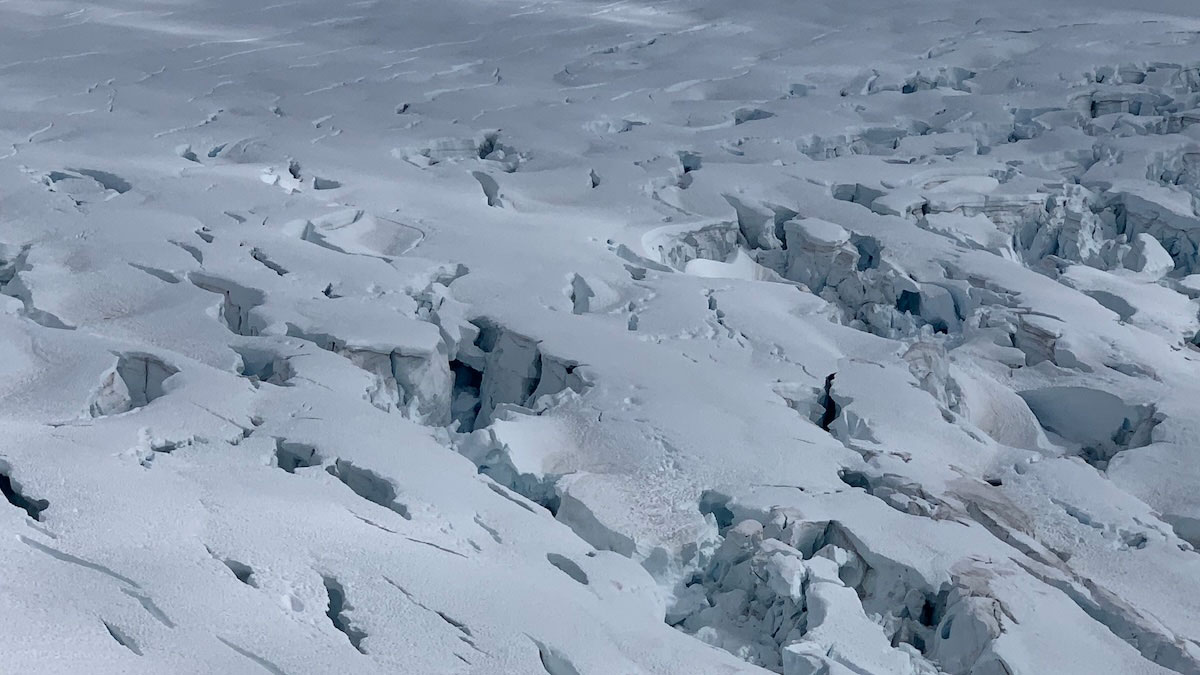
Stretching and Squeezing Release Glacial Meltwater
Seasonal changes in the forces that pull and push ice play a major role in when meltwater runs through glaciers and into the ocean.

Posted inResearch & Developments
Sea Level Rise is Accelerating, Scientists Confirm
New research closes the sea level budget gap and takes account of the drivers of sea level change.
Posted inOpinions
The Global Impact of Losing U.S. Sea Level Science
Cuts to climate science risk halting or even erasing decades of progress in global change research—just as risks from rising seas demand better data, informed decisionmaking, and faster action.
Posted inScience Updates
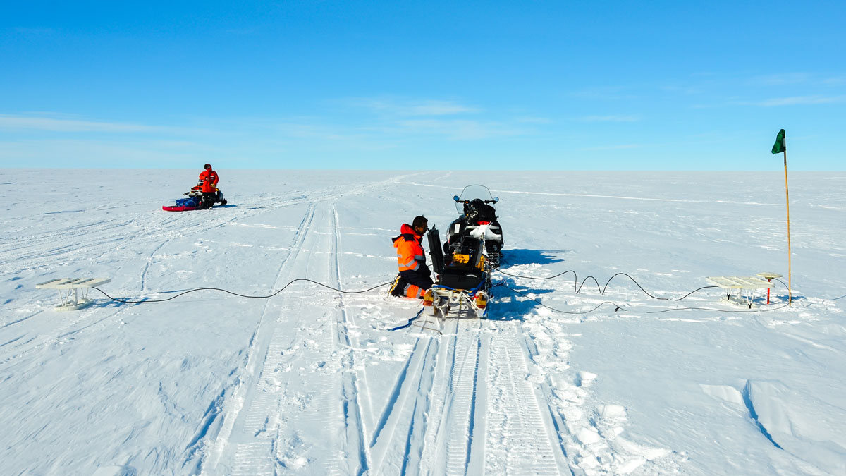
New Directions in Mapping Ice Sheet Fabrics and Flow
Polarimetric radar advances enable scientists to measure orientations of crystals, bubbles, and other properties that affect the flow of glaciers and ice sheets—and their contributions to sea level.
Posted inResearch Spotlights
How to Study Coastal Evolution
Researchers reviewed what’s known about how coastlines are changing and made recommendations for how to learn more.
Posted inResearch Spotlights
Glaciers May Flow into the Ocean More Quickly Than We Think
New research found that adjusting a key model variable may give more accurate predictions of glacial retreat.