Source: AGU Advances
A translation of this article was made possible by a partnership with Planeteando. Una traducción de este artículo fue posible gracias a una asociación con Planeteando.
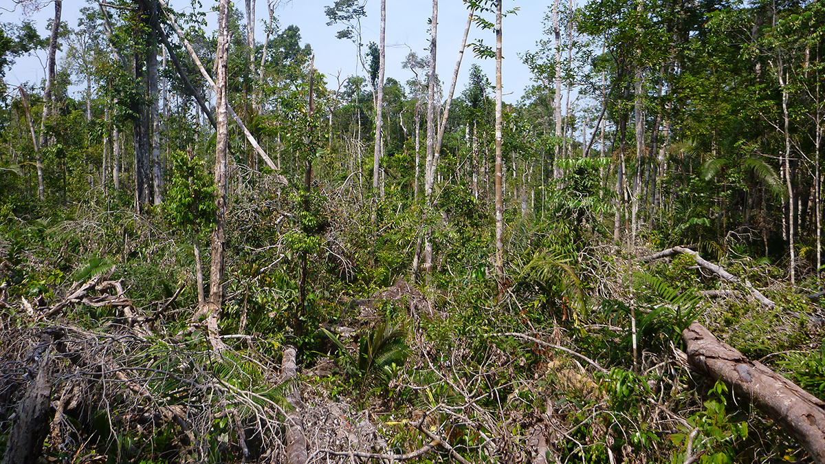
During some convective storms, downdrafts can have enough force to snap or completely uproot trees in a phenomenon known as windthrow. Windthrow events, which can range from just a few trees to many hectares in size, can affect the structure and composition of forests. Climate change has caused powerful storms to grow in number and intensity, and windthrows are one way to track this growth in the Amazon.
Urquiza-Muñoz et al. used data from Landsat satellites to compile an annual database of large windthrows (which they classified as affecting more than 30 hectares, or 74 acres) in the Amazon between 1985 and 2020. They found that the number of windthrows and the area affected by them have increased nearly fourfold over that time, from 78 windthrows affecting 6,900 hectares (17,050 acres) in 1985 to 264 windthrows affecting 32,170 hectares (79,494 acres) in 2020. Most events occurred in the central and western Amazon.
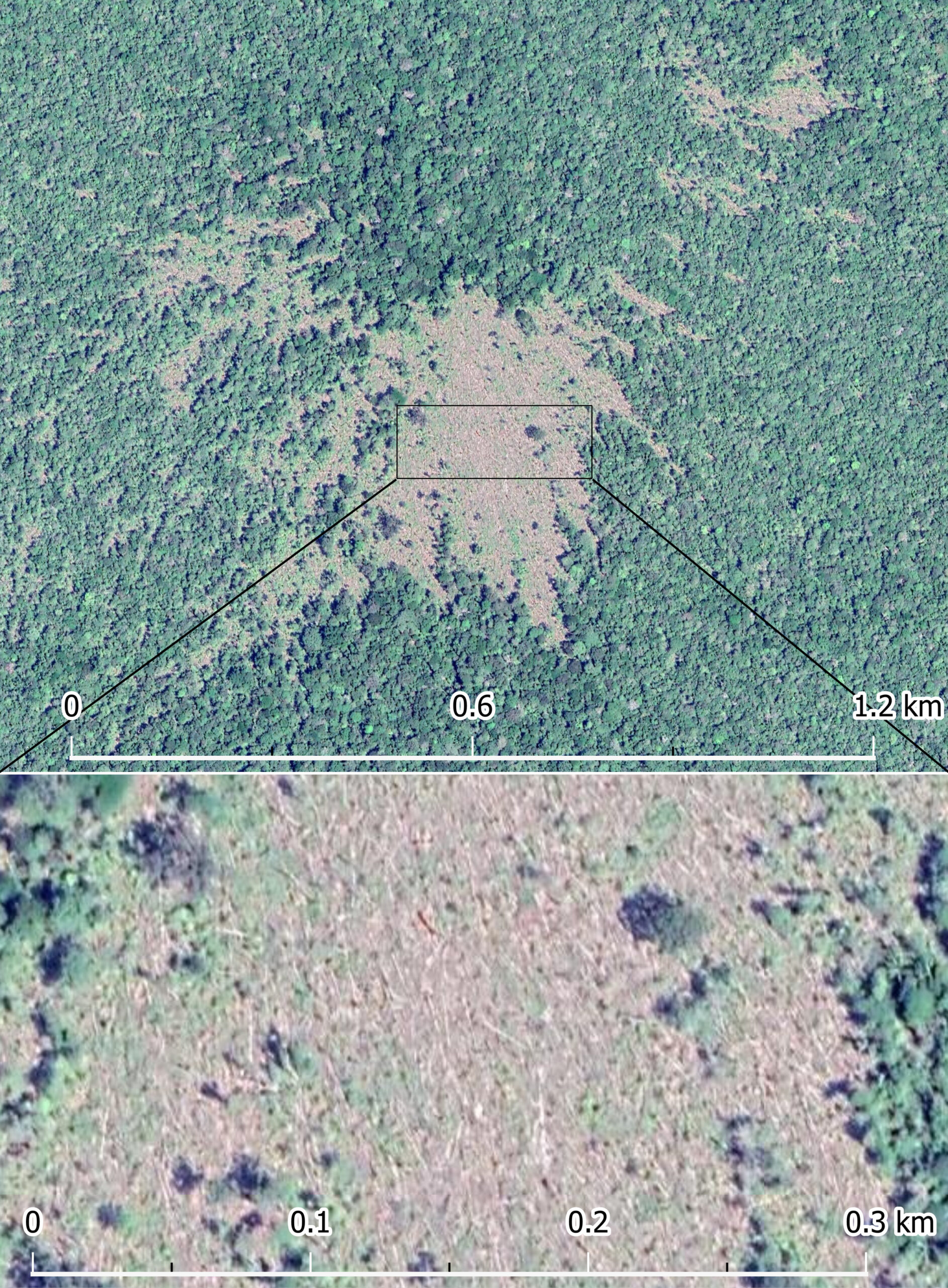
The authors created mosaics of images from the Landsat data for each year, excluding tiles with heavy cloud cover. Then, they compared each tile in the mosaic to the corresponding tile from the previous year, looking for spectral signatures that indicated downed and uprooted trees. In all, they found 3,179 large windthrows over the study period. The largest windthrow felled trees over an area of more than 2,543 hectares (6,284 acres).
The authors say some areas have much higher windthrow activity than others: Areas with more than two windthrows over the period analyzed accounted for just 3% of the study area but 35% of the windthrows. Though these events are becoming more common in general, the researchers did not find a trend of increasing or decreasing individual windthrow size over time.
The authors say their data support observations that intense storms in the Amazon are becoming more common, though they were unable to explain why there was a large variation in windthrow events between different years. Their dataset will be a useful benchmark for future studies assessing the dynamics of windthrows and could further illuminate how windthrows affect forest processes, they say. In future work, they suggest improved satellite imagery resolution could allow researchers to find and study smaller windthrows, and lidar technology could improve understanding of windthrow effects outside of core damage areas. (AGU Advances, https://doi.org/10.1029/2023AV001030, 2024)
—Nathaniel Scharping (@nathanielscharp), Science Writer