
沉积物中的地球化学标记,包括来自人类和动物粪便的有机分子,帮助科学家们追寻吐蕃帝国的兴衰。
Tibetan Plateau

Posted inOpinions
Concerns over Lithium, Water, and Climate in Earth’s Two Highest Deserts
Brine mining to meet resource demands amid renewable energy transitions is affecting water resources in South America and China. Hydrologists can help understand how and join the search for solutions.

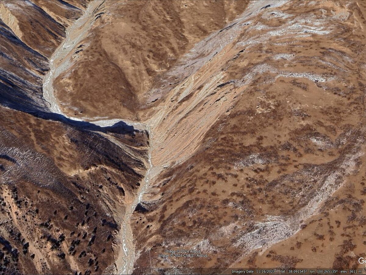
Posted inThe Landslide Blog
Landslides in the Sedongpu gully on the Tibetan Plateau
The Landslide Blog is written by Dave Petley, who is widely recognized as a world leader in the study and management of landslides. One of the most landslide-prone locations on the planet is the catchment known as the Sedongpu gully, which is located on the Tibetan Plateau. Located at [29.8009, 94.92014], this is an area […]
Posted inResearch Spotlights
断裂成熟度和断裂走向,哪个对大地震更重要?
对青藏高原2021年玛多地震的详细研究表明,与先前的假设相反,断裂走向对地震破裂动力学特征的影响有时会超过断裂成熟度的影响。
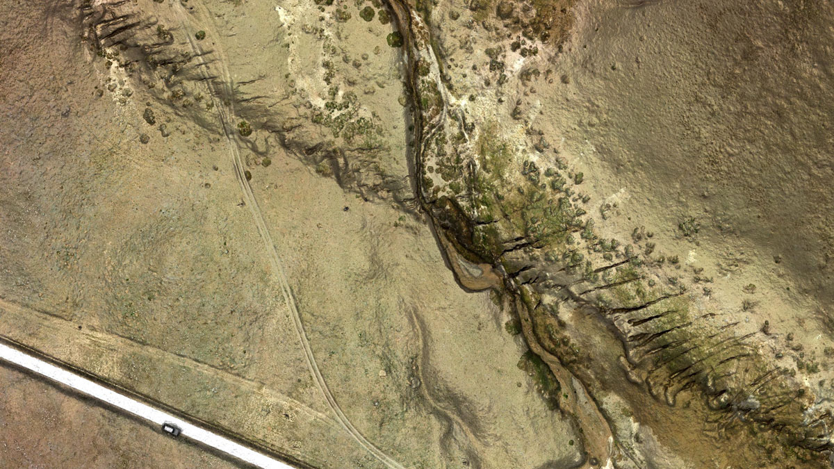
Posted inThe Landslide Blog
The 22 July 2021 Xiao Dongsuo debris flow on the Tibetan Plateau
The Landslide Blog is written by Dave Petley, who is widely recognized as a world leader in the study and management of landslides. Debris flows in arid and semi-arid areas are less common than in more humid environments, but they can have devastating consequences. There has been considerably less research into these processes than might […]

Posted inResearch Spotlights
Fault Maturity or Orientation: Which Matters More for Quakes?
Close examination of a 2021 earthquake on the Tibetan Plateau provides hints that, counter to prior assumptions, the influence of fault orientation can sometimes trump that of maturity.

Posted inNews
Mammal Droppings Preserve Human and Climate History on the Tibetan Plateau
Geochemical signatures in sediment, which includes organic molecules from human and animal poop, help scientists track the rise and fall of the Tibetan Empire.

Posted inResearch Spotlights
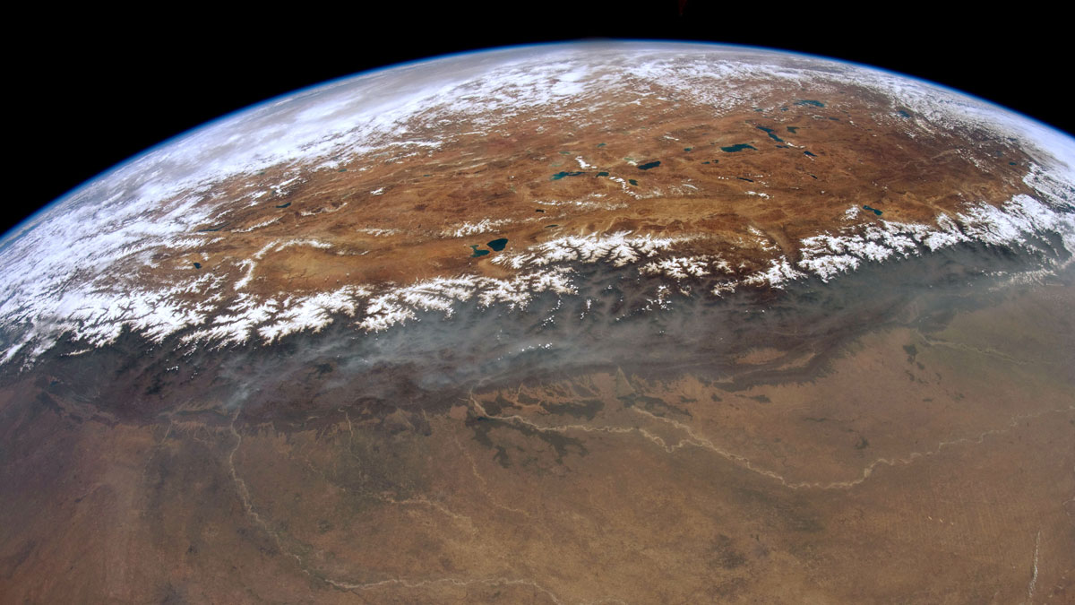
Earth’s “Third Pole” and Its Role in Global Climate
The Tibetan Plateau is a major force in the global climate system and a hot spot for climate change. A new review summarizes the state of knowledge and identifies research needs related to the region.
Posted inResearch Spotlights
研究揭示尼泊尔西部喜马拉雅港湾状地形的形成
研究人员通过热运动学研究发现,沿着板块汇聚界面大型逆冲断层在中下部地壳深处的地壳物质堆叠塑造了高原的生长和区域水系的发育。

Posted inResearch Spotlights
Uncovering the Formation of the Western Nepal Embayment
Using thermokinematics, researchers have found that crustal accretion along the megathrust at mid-lower crustal depths shapes plateau growth and regional drainage development.