
Researchers find that disadvantaged communities in Fresno are significantly sunnier and hotter than wealthier ones.
California

Posted inNews
When Forests on Land Burn, Forests Underwater Feel the Impact
Kelp is a habitat, a carbon sink, and a binding agent in your ice cream. But new research shows that California’s kelp forests are affected by the fate of their counterparts on land.
Posted inNews
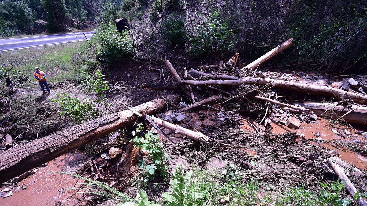
Postfire Debris Flows Strike in a Puzzling Pattern
California geologists are improving their understanding and forecasting of which slopes in wildfire-burned areas might fail during heavy rainstorms.
Posted inENGAGE, News
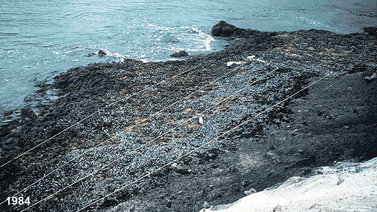
Ocean Warming Is Wiping Out Southern California’s Mussel Beds
Historic photographs reveal the dramatic retreat of mollusks as warmer waters take a toll on the health of the intertidal zone.

Posted inNews
Weather and Watershed Forecasting Make for Dam Smart Water Use
Using weather forecasts in reservoir management improves decisions about water supplies. Now researchers are studying the hydrology around reservoirs to help apply this strategy nationwide.
Posted inNews
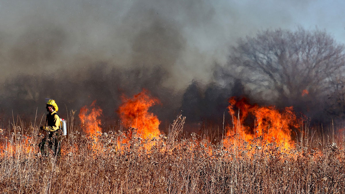
Climate Change Narrows the Window for Prescribed Fires
Longer, drier summers may mean fewer opportunities for firefighters to safely burn would-be wildfire fuel in the western United States.
Posted inEditors' Highlights
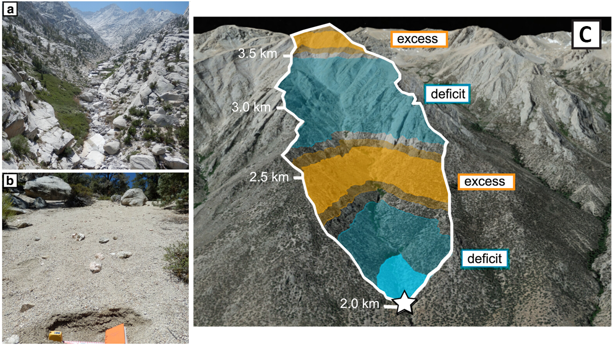
Revealing a Catchment’s Erosional Secrets: Grain Size Matters
A provenance study with 699 new samples from 12 different sediment grain sizes (from sand to boulder) shows that each fraction originates from distinct parts of a mountain catchment in California.

Posted inNews
Revolucionando la ciencia de los terremotos en Cascadia
Un nuevo centro reunirá a científicos de sismos para estudiar la zona de subducción de Cascadia y aclarar los peligros sísmicos.
Posted inNews
Shaking Up Earthquake Science in Cascadia
A new center will bring together earthquake scientists to study the Cascadia Subduction Zone and clarify seismic hazards.

Posted inNews
Natural Nitrogen Emissions Are Rising in California
Wildfires and soil microbes are releasing more nitrogen oxides in California as the climate gets warmer and drier.