Editors’ Highlights are summaries of recent papers by AGU’s journal editors.
Source: Journal of Geophysical Research: Solid Earth
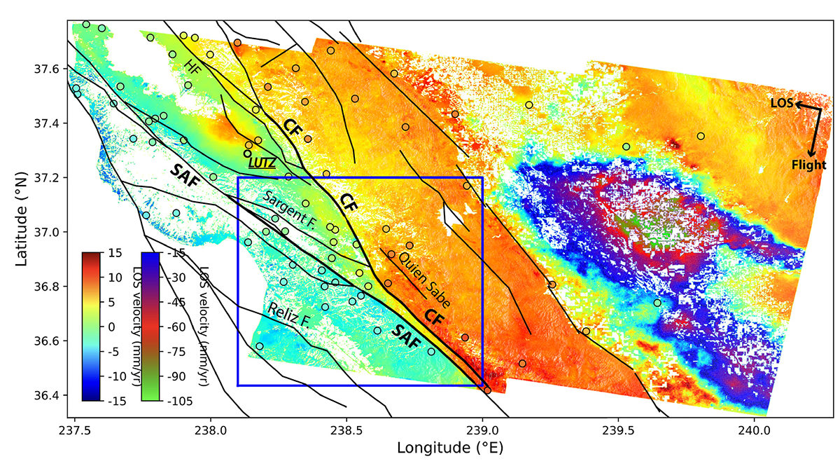
Monitoring how faults slip is essential to improve seismic hazard assessment. The San Andreas fault and nearby Calaveras fault in the South Bay area in California, USA are both known to slip continuously and aseismically near or at the surface (also known as “creep”).
Using high resolution time series of radar images acquired by the Sentinel-1 satellites over a five-year period (2015-2020), Li et al. [2023] provide fine constraints on the creep velocities, how they vary spatially along the faults, and why (mainly controlled by the fault geometry and the regional tectonic stress field). Subtle temporal fluctuations in creep velocities, likely associated with small loading perturbations, are also captured and are consistent with complementary indirect observations of creep and state of stress on faults by seismology. These new observations are key to understanding what controls fault slip behavior and how aseismic slip may interplay with, and impact, fault seismic activity.
Citation: Li, Y., Bürgmann, R., & Taira, T. (2023). Spatiotemporal variations of surface deformation, shallow creep rate, and slip partitioning between the San Andreas and southern Calaveras Fault. Journal of Geophysical Research: Solid Earth, 128, e2022JB025363. https://doi.org/10.1029/2022JB025363
—Cécile Lasserre, Associate Editor, JGR: Solid Earth