• About
  • Sections
  • Topics
    • Climate
    • Earth Science
    • Oceans
    • Space & Planets
    • Health & Ecosystems
    • Culture & Policy
    • Education & Careers
    • Opinions
  • Projects
    • ENGAGE
    • Editors’ Highlights
    • Editors’ Vox
    • Eos en Español
    • Eos 简体中文版
    • Print Archive
  • Science Policy Tracker
  • Blogs
    • Research & Developments
    • The Landslide Blog
  • Newsletter
  • Submit to Eos
  • AGU.org
  • Career Center
  • Join AGU
  • Give to AGU
  • About
  • Sections
  • Topics
    • Climate
    • Earth Science
    • Oceans
    • Space & Planets
    • Health & Ecosystems
    • Culture & Policy
    • Education & Careers
    • Opinions
  • Projects
    • ENGAGE
    • Editors’ Highlights
    • Editors’ Vox
    • Eos en Español
    • Eos 简体中文版
    • Print Archive
  • Science Policy Tracker
  • Blogs
    • Research & Developments
    • The Landslide Blog
  • Newsletter
  • Submit to Eos
Skip to content
  • AGU.org
  • Career Center
  • Join AGU
  • Give to AGU
Eos

Eos

Science News by AGU

Support Eos
Sign Up for Newsletter
  • About
  • Sections
  • Topics
    • Climate
    • Earth Science
    • Oceans
    • Space & Planets
    • Health & Ecosystems
    • Culture & Policy
    • Education & Careers
    • Opinions
  • Projects
    • ENGAGE
    • Editors’ Highlights
    • Editors’ Vox
    • Eos en Español
    • Eos 简体中文版
    • Print Archive
  • Science Policy Tracker
  • Blogs
    • Research & Developments
    • The Landslide Blog
  • Newsletter
  • Submit to Eos

Central America

Two maps of the tropical Pacific Ocean showing difference in precipitation between a control model and observations (top panel) and a model with elevated Central American orography (bottom panel).
Posted inEditors' Highlights

Raising Central American Orography Improves Climate Simulation

by Sarah Kang 9 June 20218 March 2022

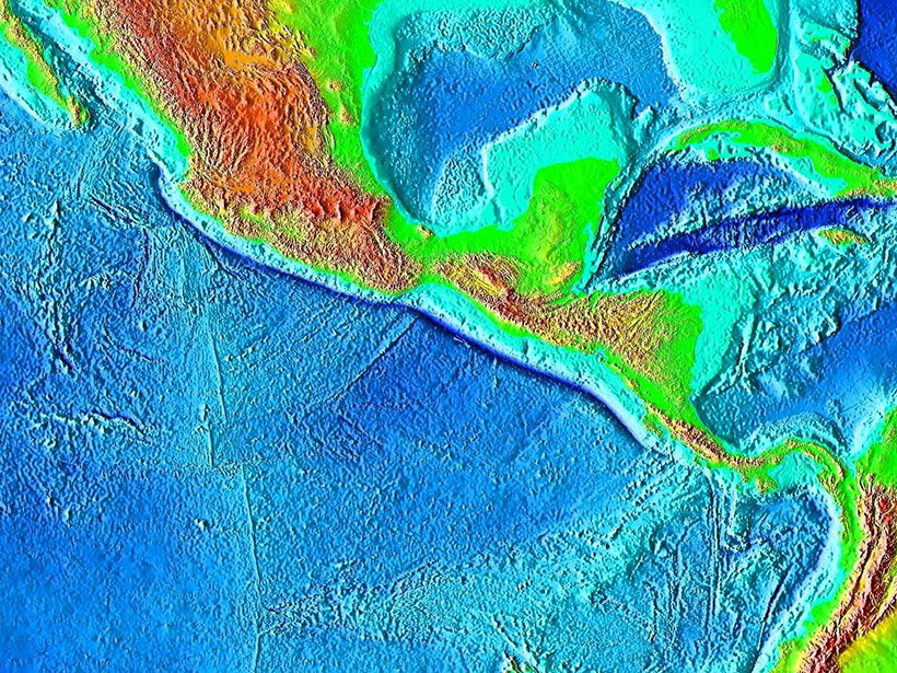
Elevation of Central American orography significantly reduces the pervasive tropical rainfall bias by blocking the easterlies and consequently warming the northeastern tropical Pacific.

Map view of the topography of Central America and surrounding ocean basins
Posted inResearch Spotlights

Subduction May Recycle Less Water Than Thought

Sarah Stanley, Science Writer by Sarah Stanley 12 February 202127 January 2023

A new analysis of seismic data from the Middle America Trench suggests that previous calculations have vastly overestimated the total amount of water transported to the mantle worldwide.

The skyline of Panama City, Panama, with fishing boats in the foreground
Posted inScience Updates

Torrential Rains and Poor Forecasts Sink Panama’s Infrastructure

by A. Bezanilla-Morlot, A. Centella-Artola, M. Sierra-Lorenzo and I. Borrajero-Montejo 27 October 20209 March 2023

Scientists are working to improve the forecasting of heavy rains in Panama following several events over the past decade that caused substantial flooding and damage.

Six sequential radar reflectivity scans of Hurricane Michael as it developed
Posted inEditors' Highlights

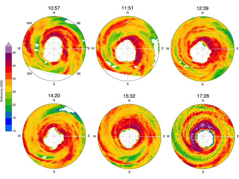
The Evolution of Observed Hurricane Eyewall Shapes

by Suzana Camargo 16 September 202025 February 2022

The observational evidence of the wind field of Hurricane Michael using radar imagery showed an eyewall structure evolution with elliptical, triangular, and square shapes for the first time.

Aerial photo of Cayos Cochinos, a series of small coral cays off the Caribbean coast of Honduras
Posted inNews

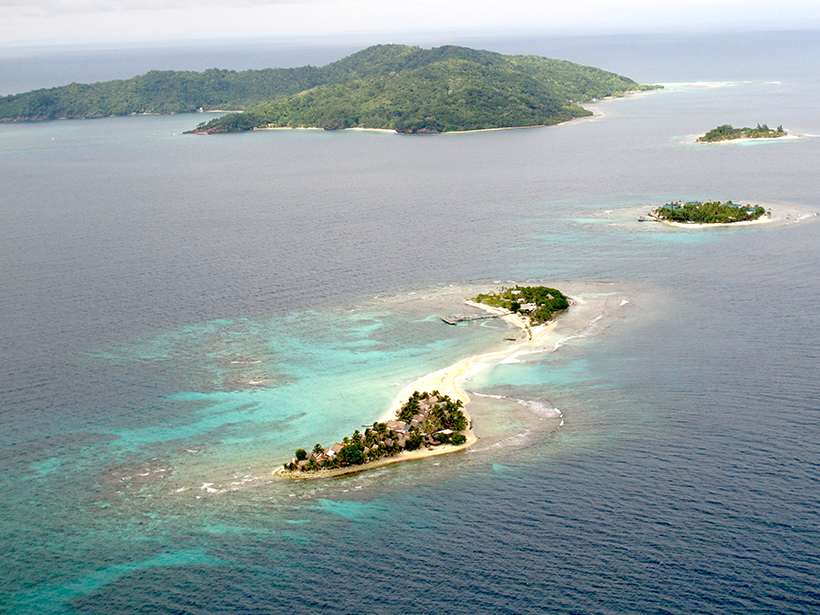
Scientists Support Local Activities to Rescue the Mesoamerican Reef

by J. Rodriguez 15 September 20203 November 2022

The reef’s report card analyzed 286 sites in Mexico, Belize, Guatemala, and Honduras. Communities, scientists, and governments are working to improve coral and ecosystem resilience.

The hyperacidic lake inside the crater of Poás volcano in Costa Rica
Posted inScience Updates

Microbial Influences on Subduction Zone Carbon Cycling

by D. Giovannelli, P. H. Barry, J. M. de Moor, K. G. Lloyd and M. O. Schrenk 3 March 202024 October 2022

An innovative collaboration is investigating how geobiological processes alter fluxes of carbon and other materials between the deep Earth and the surface.

Satellite image of a city between a volcano and a lake
Posted inNews

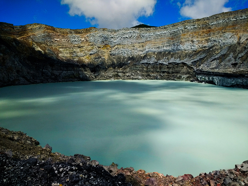
Eruption in El Salvador Was One of the Holocene’s Largest

Katherine Kornei, Science Writer by Katherine Kornei 5 June 201922 August 2023

Roughly 1,500 years ago, the Tierra Blanca Joven eruption blanketed Central America in ash and likely displaced Maya settlements, new research shows.

Hurricane Matthew brought high winds and heavy rain to the Caribbean in October 2016.
Posted inOpinions

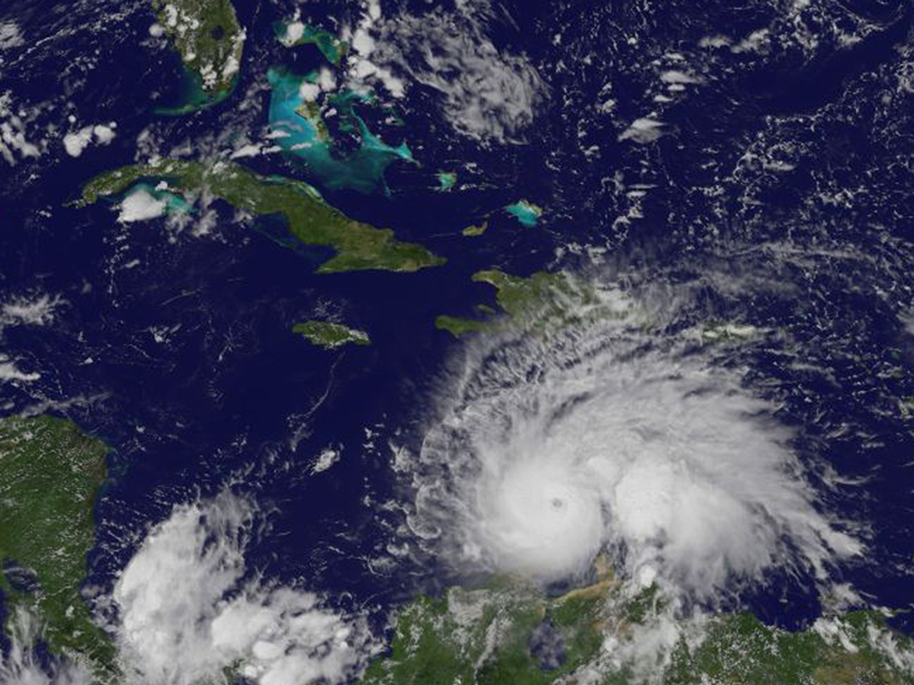
Climate Change’s Pulse Is in Central America and the Caribbean

by J. E. González, Matei Georgescu, M. C. Lemos, N. Hosannah and D. Niyogi 27 April 201716 March 2023

Nations that border the Gulf of Mexico and Caribbean Sea are ideally placed for tracking the effects of global climate change and testing innovative ways to adapt to future changes.

After a 2012 landslide in Finca Loma Linda, Guatemala, 46 people were forced to evacuate to an emergency shelter.
Posted inScience Updates

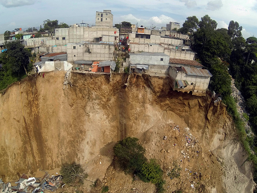
An Early Warning System for Landslide Danger

by A. J. Posner and K. P. Georgakakos 3 November 20166 January 2023

Advances in satellite imaging, mapping, and rainfall estimations have made it possible to implement a regional real-time assessment of landslide hazard threats across Central America.

Posts pagination

Newer posts 1 2
A view of a bridge, with the New Orleans skyline visible in the distance between the bridge and the water. A purple tint, a teal curved line representing a river, and the text “#AGU25 coverage from Eos” overlie the photo.

Features from AGU Publications

Research Spotlights

Watershed Sustainability Project Centers Place-Based Research

4 December 20254 December 2025
Editors' Highlights

Changes in Slab Dip Cause Rapid Changes in Plate Motion

4 December 20252 December 2025
Editors' Vox

Hydrothermal Circulation and Its Impact on the Earth System

3 December 20253 December 2025
Eos logo at left; AGU logo at right

About Eos
ENGAGE
Awards
Contact

Advertise
Submit
Career Center
Sitemap

© 2025 American Geophysical Union. All rights reserved Powered by Newspack