热带气旋可以卷走鸟类和昆虫,并将它们带到很远的地方。
China
The Woda landslide on the Jinsha River
The Landslide Blog is written by Dave Petley, who is widely recognized as a world leader in the study and management of landslides. An article in the journal Natural Hazards (Yao et al. 2023) examines the Woda landslide on the Jinsha River. The study tries to determine the potential impact of the failure of a […]
Rongjiang: the 4 June 2022 landslide-induced, high speed railway accident in Guizhou, China
The Landslide Blog is written by Dave Petley, who is widely recognized as a world leader in the study and management of landslides. On 4 June 2022, a high speed train traveling at about 250 km per hour (155 miles per hour) struck a 200 cubic metre landslide that had inundated the track close to […]
Landslides triggered by the 5 September 2022 Ms=6.8 Luding Earthquake in China
The 5 September 2023 Ms=6.8 Luding Earthquake in China killed an estimated 118 people, of whom 80% were killed by landslides.
A dramatic landslide video from Chongzhou in Sichuan Province, China
A small truck had a lucky escape when a powerful rockslide hit a road in Chongzhou in Sichuan Province in China
Radar Tracks Unfortunate Creatures Trapped in Tropical Cyclones
Cyclones can sweep up birds and insects and transport them great distances.
Earth’s Critical Zone Remains a Mystery Without its People
Achieving the UN Sustainable Development Goals may only be possible if human activities are central to critical zone science.
The 12 November 2014 mine waste landslide at Dagushan in Anshan, China
The Landslide Blog is written by Dave Petley, who is widely recognized as a world leader in the study and management of landslides. On 12 November 2014, an 8.45 million cubic metre landslide occurred in a mine waste pile at the Dagushan open-pit iron mine in Anshan, China. The failure occurred in a a huge […]
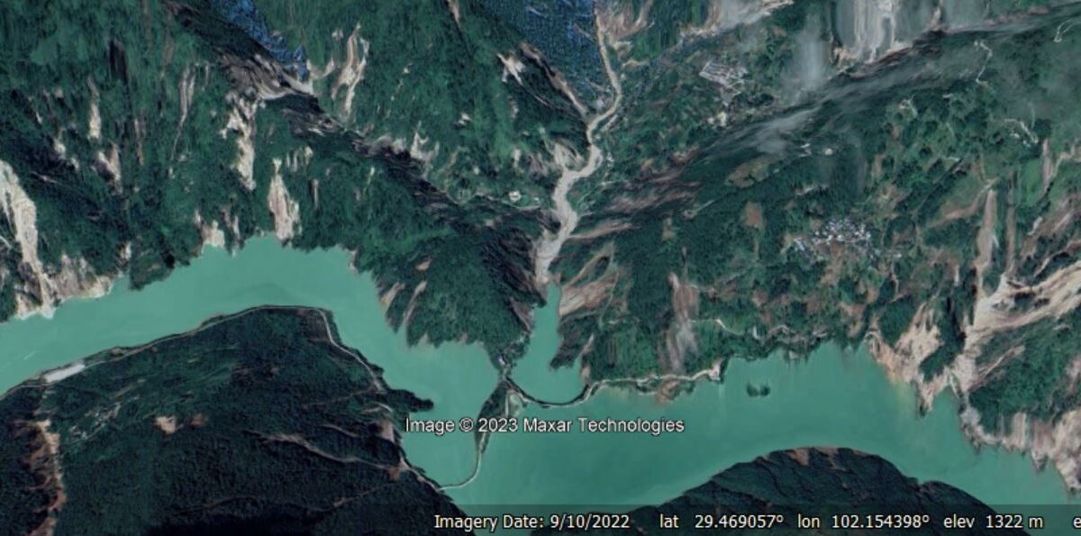
The Temi landslide – an ancient, valley-blocking failure in Sichuan Province, China
Xie et al. 2023 describe the ancient, 35 million cubic metre, valley-blocking Temi landslide in China.
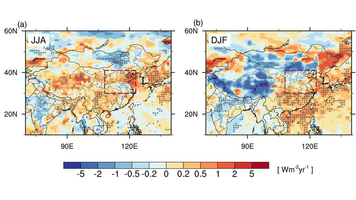
A New Perspective on Aerosols and Emissions Over Northern China
During 2013-2019, a distinct seasonality for trends of aerosol concentrations and optical properties was found over Northern China.


