
Intensifying storms may warrant a new category of hurricane wind speeds.
hurricanes, typhoons, & cyclones

Posted inNews
A Philippine Island Detective Story
Researchers snorkeled, drilled, profiled, mapped, and interviewed to unlock clues to how an island was born.


Posted inNews
Atlantic Hurricanes Are Intensifying Faster
Warmer waters and other factors are allowing Atlantic hurricanes to grow stronger faster.

Posted inNews
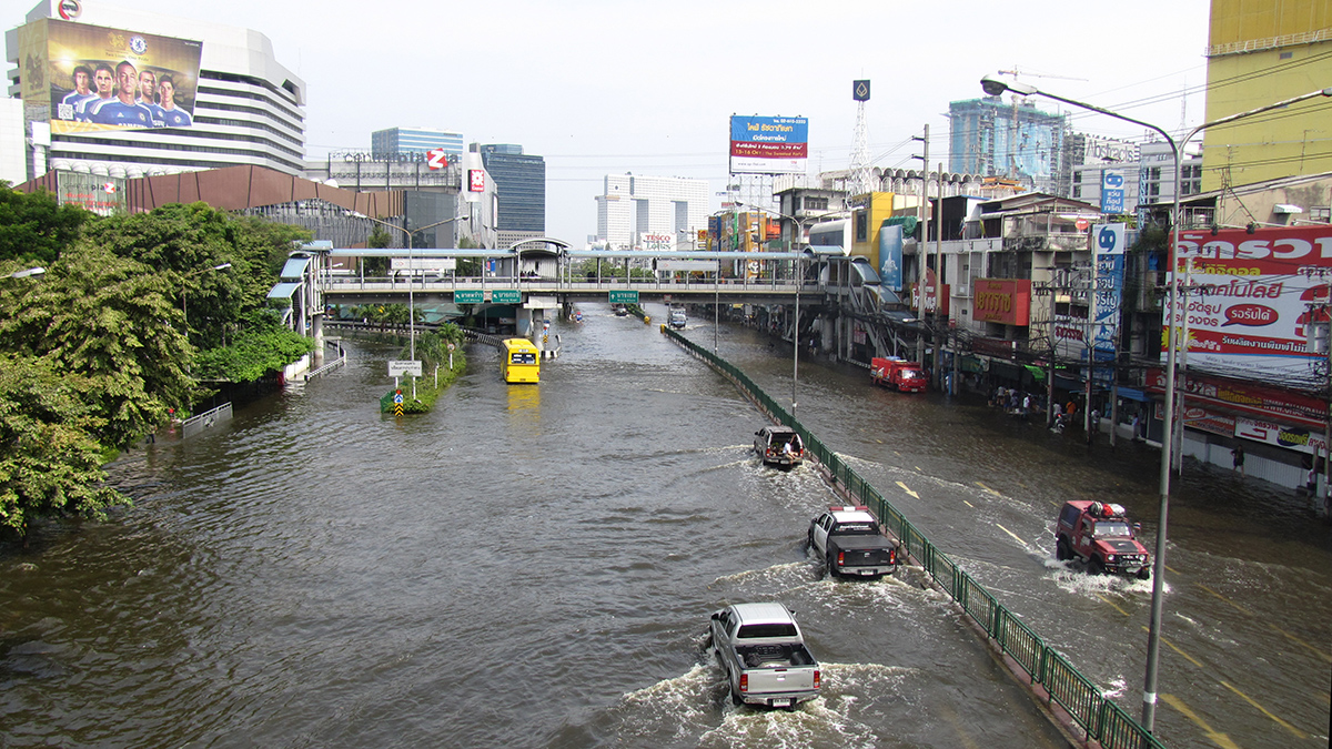
Rainfall from Tropical Storms Might Be on the Downswing
Two decades’ worth of satellite data suggest that the rainfall rates of tropical cyclones might be decreasing relative to background levels.

Posted inNews
Hurricane Harvey Filled Houston with Sediment
The storm’s record-setting rains moved an equally impressive amount of sediment and elevated the risk and expense of absorbing all that muck.

Posted inResearch Spotlights
Radar Tracks Unfortunate Creatures Trapped in Tropical Cyclones
Cyclones can sweep up birds and insects and transport them great distances.

Posted inThe Landslide Blog
Cyclone Gabrielle in New Zealand triggered 140,000 landslides
The Landslide Blog is written by Dave Petley, who is widely recognized as a world leader in the study and management of landslides. Back in February 2023 I highlighted the large numbers of landslides, and their impacts, associated with the passage of Cyclone Gabrielle in North Island of New Zealand. One landslide, at Manukau Heads, […]
Posted inNews
Paleostorm Chasers Test a New Detection Tool
A method typically used to date sediments shows promise for documenting tropical storms through history—information needed for future projections of storm activity.
Posted inThe Landslide Blog
Passing through the eye of Typhoon Haikui in Taiwan
The Landslide Blog is written by Dave Petley, who is widely recognized as a world leader in the study and management of landslides. Over the last two weeks, I travelled with my daughter Holly through Taiwan on vacation. Loyal readers will know that in the early part of my career I spent some time in […]