
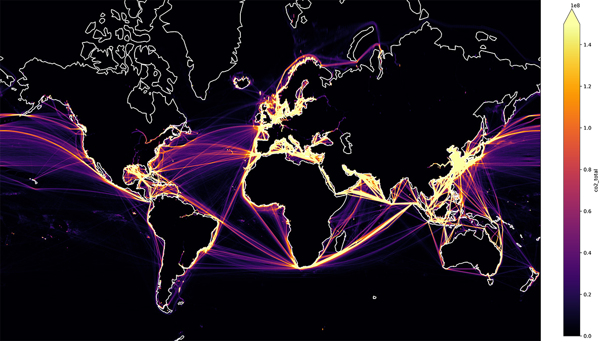
Using machine learning, researchers found that nearly 20% of high seas fishing could be unauthorized.
data management
Posted inNews
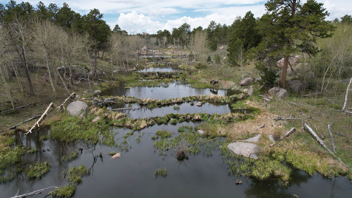
Scientists EEAGER-ly Track Beavers Across Western United States
Efficiently tracking nature’s engineers—beavers—at the scale of entire watersheds over time is now possible, thanks to a new artificial intelligence–trained model called EEAGER.
Posted inNews
Spurring Ocean Research with Open Data
Ocean data abound, but accessing them is a challenge, making tackling climate change difficult. One nonprofit is trying to compile them.
Posted inEditors' Highlights
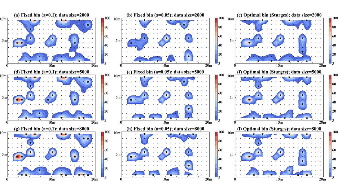
Using Big Data for Monitoring Network Design and Beyond
Large data sets can be generated using deep learning to improve the design of observation networks for monitoring subsurface flow and transport.
Posted inEditors' Vox
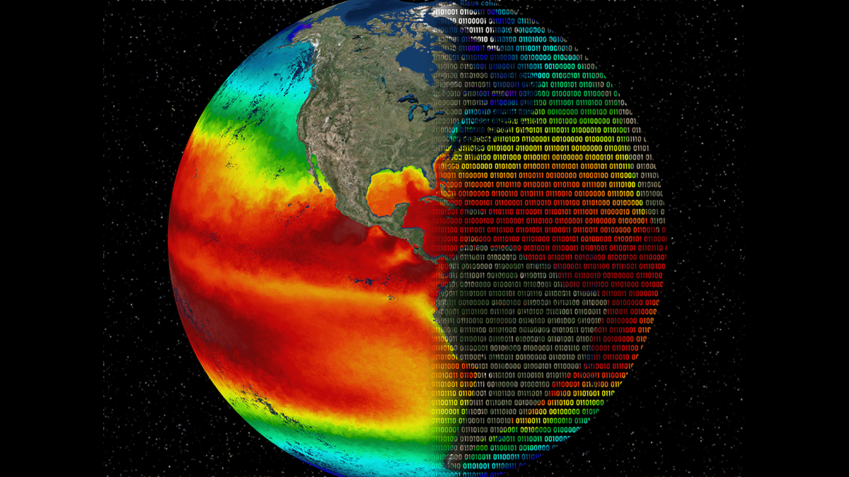
Analyzing Big Earth Data: Progress, Challenges, Opportunities
Big Earth data are accumulating at a rapid rate with challenges for understanding and using the data, but new tools and applications are enabling analysis and enhancing usability by policy makers.
Posted inNews
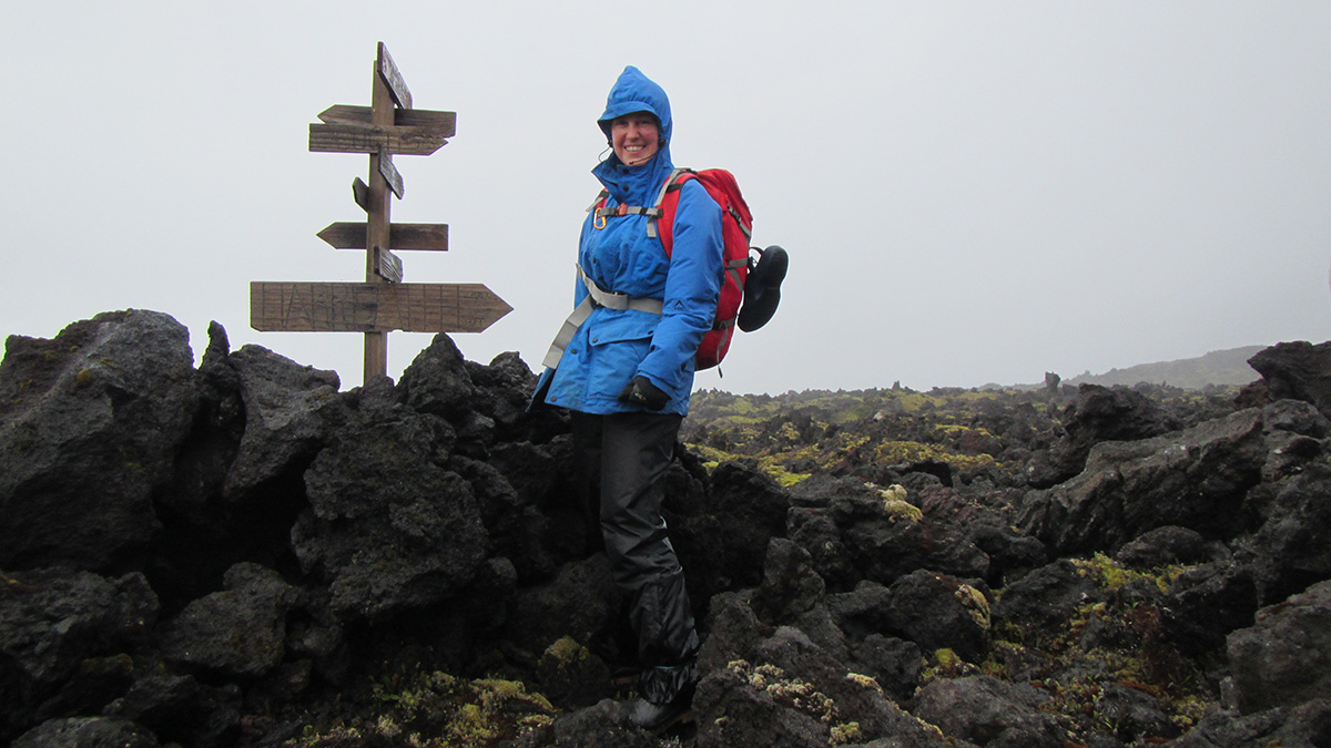
Geospatial Database for the Prince Edward Islands
South African scientists map uninhabited islands in the Southern Ocean.
Posted inEditors' Vox
Machine Learning Helps to Solve Problems in Heliophysics
A new special collection invites papers pertaining to the use of machine learning techniques in all sub-fields of heliophysics.

Posted inEditors' Highlights
Deep Learning for Hydrologic Projections Under Climate Change
Extrapolation or not? Big data may help deep learning to go places where it has not been before by transferring learned hydrologic relationships.
Posted inResearch Spotlights
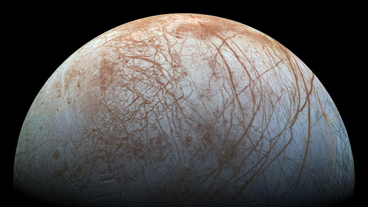
Zipping Up Data to Zap Them Back from an Icy Moon
NASA wants to send instruments to distant moons like Europa and Enceladus to search for life. But getting vital data back to Earth over limited bandwidth will take some impressive compression software.

Posted inNews
Las redes sociales complementan a la ciencia durante los desastres naturales
La información compartida en las plataformas de redes sociales podría ayudar a los científicos a recopilar datos en tiempo real y ayudar a las agencias en los esfuerzos de ayuda.