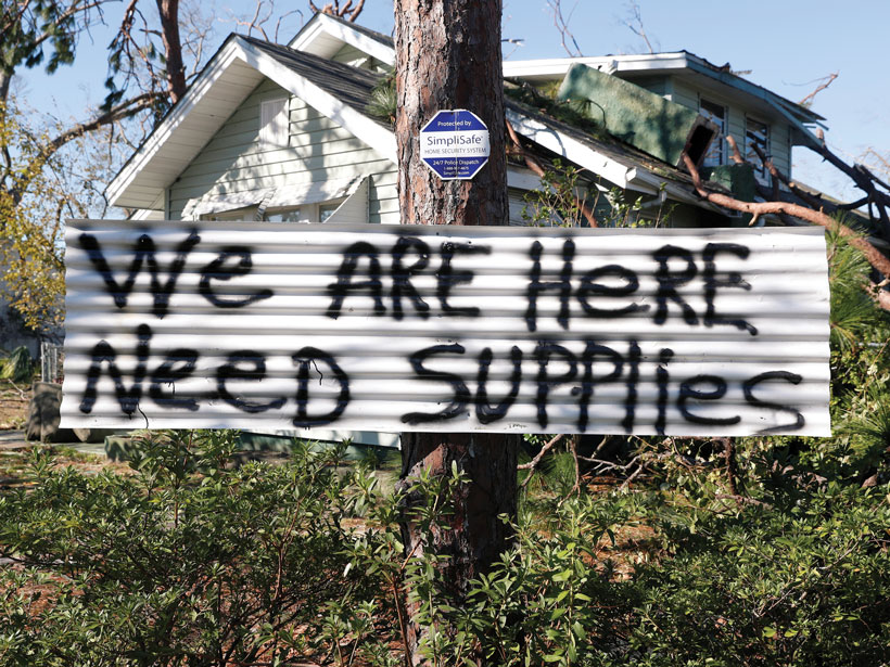
As disadvantaged communities suffer disproportionately from natural hazards, scientists, policymakers, and emergency managers explore why policies are failing—and what can be done about it.
disaster management

Posted inFeatures
An Unfought Geoscience Battle in U.S. Prisons
Prisoners, activists, and lawyers are fighting to protect incarcerated people from pollution and the dangers of climate change. There’s a place for geoscientists in the fight too.
Posted inEditors' Highlights
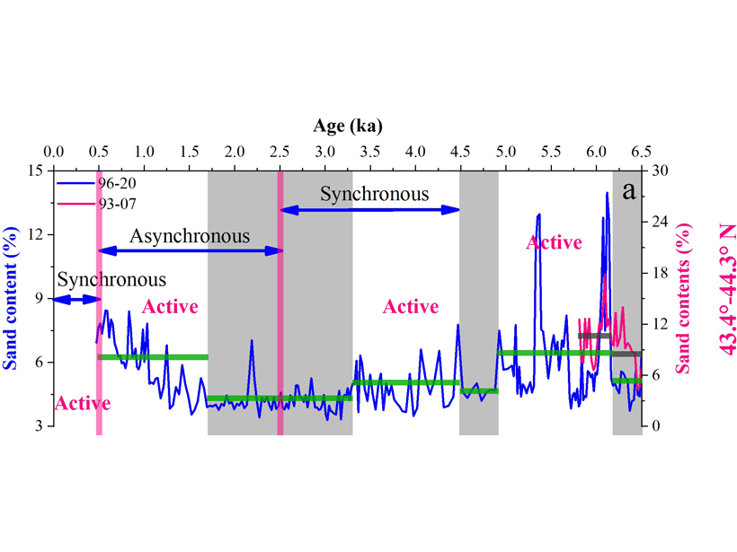
Abrupt Climate Shifts Change the Latitudes of Storm Activity
A new 6500-year construction of storms combined with other paleo-storm records finds abrupt changes in the Atlantic Ocean circulation impact the latitudinal preference of storm activity.
Posted inEditors' Highlights
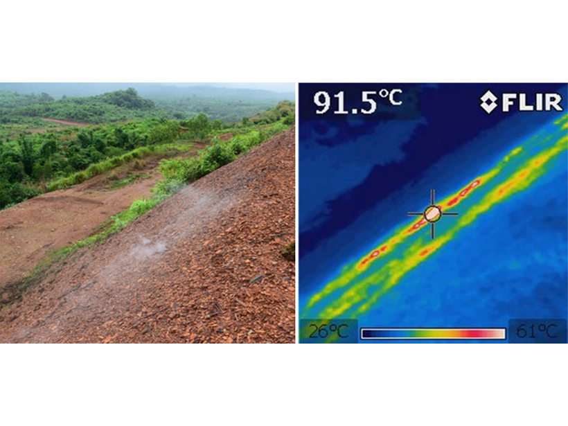
Citizen Science Reduces Risks from Combusting Coal-Mine Wastes
A community-based citizen science study on spontaneously combusting coal-mine waste heaps in Myanmar underpins the development of risk management plans to protect individuals and communities.

Posted inNews
Heavy Rains, Human Activity, and Rising Waters at Lake Victoria
Water levels in Africa’s largest lake have risen over a meter since last fall and continue to increase as land use changes and heavy rains enhance the flow.
Posted inNews
Geoscientists Help Map the Pandemic
Data visualization and mapping are valuable tools in the fight against COVID-19. Geoscientists can help healthcare workers and shape public policy.

Posted inNews
Leveraging Satellite Sensors for Oil Spill Detection
By using multiple remote sensors, scientists can quickly estimate the nature and thickness of oil spills—important factors for containment efforts.
Posted inFeatures
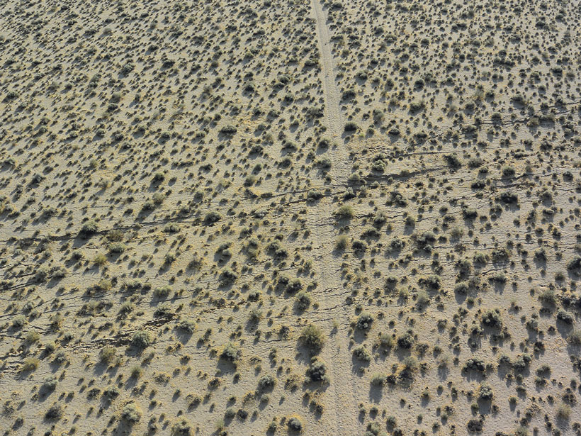
Scientists Scramble to Collect Data After Ridgecrest Earthquakes
Ground shaking in Southern California, including a magnitude 7.1 temblor, triggered a massive mobilization effort to collect seismological, geological, and geodetic data.

Posted inEditors' Vox
Society’s High Stakes Game of Chance Against Nature
We can better understand the risks of natural hazards and develop more effective mitigation strategies when geoscience and social science perspectives are combined.

Posted inOpinions
Investing in Science to Improve Climate Risk Management
Integrating Earth science research and observations into adaptation planning helps identify effective strategies to manage climate risks.