
Video footage gathered from social media is used to reconstruct the timing and likely source(s) of the tsunami generated by the 2018 Palu earthquake.
disaster management
Posted inNews
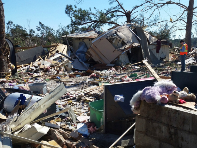
Tornado Warnings Don’t Adequately Prepare Mobile Home Residents
A survey of the southeastern United States shows that nearly half of mobile home residents don’t know where to shelter during a tornado, and many aren’t getting the resources they need to survive one.
Posted inNews
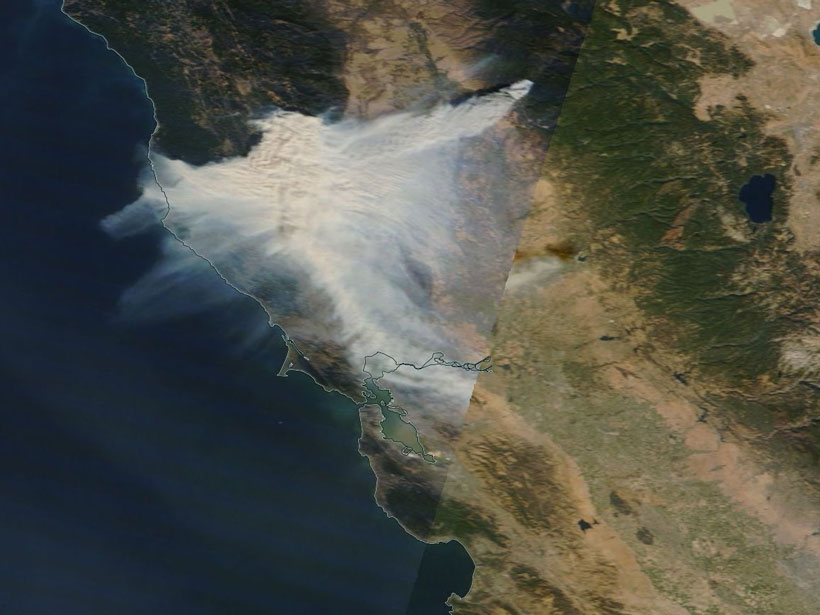
New Eyes on Wildfires
Onboard machine learning and compact thermal imaging could turn satellites into real-time fire management tools to help officials on the ground.
Posted inScience Updates
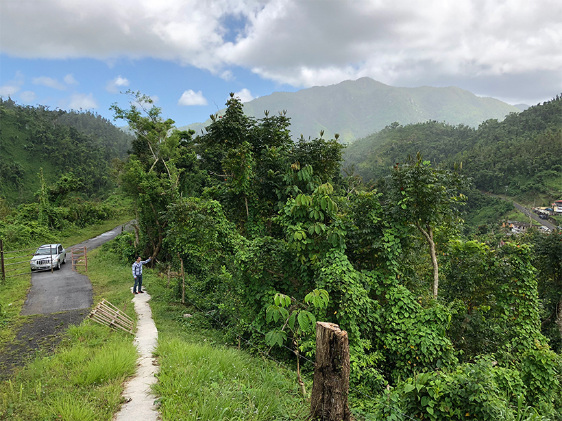
Sharing Data Helps Puerto Ricans Rebound After Hurricane Maria
Recent hurricane seasons left many communities wondering if this is the new normal. Digital infrastructure designed for citizen data collection may help these communities increase resilience.
Posted inResearch Spotlights
Improving Water Resources Management with Satellite Data
An extensive review reveals that remote sensing is changing the way we manage water resources and suggests that the coming years will bring both exciting advancements and new challenges.

Posted inEditors' Vox
The Long and Winding Road: Making Resilience Real
As humans face an inherently riskier world, a special collection in Earth’s Future explores thematic, theoretical, and empirical approaches to resilient decision-making.

Posted inScience Updates
Bridging the Gap Between Sustainability and Disaster Management
IGCS Summer School 2018 on Coastal and River Hazards & Management Strategies; Aachen, Germany, 14–25 July 2018

Posted inOpinions
Wireless Frequency Sharing May Impede Weather Satellite Signals
The delivery of weather satellite imagery is reliable today, but will it stay that way in the future?

Posted inResearch Spotlights
A Near-Real-Time Tool to Characterize Global Landslide Hazards
By fusing susceptibility information with precipitation data, a new model generates “nowcasts” to predict the potential for rainfall-triggered landslides in steep terrain between 50°N and 50°S.

Posted inScience Updates
How Paleofire Research Can Better Inform Ecosystem Management
Global Paleofire Working Group 2: Paleofire Knowledge for Current and Future Ecosystem Management; Saint-Hippolyte, Quebec, Canada, 10–14 October 2017