
State-of-art numerical simulations illustrate how a small-scale shear instability can become a giant earthquake in a manner that is consistent with seismological observation.
earthquakes
Posted inScience Updates
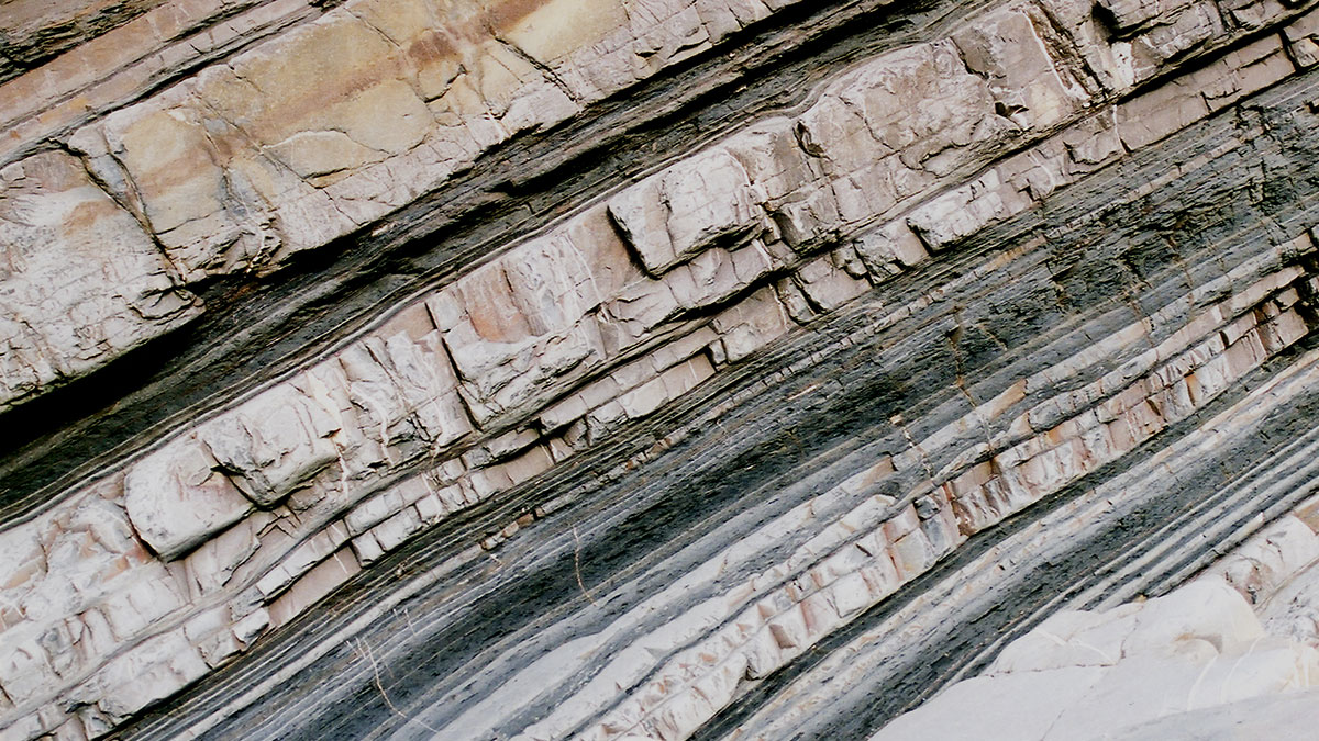
Submarine Avalanche Deposits Hold Clues to Past Earthquakes
Scientists are making progress on illuminating how undersea sedimentary deposits called turbidites form and on reconstructing the complex histories they record. But it’s not an easy task.

Posted inNews
Iceland’s Recent Eruptions Driven by Tectonic Stress
Magma flow in the magmatic dike near Grindavík was among the fastest recorded. The processes driving that flow could be at play at volcanoes in Hawaii, off the African coast, and anywhere crustal plates split apart.

Posted inResearch Spotlights
Plate Boundaries May Experience Higher Temperature and Stress Than We Thought
Surface heat flux data shed light on conditions deep below Earth’s surface, at a tectonic plate interface where major earthquakes initiate.
Posted inEditors' Highlights
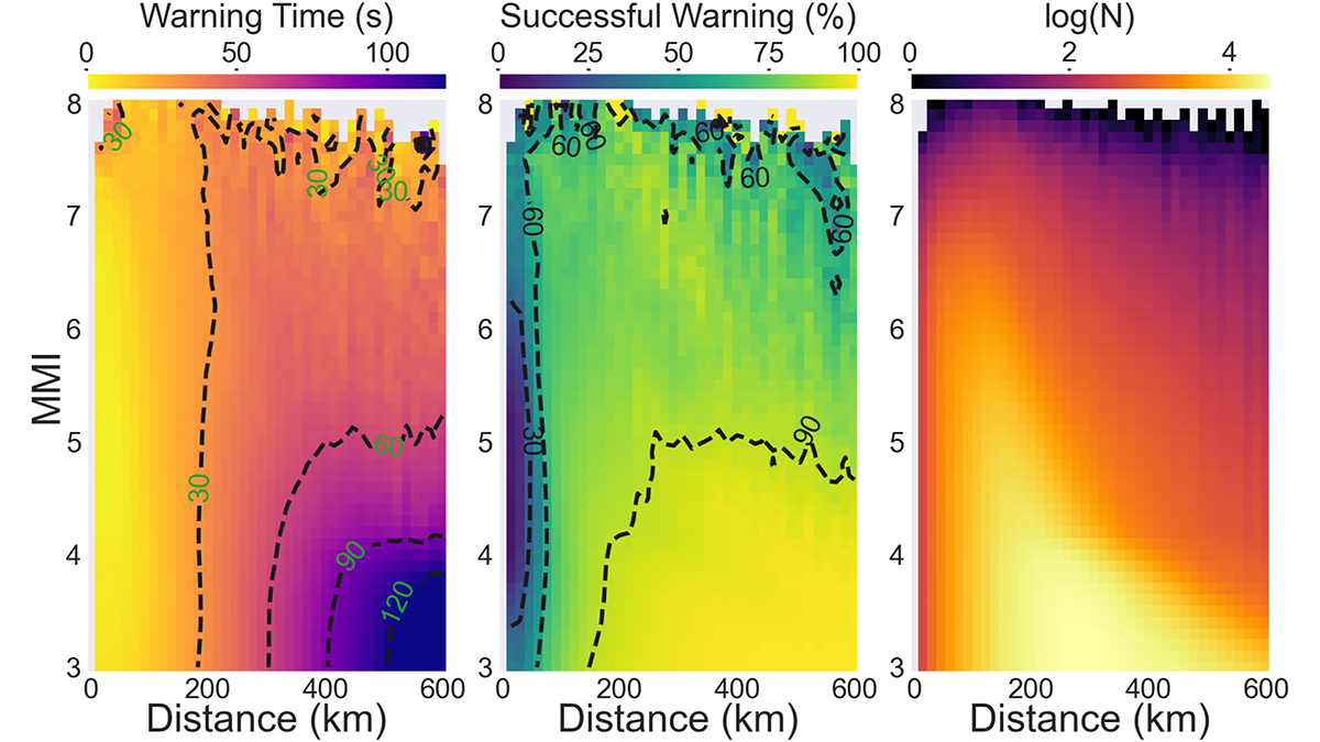
Deep Learning Facilitates Earthquake Early Warning
A deep learning model trained with real-time satellite data significantly reduces the time to predict the ground motion of big earthquakes.

Posted inNews
The United States Has an Updated Map of Earthquake Hazards
The new National Seismic Hazard Model shows where damaging earthquakes are likely to occur, informing public safety and infrastructure policies.

Posted inResearch Spotlights
Scientists Model What’s Moving Beneath Earth’s Surface
A 3D printed model of a fault served as the setting for a hydrofracturing experiment exploring the mechanisms behind slow earthquakes.

Posted inNews
Magnitude 7.0 Quake Rattles Kyrgyzstan-China Border
The quake struck in the remote Tien Shan mountains.

Posted inEditors' Highlights
Law and Order for Friction and Faults: One Law to Rule Them All
Faults are made of complex materials with complex behaviors, and having a single model that can predict these behaviors is an advance in understanding deformation and the earthquake cycle.

Posted inNews
Frost Quakes Shake Up Finland’s Wetlands
New research shows frost quakes may happen more frequently in wetland areas and, similar to earthquakes, can cause damage to infrastructure.