• About
  • Special Reports
  • Topics
    • Climate
    • Earth Science
    • Oceans
    • Space & Planets
    • Health & Ecosystems
    • Culture & Policy
    • Education & Careers
    • Opinions
  • Projects
    • Postcards From the Field
    • ENGAGE
    • Editors’ Highlights
    • Editors’ Vox
    • Eos en Español
    • Eos 简体中文版
    • Print Archive: 2015–2025
  • Policy Tracker
  • Blogs
    • Research & Developments
    • The Landslide Blog
  • Newsletter
  • Submit to Eos
  • AGU.org
  • Career Center
  • Join AGU
  • Give to AGU
  • About
  • Special Reports
  • Topics
    • Climate
    • Earth Science
    • Oceans
    • Space & Planets
    • Health & Ecosystems
    • Culture & Policy
    • Education & Careers
    • Opinions
  • Projects
    • Postcards From the Field
    • ENGAGE
    • Editors’ Highlights
    • Editors’ Vox
    • Eos en Español
    • Eos 简体中文版
    • Print Archive: 2015–2025
  • Policy Tracker
  • Blogs
    • Research & Developments
    • The Landslide Blog
  • Newsletter
  • Submit to Eos
Skip to content
  • AGU.org
  • Career Center
  • Join AGU
  • Give to AGU
Eos

Eos

Science News by AGU

Support Eos
Sign Up for Newsletter
  • About
  • Special Reports
  • Topics
    • Climate
    • Earth Science
    • Oceans
    • Space & Planets
    • Health & Ecosystems
    • Culture & Policy
    • Education & Careers
    • Opinions
  • Projects
    • Postcards From the Field
    • ENGAGE
    • Editors’ Highlights
    • Editors’ Vox
    • Eos en Español
    • Eos 简体中文版
    • Print Archive: 2015–2025
  • Policy Tracker
  • Blogs
    • Research & Developments
    • The Landslide Blog
  • Newsletter
  • Submit to Eos

earthquakes

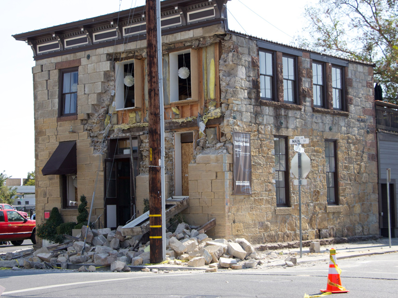
Stone crumbled off the surface of a building in Napa after the 2014 magnitude 6.0 earthquake.
Posted inNews

Overlooked Data Source Improves Quake Intensity Maps

Sarah Derouin, Science Writer by Sarah Derouin 20 February 20178 December 2022

A new approach may fine-tune estimates of the range of shaking from earthquakes and help define areas of potential damage.
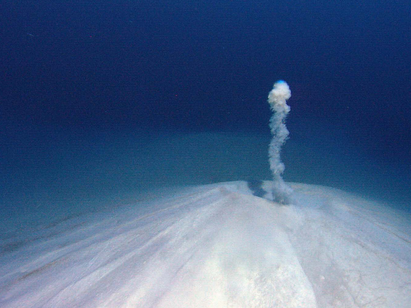
Researchers trace boron in fluids released by subducting slabs to assess how tectonic plates and ocean waters interact at subduction zones.
Posted inResearch Spotlights

Fingerprinting the Source of Fore-Arc Fluids

by Terri Cook 9 February 20178 February 2023

A new model tracks boron and other tracers in fluids expelled from subducting slabs to help identify the fluids' source regions and migration routes.

The Enguri Dam, nestled in the highly seismic mountains of the Caucasus, is surrounded by steep, landslide-prone slopes.
Posted inScience Updates

International Effort Tackles Landslide Hazards to Keep the Peace

by A. Tibaldi and N. Tsereteli 30 January 201713 January 2022

Earth scientists work with the North Atlantic Treaty Organization to help keep a border-straddling hydroelectric power plant on the Black Sea coast safe from landslides.
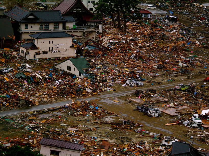
An offshore subduction zone drove the tsunami that devastated Japan in 2011.
Posted inResearch Spotlights

An Up Close Look at the Megaquakes That Cause Tsunamis

by S. Witman 25 January 20176 December 2021

Researchers recreate changes in the seafloor during Japan's devastating 2011 tsunami.

Posted inResearch Spotlights

River's Rise Linked to Oklahoma's Largest Earthquake

by S. Witman 13 January 20179 May 2022

As human-induced earthquakes increase in frequency and magnitude, researchers race to uncover their effects on surface water and groundwater.

glacier calving front
Posted inNews

More Frequent Glacial Quakes on Greenland Signal Ice Retreat

JoAnna Wendel, freelance science writer and illustrator by JoAnna Wendel 5 January 201711 January 2022

Between 1993 and 2011, the annual number of earthquakes caused by gigantic blocks of ice breaking away from Greenland's glaciers has increased, further evidence of accelerating ice loss.

Processes like mining and drilling tunnels, which displace material from the subsurface, can induce earthquakes.
Posted inNews

It’s Not Just Fracking: New Database of Human-Induced Quakes

JoAnna Wendel, freelance science writer and illustrator by JoAnna Wendel 22 December 201616 February 2022

In the largest compilation of anthropogenically induced earthquakes, causes range from building water reservoirs to mining.

Researchers pinpoint differences in fracture energy and rupture mechanisms between deep and shallow earthquakes.
Posted inResearch Spotlights

Probing the Source Properties of Deep Earthquakes

by Terri Cook 19 December 201610 March 2022

A global review of earthquake rupture parameters reveals that deep earthquakes have larger fracture energies and may have different rupture mechanisms than shallower seismic events.

Posted inEditors' Vox

Frontiers in Cryoseismology

by Fabio Florindo and Evgeny A. Podolskiy 8 December 201611 January 2022

Recent review provides timely and comprehensive resource for emerging field.

A building torn in two in Concepción, Chile, following a magnitude 8.8 earthquake in 2010.
Posted inResearch Spotlights

Understanding Tectonic Processes Following Great Earthquakes

by S. Witman 2 December 20165 October 2022

Scientists parse out the processes underlying tectonic signals detected by GPS networks.

Posts pagination

Newer posts 1 … 37 38 39 40 41 … 46 Older posts
Over a dark blue-green square appear the words Special Report: The State of the Science 1 Year On.

Features from AGU Publications

Research Spotlights

How Water Flows Toward Cities During Hurricanes

30 July 202630 July 2026
Editors' Highlights

The Definitive Guide to the TEX86 Paleothermometer

3 August 20263 August 2026
Editors' Vox

The Hidden Costs of Mining River Sand

27 July 202627 July 2026
Eos logo at left; AGU logo at right

About Eos
ENGAGE
Awards
Contact

Advertise
Submit
Career Center
Sitemap

© 2026 American Geophysical Union. All rights reserved Powered by Newspack