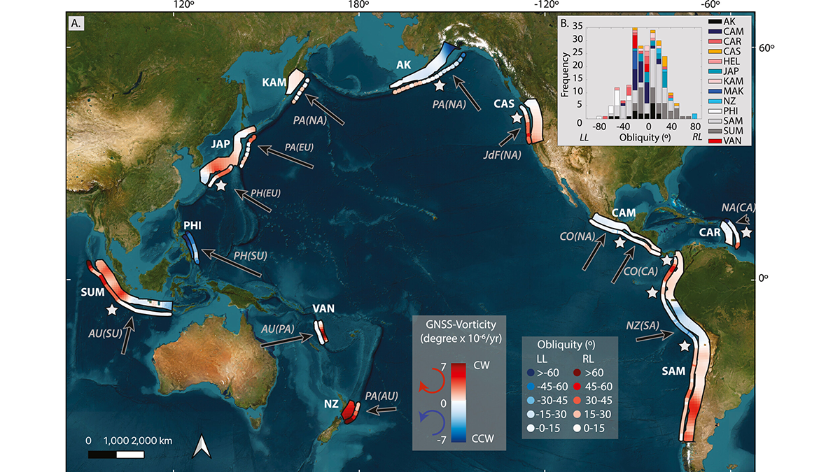
A global reanalysis of both short- and long-term deformation clarifies how obliquity affects strain partitioning in convergent plate boundaries.
earthquakes
Posted inEditors' Highlights
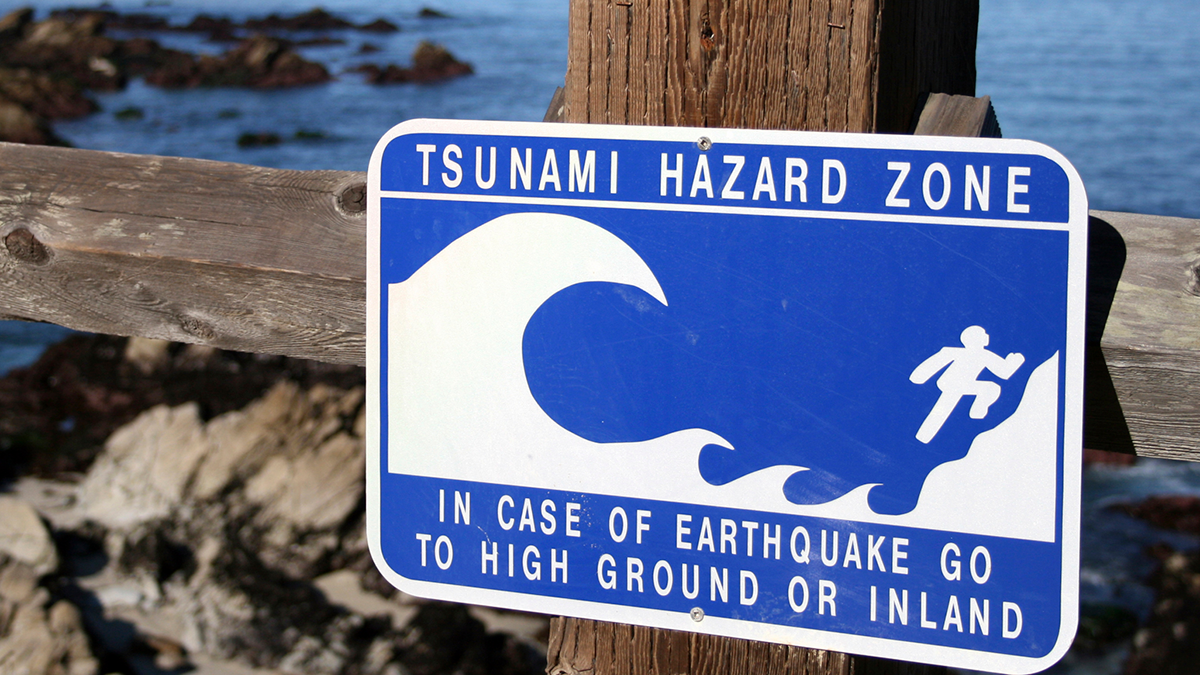
T-waves May Improve Tsunami Early Warning Systems
A unique acoustic wave related to the generation of tsunamis could be used to enhance early warning systems.
Posted inEditors' Highlights
Will It Run Away? Documenting Creep Bursts in a Slow-Moving Landslide
After 11-years of monitoring a slow-moving landslide and its shear zone in Norway, scientists reveal a complex pattern of creep bursts that require a rethink of the driving mechanisms.

Posted inEditors' Highlights
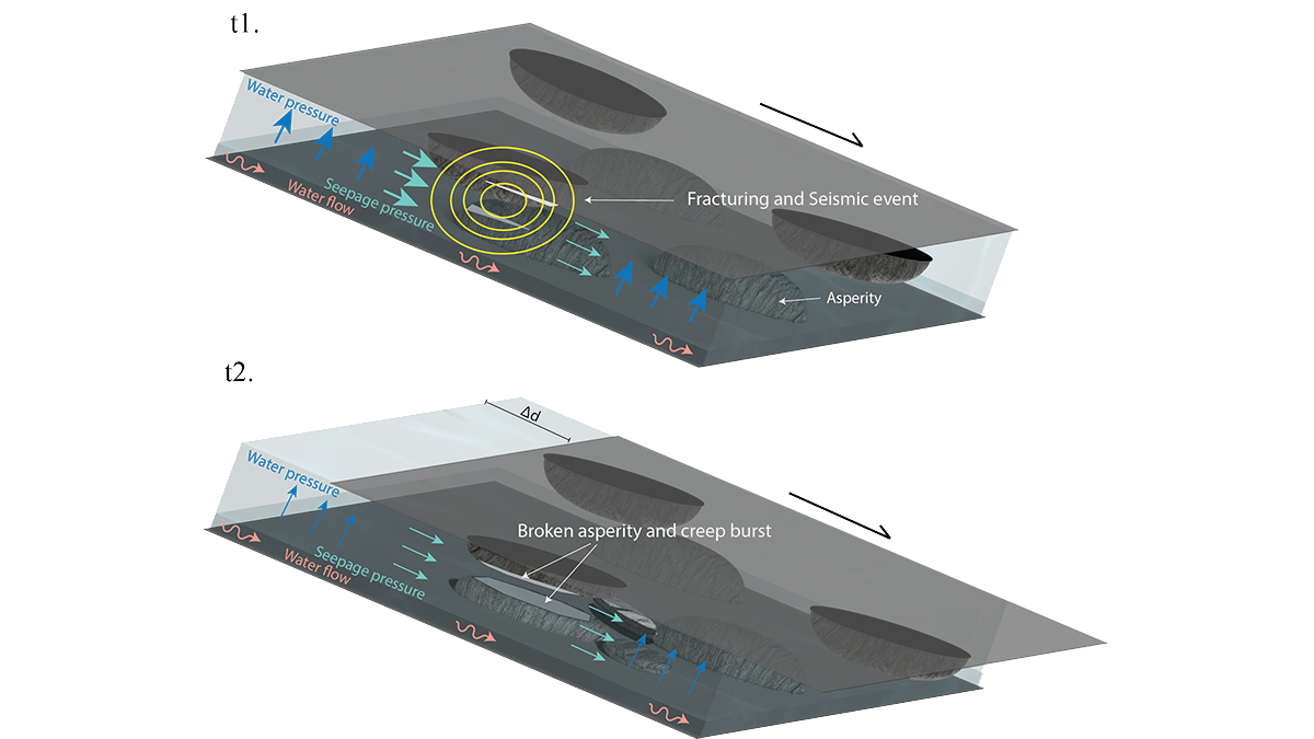
Slow But Powerful Fault Slip Can Simply Arise from Fluid Flow
Cyclic changes of fluid pressure in fault zones can induce slow-slip events that advance in the direction of fluid flow, even when the faults are stable.

Posted inResearch Spotlights
Modeling the Long and Short of Subduction Zones
A new subduction model could reveal important insights about megathrust earthquakes.

Posted inThe Landslide Blog
Landslides from the 17 December 2024 Mw=7.3 Port Vila earthquake in Vanuatu
The Landslide Blog is written by Dave Petley, who is widely recognized as a world leader in the study and management of landslides. In terms of “natural” disasters, attention is currently focused on events in Los Angeles, which will in due course may have substantial implications for landslides. A large atmospheric river event in the […]
Posted inEditors' Vox
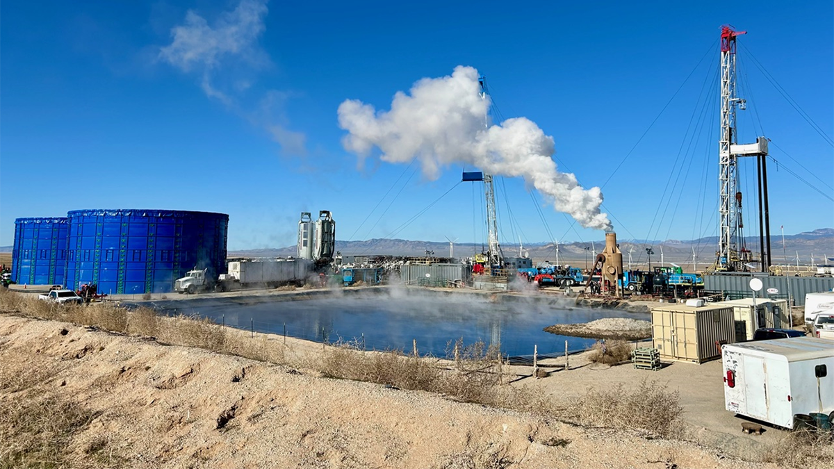
Guidelines for Managing Induced Seismicity Risks
Consolidating state-of-the-art science into guidelines provides a path forward for managing induced seismicity risks and highlights avenues for future research.

Posted inNews
Improving Earthquake Early Warning Access for the Deaf Community
Earthquake early warning systems are rarely accessible to people who are deaf or hard of hearing. A group of scientists is working to change that.
Posted inEditors' Highlights
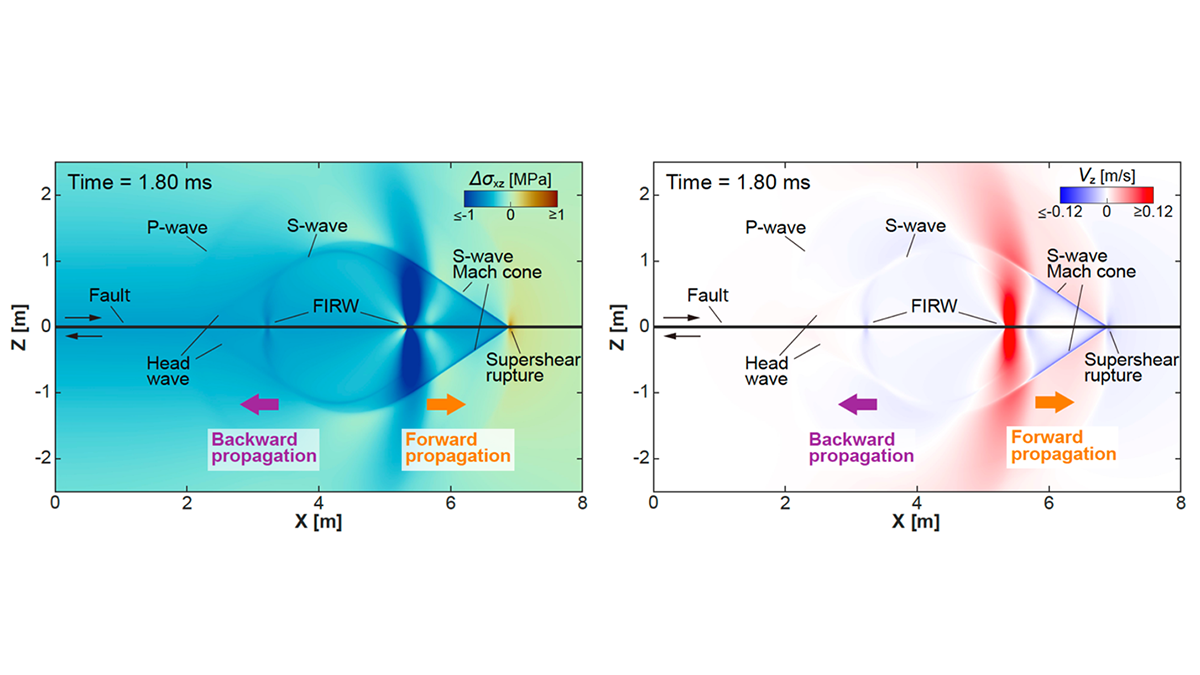
Rewinding the Fault: Stress Perturbations Promote Back-Propagating Ruptures
Free surface reflection and fault geometric asperities can excite backward propagation in the form of an interface wave or high-order re-rupture.

Posted inEditors' Highlights
Past Fracture Damage Can Inhibit Earthquake Slip
Around the surface rupture of the 2008 Wenchuan earthquake, a new study documents an anti-correlation between pre-existing fracture damage and earthquake slip – implying that damage inhibited slip.