More than 21,000 pits, depressions, and closed valleys on Titan may provide access to underground voids or caves.
erosion & weathering
Posted inEditors' Highlights
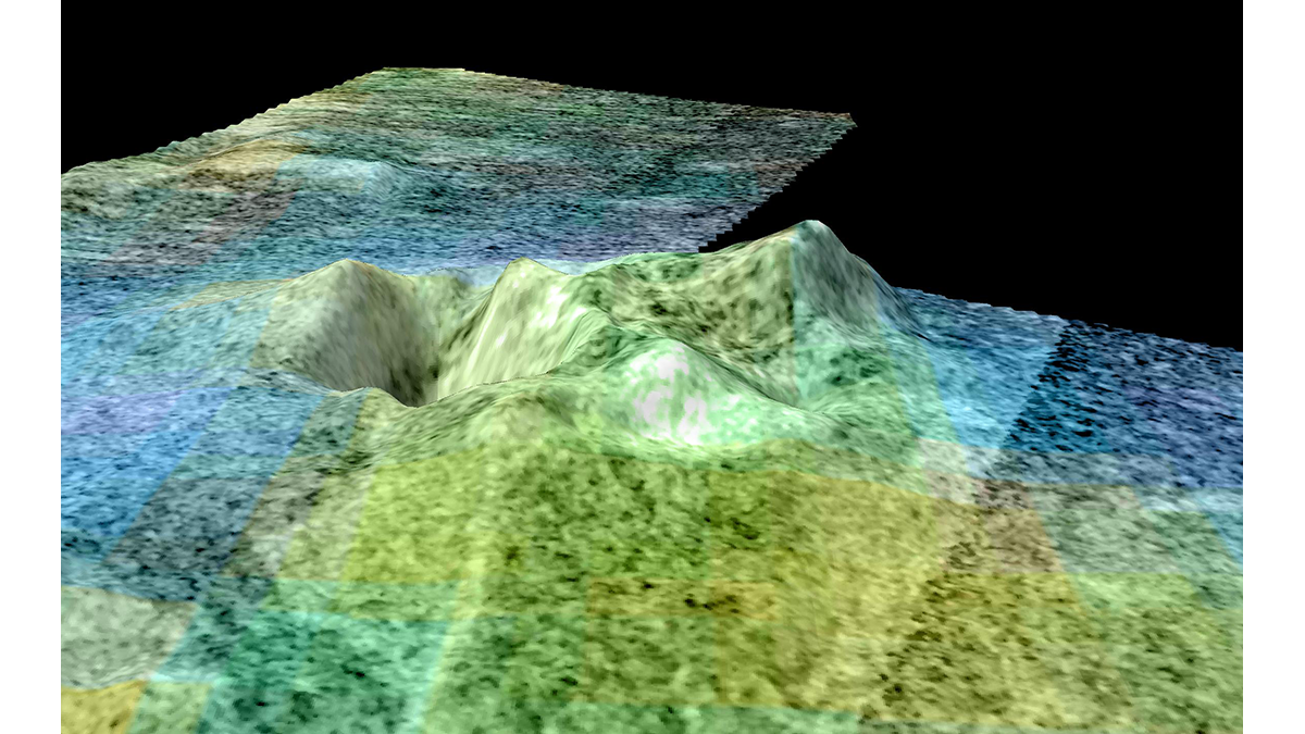
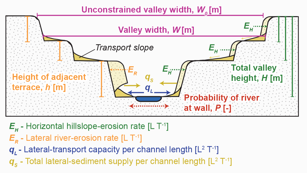
Why Do Fluvial Valleys Behave So Differently?
Source: AGU Advances Editors’ Highlights are summaries of recent papers by AGU’s journal editors. The shape of fluvial valleys results from the complex interaction between climate and the local environment. Our current knowledge suggests that river discharge and valley-wall lithology are the main controls on valley width. Yet, current models based on these observations fail […]
Posted inNews
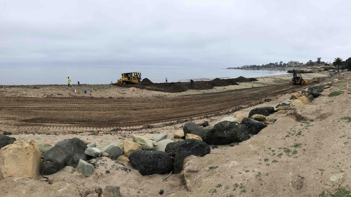
Managing Mudslide Debris After Fires
California officials faced a conundrum in dealing with mudslides after the Thomas Fire.
Posted inNews
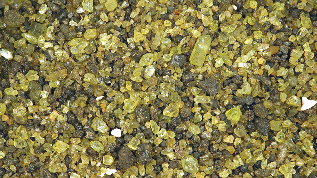
Can These Rocks Help Rein in Climate Change?
Spreading olivine on beaches could accelerate ocean uptake of carbon dioxide and potentially limit climate change. The concept and execution still face some scrutiny from scientists.
Posted inEditors' Vox
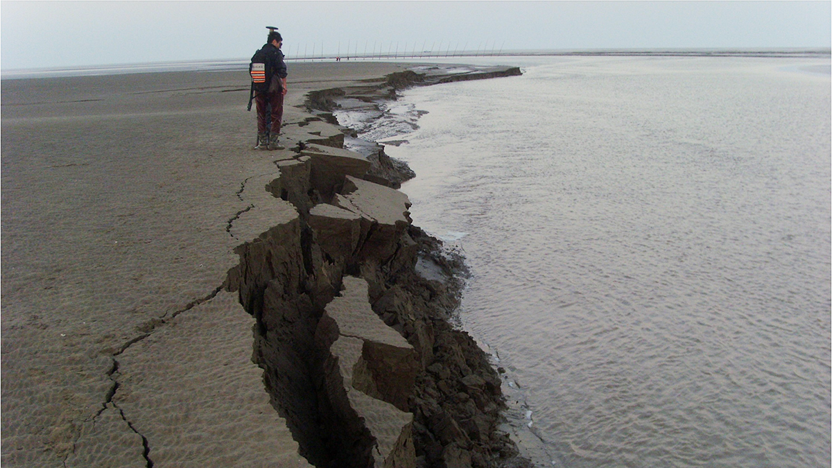
Bank Retreat Controls River and Estuary Morphodynamics
Understanding and predicting the geomorphological response of fluvial and tidal channels to bank retreat underpins the robust management of water courses and the protection of wetlands.
Posted inEditors' Highlights
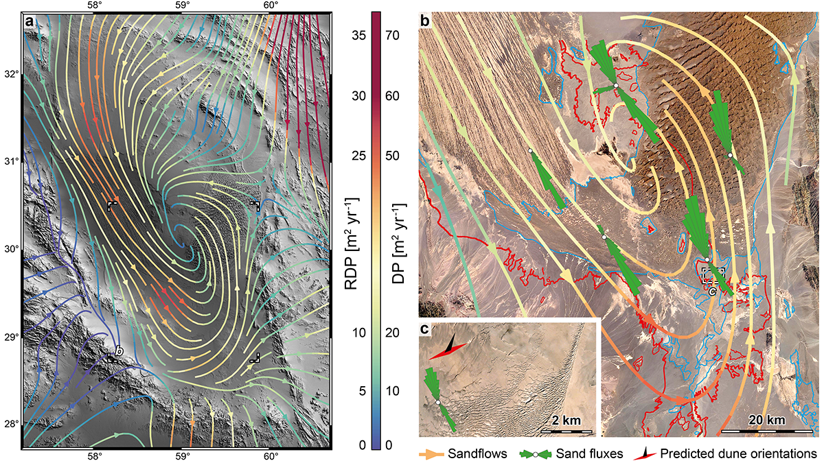
A Unique Glimpse at Sediment Erosion and Deposition by Wind
The Lut Desert in Iran is an exceptional natural laboratory to study how wind moves sediment across the landscape. A new study quantifies erosional and depositional sediment fluxes of the desert.

Posted inNews
Satellites Show Magnitude of Human Influence on River Sediment Flux
Dam-building has decreased the amount of sediment transported by rivers, while land use changes have increased the amount.

Posted inResearch Spotlights
Small Catchments Sustain Silicon Signatures Following Storms
Watersheds have unique patterns of silicon export due to differences in subsurface water routing and biogeochemical reactions.
Posted inEditors' Highlights
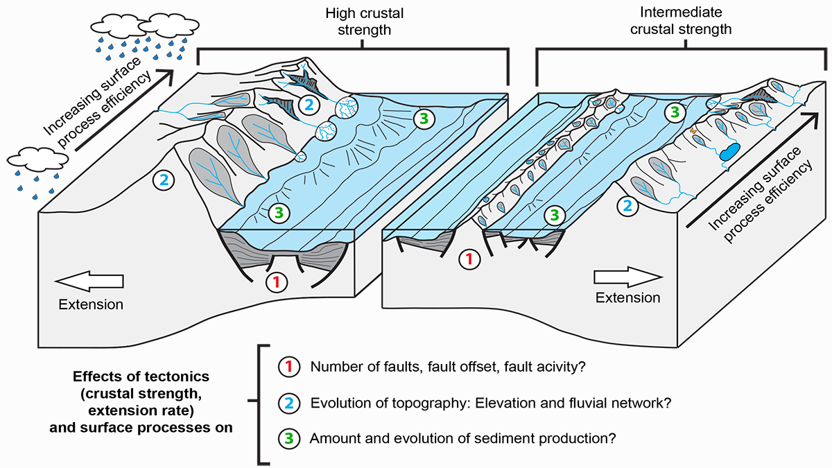
The Lost Topography Around Continental Rifts
Numerical models provide quantitative constraints on topography lost to erosion, showing how the sediment influx in a sedimentary basin reflects its tectonic and topographic evolution.

Posted inEditors' Highlights
Extreme Lithium Isotope Fractionations During Intense Weathering
Extreme lithium fractionation is observed when primary minerals in andesite are transformed to secondary clay minerals and then to oxides with intensive chemical weathering in a tropical climate.