
An international team overcame many challenges, including from the COVID-19 pandemic, to deploy a dense seismic network along an understudied fault system that poses hazards to millions in Indonesia.
faults

Posted inEditors' Highlights
Clay Type, Not Just Content, Crucial for Fault Zone Permeability
Faults containing clays are often considered as barriers to fluid flow but new work shows that fault processes leading to the formation of clays can increase permeability relative to the host rock.

Posted inResearch Spotlights
Clues to Pluto’s History Lie in Its Faults
Studying geological features on Pluto’s surface can illuminate the ancient history of how the dwarf planet formed.

Posted inResearch Spotlights
How Fault Surface Features Can Tell Us About Future Earthquakes
A new study suggests ways to quantify fault maturity, a property that affects earthquake characteristics.
Posted inNews
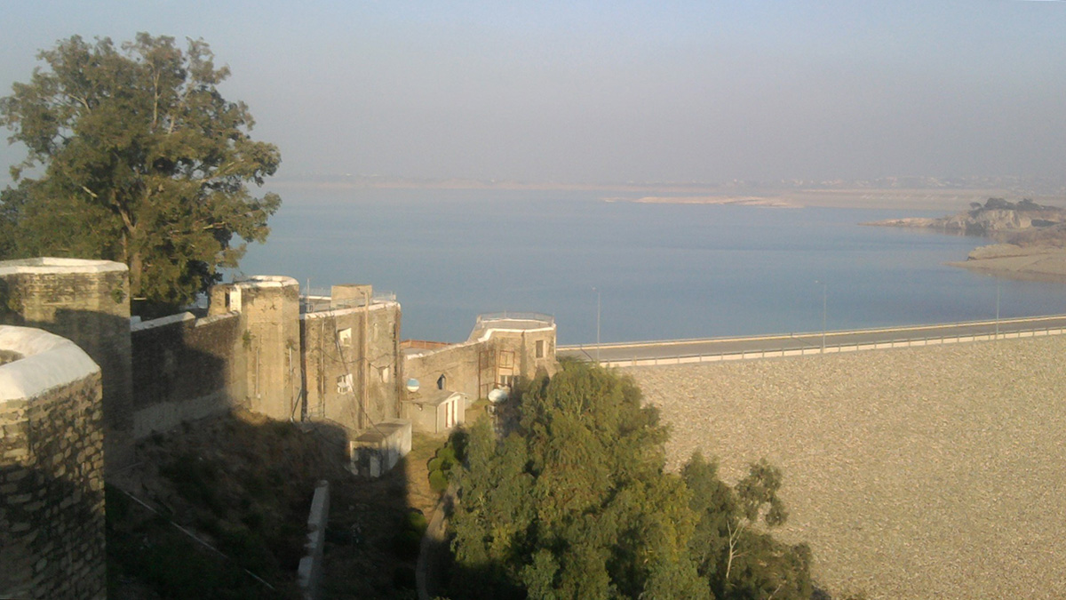
A Monsoon-Filled Reservoir Might Have Nudged a Fault to Fail
New research examines whether a sudden increase in water loading in Pakistan’s Mangla Dam might have been connected to the 2019 New Mirpur earthquake.

Posted inResearch Spotlights
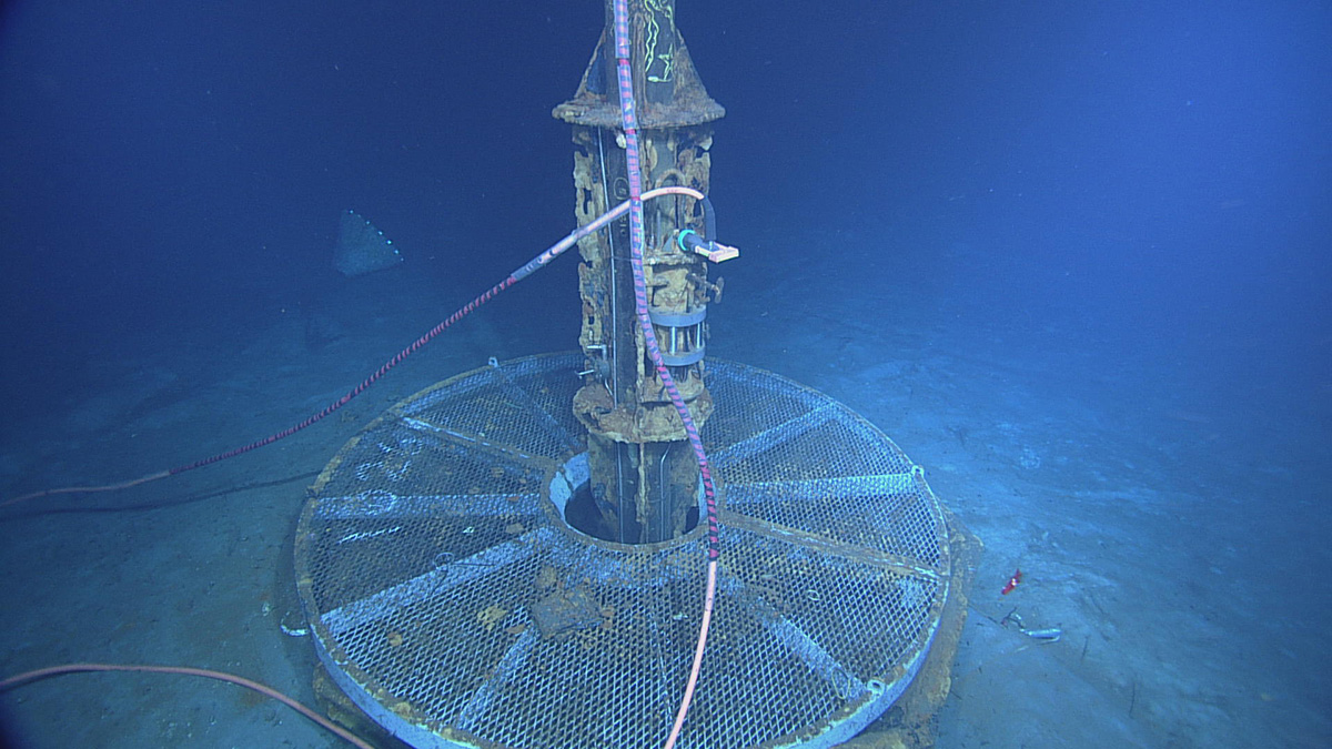
Faults in Oceanic Crust Contribute to Slow Seismic Waves
New high-sampling rate measurements of fluid pressures in oceanic crust reveal unresolved fractures and pathways for fluid flow.

Posted inENGAGE, News
Drone Rules Make Tracking Down Faults a Difficult Feat
Regulations differ from country to country, but on one point, they’re relatively uniform: Drones must remain within their operators’ line of sight. How do earthquake scientists collect drone data while working within the rules?

Posted inResearch Spotlights
A New Method Produces Improved Surface Strain Rate Maps
The transdimensional Bayesian approach handles GPS data limitations better than existing methods and may assist future seismic hazard assessment studies.
Posted inEditors' Highlights
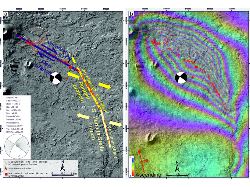
Volcano—Tectonic Interactions at Etna
Mapping of a 2018 earthquake that ruptured the eastern flank of Mount Etna shows that it occurred on a tectonic lineament that predates the volcano, and the kinematics match nearby tectonic domains.