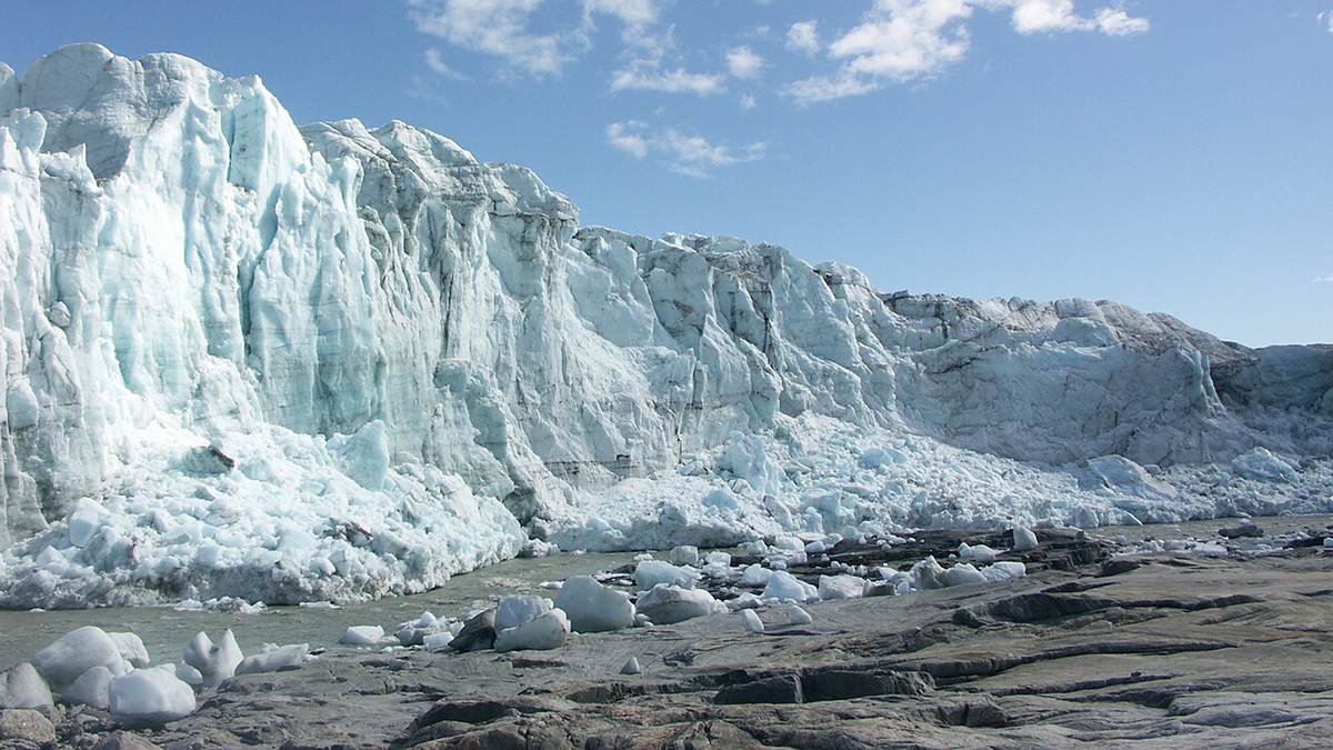
A new study provides insights into where the channels that drain subglacial water from underneath the Greenland Ice Sheet are most likely located.
geomorphology

Posted inNews
A Seychelles Shoreline Resists the Rising Seas
The geomorphology of a protected atoll likely contributed to its ability to maintain its shoreline over a turbulent half-century.
Posted inNews
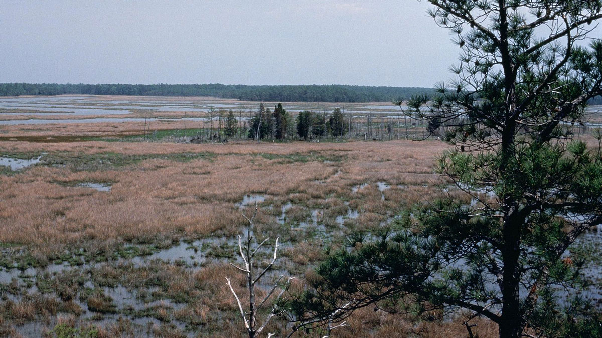
As Seas Rise, Marshes May Still Trap Carbon—and Cool the Planet
Rising seas spell doom for coastal wetlands trapping carbon—or do they? New research reveals that as these ecosystems transition, they can still trap carbon and possibly cool the planet.
Posted inNews
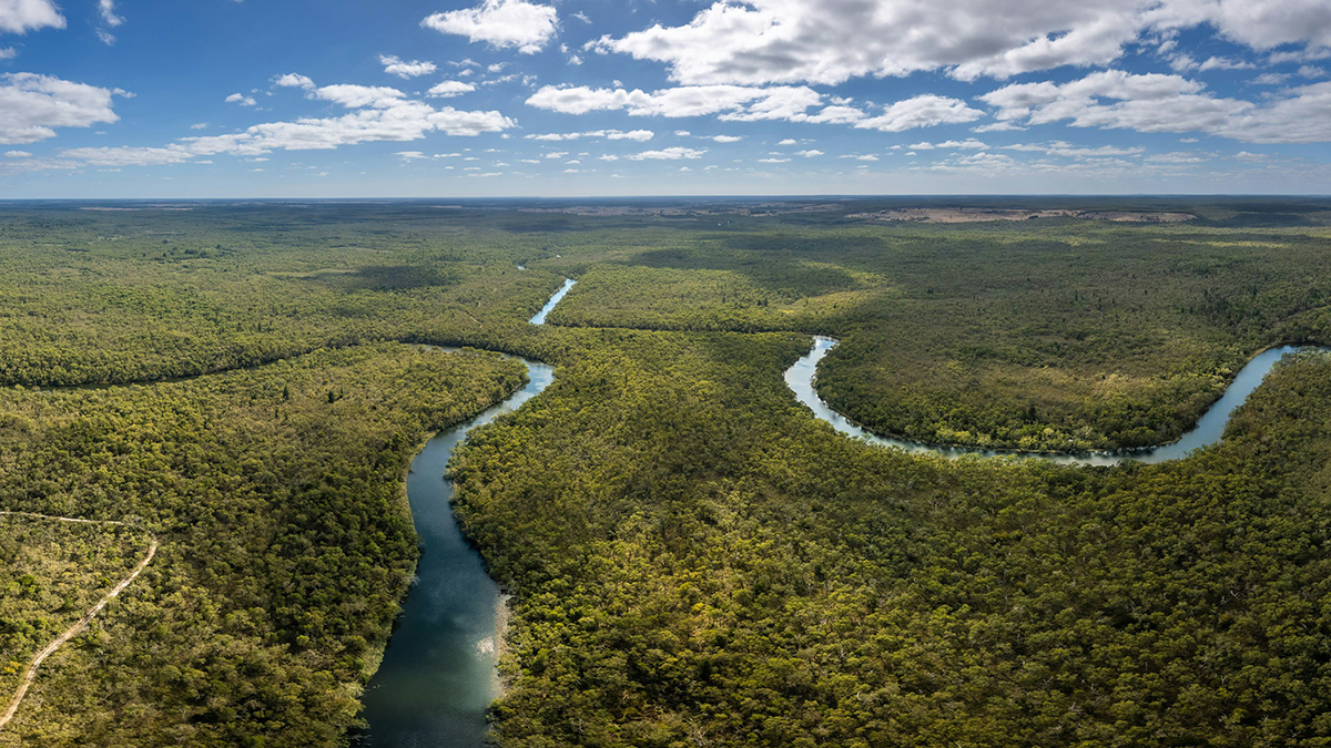
New Rules for Catastrophic River Avulsion
Scientists thought two factors influencing river avulsion were unrelated, but new research suggests they may be working in tandem. The findings could help predict new river pathways and improve disaster preparedness.
Posted inNews
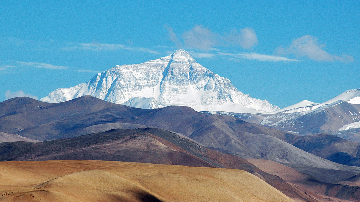
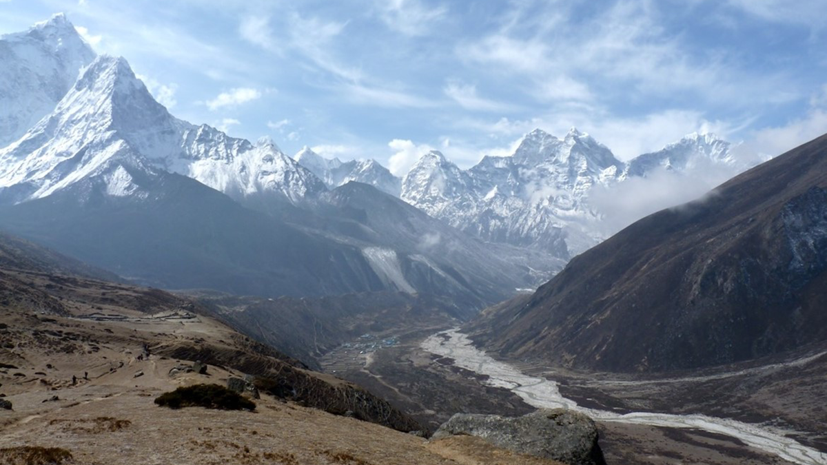
A Pirate River May Be Giving Mount Everest a Boost
Rapid erosion can cause mountains to rise—even the world’s tallest peak.
Posted inEditors' Highlights
Sediment Dampens the Impact of Glaciation on Cenozoic Denudation
Rates of continental-scale sediment flux and denudation are similar between glacial and interglacial periods when the aggradation of glacier-eroded sediment inhibits fluvial erosion downstream.
Posted inResearch Spotlights
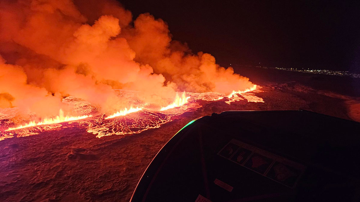
En una rara oportunidad, investigadores observan la formación de los valles islandeses
Durante el período previo a las recientes erupciones volcánicas cerca de la ciudad de Grindavík, científicos documentaron la formación de grabens en tiempo real.

Posted inNews
Hungry Stingrays Shift Serious Amounts of Sediment
While digging for food on estuary bottoms, rays push around literally tons of sediment, changing their habitat in profound ways.

Posted inResearch Spotlights
In Rare Opportunity, Researchers Observe Formation of Icelandic Valleys
During the lead-up to recent volcanic eruptions near the city of Grindavík, scientists documented graben formation in real time.
Posted inNews
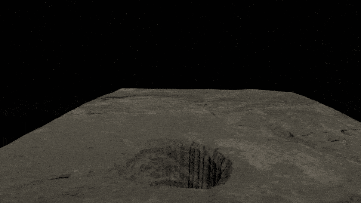
Lunar Lava Tube Revealed Beneath Collapsed Pit
The Sea of Tranquility is home to at least one lunar lava tube, which could preserve a pristine and unweathered record of lunar volcanism.