
New research says it’s plausible the Great Sphinx started life as a geomorphological oddity known as a yardang.
geomorphology

Posted inEditors' Highlights
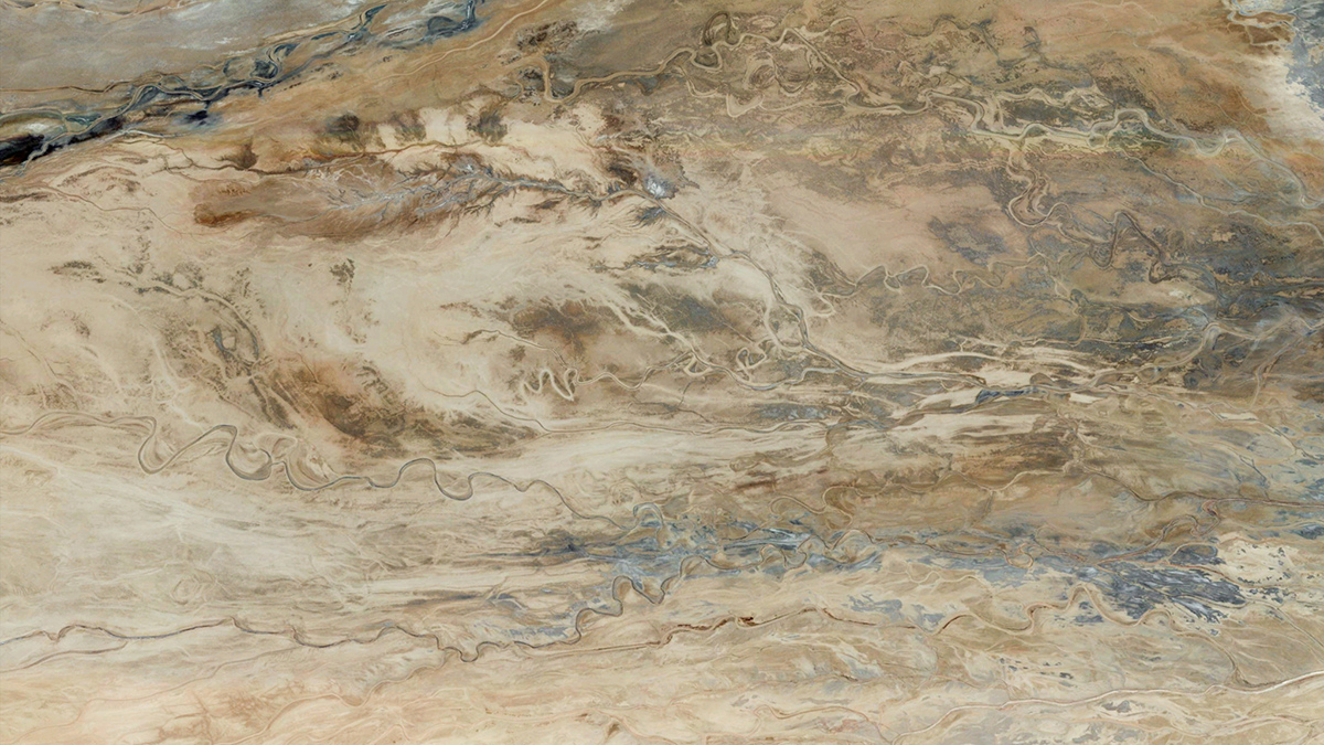
Desert Landscape Evolution Controlled by Storm Intensity
A new study in the Negev Desert finds that long-term erosion of a desert escarpment occurs in drier areas where intense storms are most frequent.

Posted inNews
Ancient Mars May Have Had a Cyclical Climate
Hexagonal structures in sediments are evidence of repeated wet and dry conditions on the Red Planet.

Posted inNews
Las plantas construyen dunas pero pueden acelerar la erosión durante tormentas fuertes
Cuando las olas golpean las dunas con vegetación, se forman áreas anegadas frente a las plantas, lo que facilita que la arena sea arrastrada por la corriente más fácilmente. Sin embargo, las plantas aún son necesarias para formar las dunas en primera instancia.
Posted inResearch Spotlights
Mud Could Have Made Meandering Rivers Long Before Plants Arrived
New evidence from 1.2-billion-year-old rocks suggests that single, sinuous channels could have formed in muddy floodplain sediments without the stabilizing help of vegetation.

Posted inNews
Plants Build Dunes but Can Speed Erosion During Severe Storms
When waves hit vegetated dunes, waterlogged areas form in front of plants, making for sand that’s easier to wash away. But you still need plants to form dunes in the first place.

Posted inNews
Supersized Potholes Discovered off South African Coast
Curious circular pits off South Africa’s Eastern Cape coast are larger than any similar feature previously recorded. Their origin remains a morphological mystery.

Posted inENGAGE, News
As the Arctic Warms, These Rivers Are Slowing Down
The Arctic is warming up, but instead of large rivers migrating faster, they’re actually slowing down because of shrubification.
Posted inNews
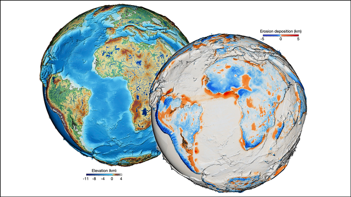
One Surface Model to Rule Them All?
For the first time, scientists have forged a nearly all-encompassing model of Earth’s surface evolution over the past 100 million years.

Posted inNews
In New Zealand, Fish Are Helping Scientists Find Gold
Enormous amounts of gold lie buried beneath the rubble of New Zealand’s mountains, and scientists are using freshwater fish genetics to find it.