
In mid-December 1952, a landslide careened into the ocean in West Greenland and triggered a tsunami. The deluge of water damaged a building in a nearby village. Ten kilometers away, waves overtook four fishermen. One died, and the other three scrambled in freezing clothes into a hut. A local newspaper reported accounts of the tsunami, but the details were otherwise a mystery.
Then, in 2017, another landslide in Greenland triggered a tsunami. This one killed four people and forced two villages to be permanently abandoned. After the disaster, Kristian Svennevig, a geologist with the Geological Survey of Denmark and Greenland, and his colleagues were tasked with quantifying future landslide risk in Greenland.
“We can look at slopes that are moving today, and we can speculate how they’re going to fail,” Svennevig said. “But the best way is to actually look at what has failed and how.” The team reopened the case of the deadly 1952 landslide and made a surprising discovery: Climate change may have primed the disaster.
“Potentially, this is the first death that we can tie directly to climate change in the Arctic,” Svennevig said.
Peering into the Past
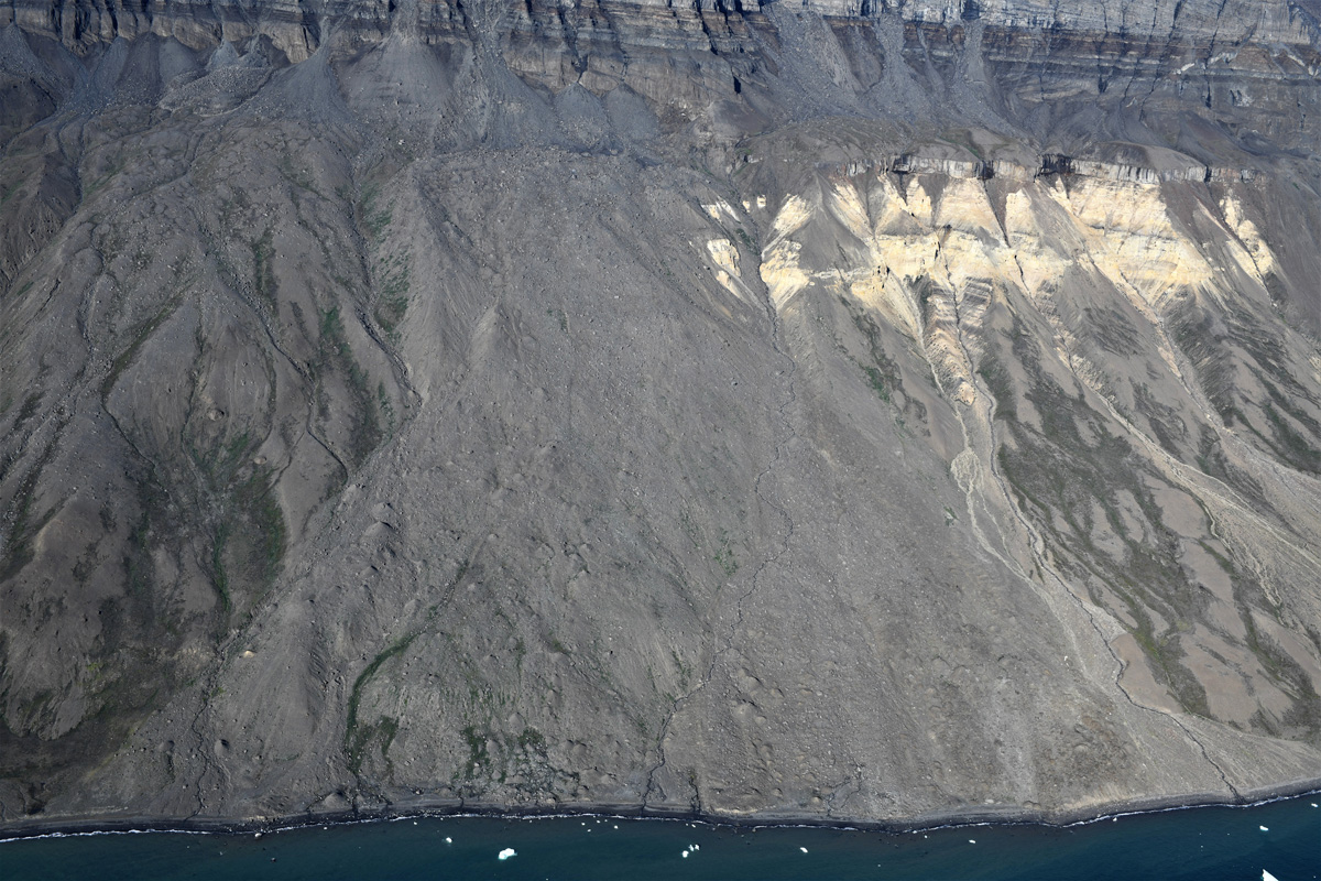
Svennevig started by studying eyewitness accounts, which helped determine a more precise time for the landslide and the size of the tsunami. He also found video and aerial photographs of the slope from 1949 (before the slide) and 1953 (soon after it). The researchers themselves collected images of the region in 2019.
Annette Patton, a geoscientist with the Sitka Sound Science Center who wasn’t involved with the research, emphasized that gathering details about any landslide is challenging, especially one this old. “This type of information is absolutely invaluable,” she said. “The more events you can include in your analysis of a region as a whole, with detailed information about timing and impacts, the more robust your understanding of landslide processes across the region.”
When Permafrost Thaws
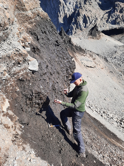
By scrutinizing the slide’s debris, the scientists made a crucial observation. “What we saw in the 1952 landslide were these cones of loose material lying around,” Svennevig said. The cones, known as molards, form when permafrost thaws within frozen blocks of gravel. “In a way, it’s permafrost cemented,” Svennevig said.
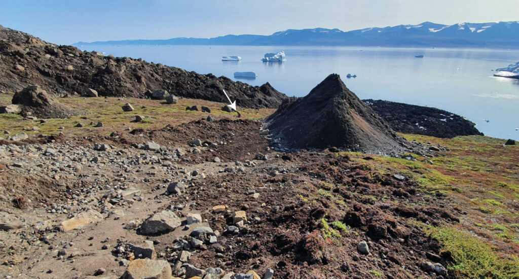
The depth of the landslide suggested that the permafrost thaw couldn’t be chalked up to normal, yearly variation in climate. Annual fluctuations in temperature can be observed only at about 10–15 meters inside permafrozen slopes. “That the 1952 landslide was 80 meters inside the slope is a sign that there’s something going on beyond the yearly fluctuations,” Svennevig said.
Once a permafrozen slope starts to warm, it becomes more plastic, and rock starts to creep downhill. The landslide trigger could have been anything from water infiltration to an unlucky reindeer, Svennevig said, but “if the slope wasn’t creeping, it wouldn’t fail.”
On the basis of these observations, recently published in Science of the Total Environment, the scientists concluded that Arctic warming set the stage for the 1952 landslide by degrading permafrost. It’s the earliest example of this type of landslide in the Arctic, and it resulted from warming that began at the turn of the 20th century.
A Unique Comparison
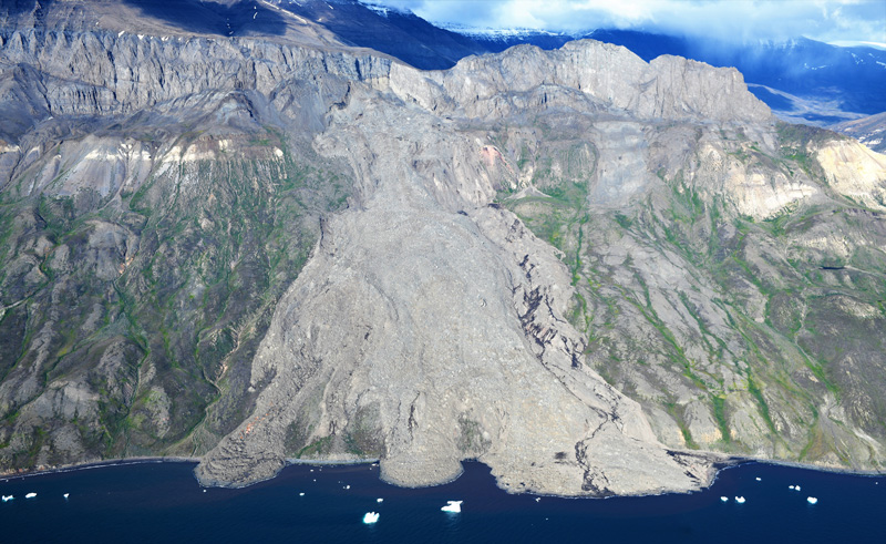
In 2021, Svennevig was almost finished putting together the paper on the 1952 landslide when a new, very similar landslide happened 7 kilometers away. “They’re from the same elevation, same material, almost the same depth, and same volume,” Svennevig said. Yet the 2021 event did not produce a tsunami. Comparing these landslides could help scientists identify slopes that are most likely to fail and cause tsunamis in the future.
And with the current warming trends, fail they will, scientists have said. “There [are] going to be big changes in the extent of permafrost within this next century,” Patton said. “It’s likely that we’ll see some big changes in landslide processes at a fundamental level in that same scale.”
—Andrew Chapman (@andrew7chapman), Science Writer
This news article is included in our ENGAGE resource for educators seeking science news for their classroom lessons. Browse all ENGAGE articles, and share with your fellow educators how you integrated the article into an activity in the comments section below.