
Researchers investigated concentrations of clumped methane isotopes to learn more about how levels of the potent greenhouse gas have changed over the industrial era.
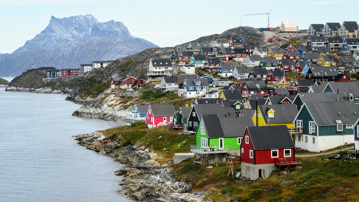
Greenland
Posted inResearch Spotlights
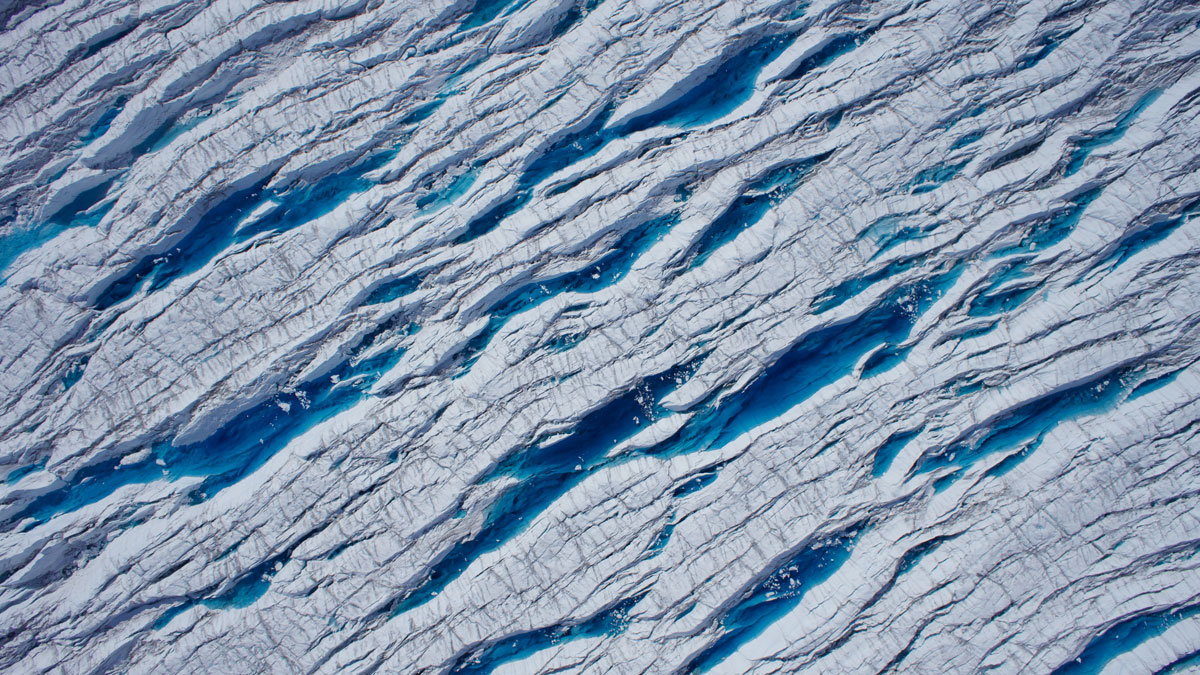
Stretching and Squeezing Release Glacial Meltwater
Seasonal changes in the forces that pull and push ice play a major role in when meltwater runs through glaciers and into the ocean.

Posted inResearch & Developments
Sea Level Rise is Accelerating, Scientists Confirm
New research closes the sea level budget gap and takes account of the drivers of sea level change.
Posted inScience Updates
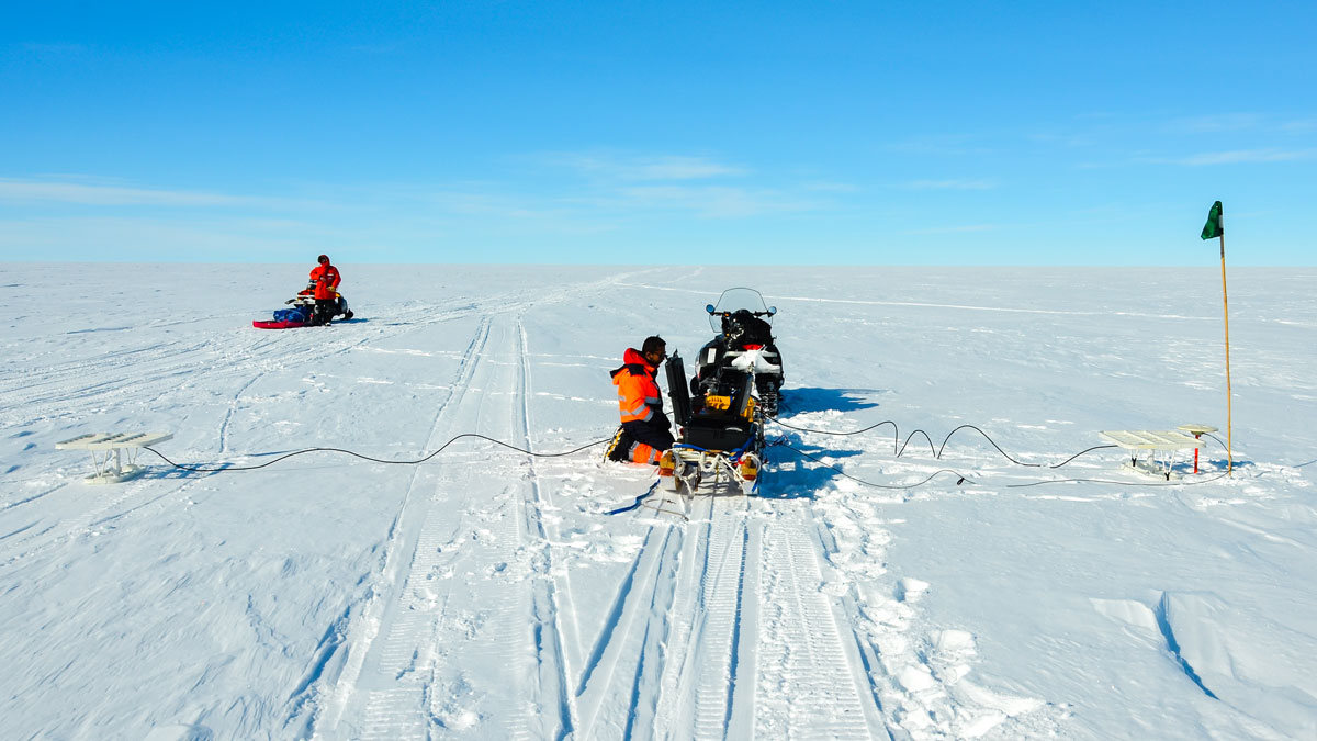
New Directions in Mapping Ice Sheet Fabrics and Flow
Polarimetric radar advances enable scientists to measure orientations of crystals, bubbles, and other properties that affect the flow of glaciers and ice sheets—and their contributions to sea level.
Posted inScience Updates
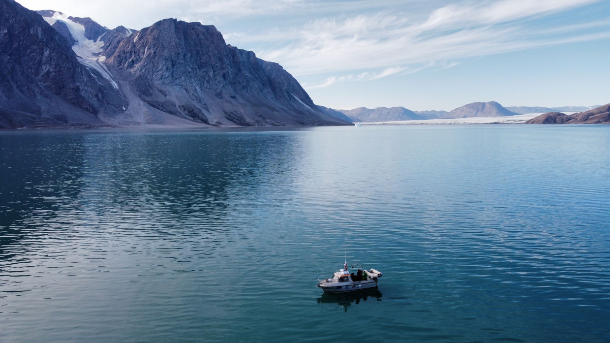
Melting Glaciers Make the Coastal Ocean More Sensitive
Fresh water from retreating ice does more than raise sea levels. It affects how the ocean responds to acidification and other environmental changes.
Posted inEditors' Highlights
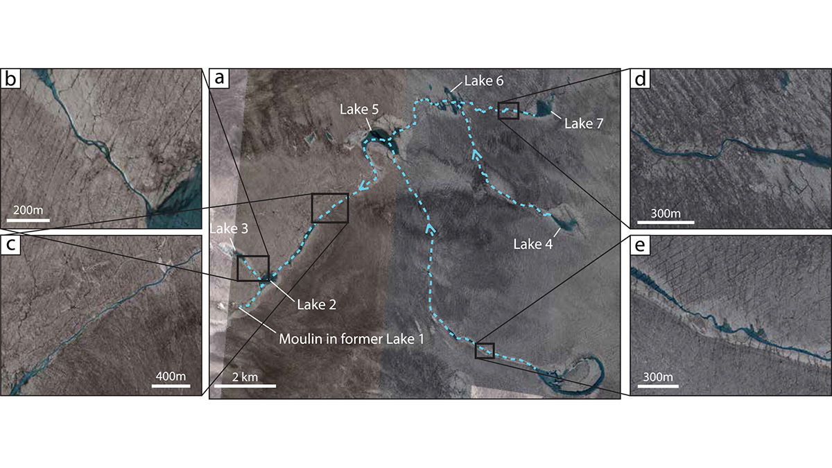
The Fate of the Greenland Ice Sheet: Deep Learning from SkySat Images
Surface meltwater ponding and drainage in the Greenland Ice Sheet is analyzed at high spatial and temporal resolution through SkySat imagery and deep learning.
Posted inNews
Greenland Dust Delivers Nutrients to Ice-Melting Algae
Researchers scrutinized aerosols above and within the ice sheet, finding phosphorus and other mineral particles.
Posted inResearch & Developments
Hundreds of Scientists “Vehemently Oppose” U.S. Effort to Purchase Greenland
More than 200 scientists scientists have signed a letter condemning U.S. President Donald Trump’s efforts to acquire Greenland.
Posted inEditors' Highlights
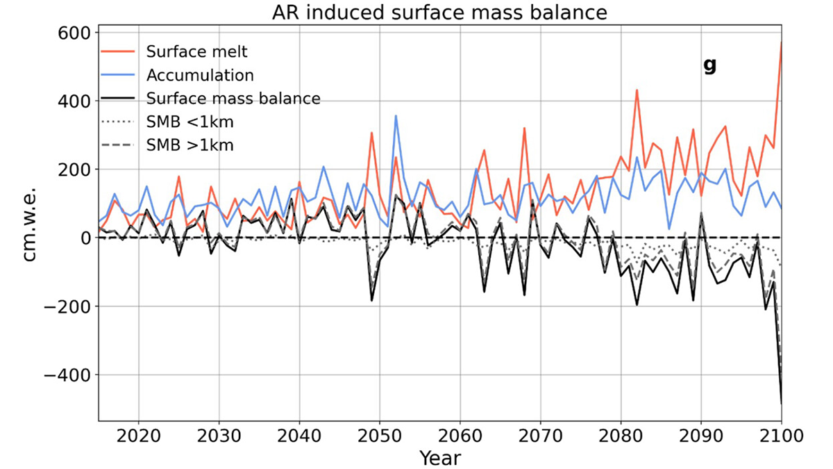
Atmospheric Rivers Shaped Greenland’s Ancient Ice
New simulations reveal how atmospheric rivers influenced Greenland’s ice sheet during the Last Interglacial—offering clues to future melt in a warming world.
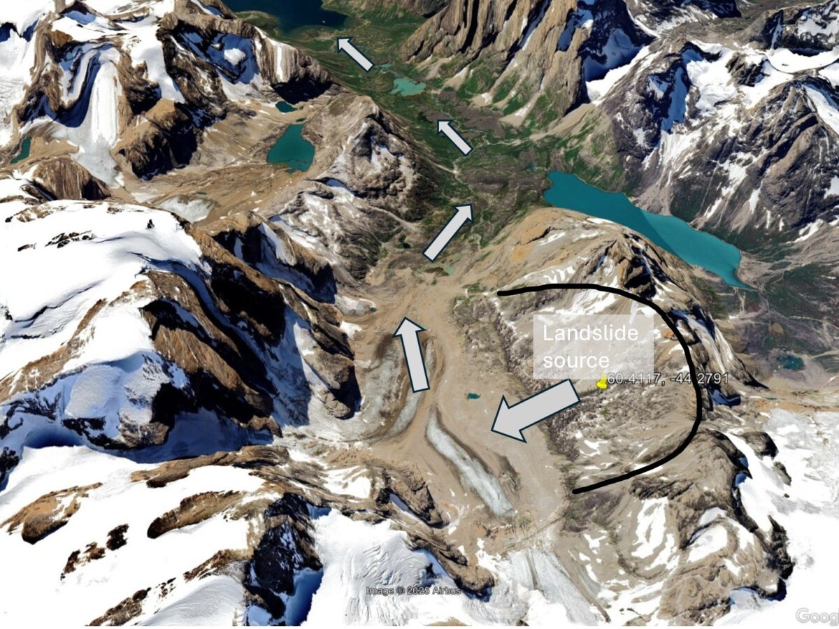
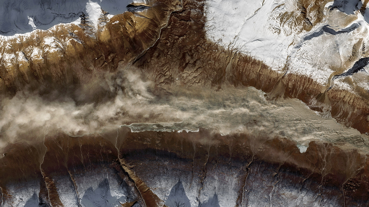
Posted inThe Landslide Blog
The giant Tupaasat rock avalanche in South Greenland
A new paper describes a rock avalanche in Greenland about 10,900 years BP that had a volume of over 1 billion cubic metres and that travelled almost 16 kilometres. A fascinating paper (Pedersen et al. 2026) has just been published in the journal Geomorphology that describes a newly-discovered ancient rock avalanche in Greenland. This landslide, […]