• About
  • Special Reports
  • Topics
    • Climate
    • Earth Science
    • Oceans
    • Space & Planets
    • Health & Ecosystems
    • Culture & Policy
    • Education & Careers
    • Opinions
  • Projects
    • Postcards From the Field
    • ENGAGE
    • Editors’ Highlights
    • Editors’ Vox
    • Eos en Español
    • Eos 简体中文版
    • Print Archive: 2015–2025
  • Policy Tracker
  • Blogs
    • Research & Developments
    • The Landslide Blog
  • Newsletter
  • Submit to Eos
  • AGU.org
  • Career Center
  • Join AGU
  • Give to AGU
  • About
  • Special Reports
  • Topics
    • Climate
    • Earth Science
    • Oceans
    • Space & Planets
    • Health & Ecosystems
    • Culture & Policy
    • Education & Careers
    • Opinions
  • Projects
    • Postcards From the Field
    • ENGAGE
    • Editors’ Highlights
    • Editors’ Vox
    • Eos en Español
    • Eos 简体中文版
    • Print Archive: 2015–2025
  • Policy Tracker
  • Blogs
    • Research & Developments
    • The Landslide Blog
  • Newsletter
  • Submit to Eos
Skip to content
  • AGU.org
  • Career Center
  • Join AGU
  • Give to AGU
Eos

Eos

Science News by AGU

Support Eos
Sign Up for Newsletter
  • About
  • Special Reports
  • Topics
    • Climate
    • Earth Science
    • Oceans
    • Space & Planets
    • Health & Ecosystems
    • Culture & Policy
    • Education & Careers
    • Opinions
  • Projects
    • Postcards From the Field
    • ENGAGE
    • Editors’ Highlights
    • Editors’ Vox
    • Eos en Español
    • Eos 简体中文版
    • Print Archive: 2015–2025
  • Policy Tracker
  • Blogs
    • Research & Developments
    • The Landslide Blog
  • Newsletter
  • Submit to Eos

geomorphology

Aerial image of the 1952 landslide showing the debris path that leads into the ocean
Posted inENGAGE, News

A 1952 Landslide Hints at Early Permafrost Thaw in the Arctic

by Andrew Chapman 22 March 20234 April 2023

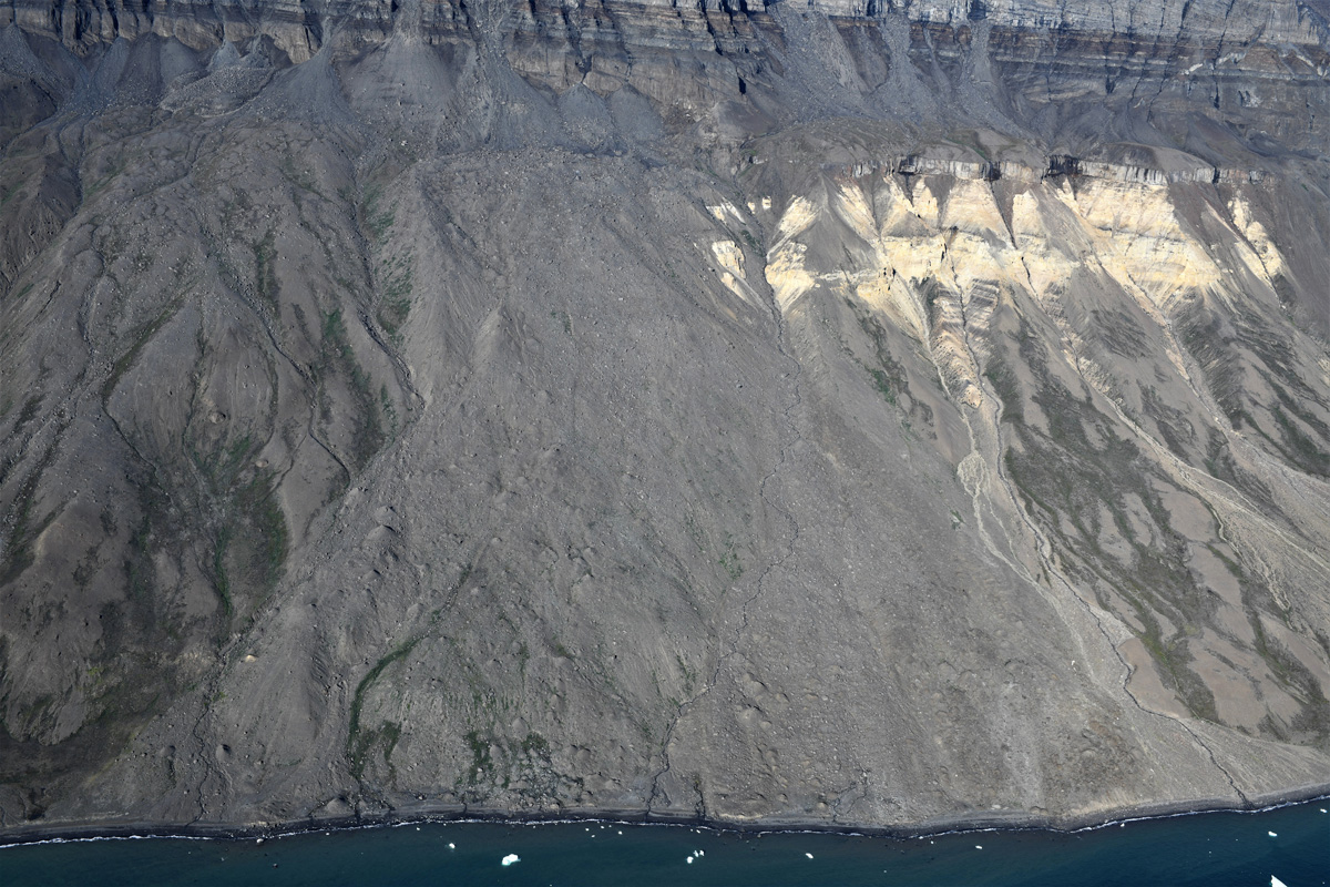
Scientists took a deeper look at a 70-year-old slide and found that climate change likely set the stage for the disaster.

Photo of the Apennine Mountains in Italy.
Posted inEditors' Highlights

Topography Along the Apennines Reflects Subduction Dynamics

by Duna Roda-Boluda 15 March 202313 March 2023

Topography and exhumation vary strongly along the Apennines, reflecting the geometry of the Moho and different geodynamic mechanisms.

Underwater photo of earth-toned stones of various shape, some with moss, and rays of sunshine.
Posted inNews

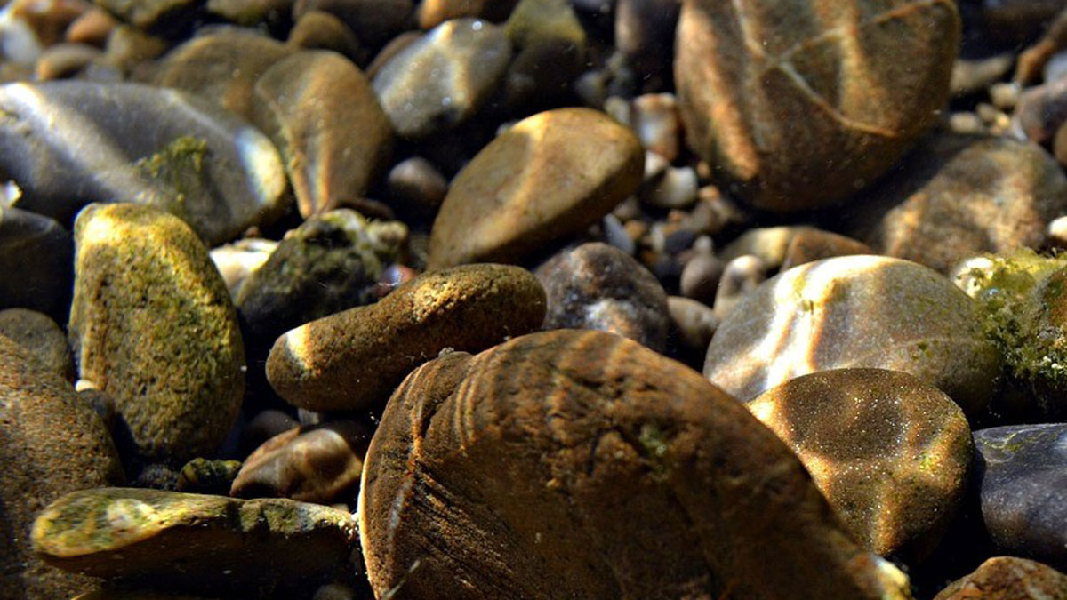
Decoding the Secrets of Shifting Sediments

by Clarissa Wright 23 February 202324 February 2023

In the small-scale details of grain shape, researchers have found a new way to understand how sediment flows in a river, a process shaping Earth’s landscapes.

Australia’s remote Nullarbor Plain.
Posted inNews

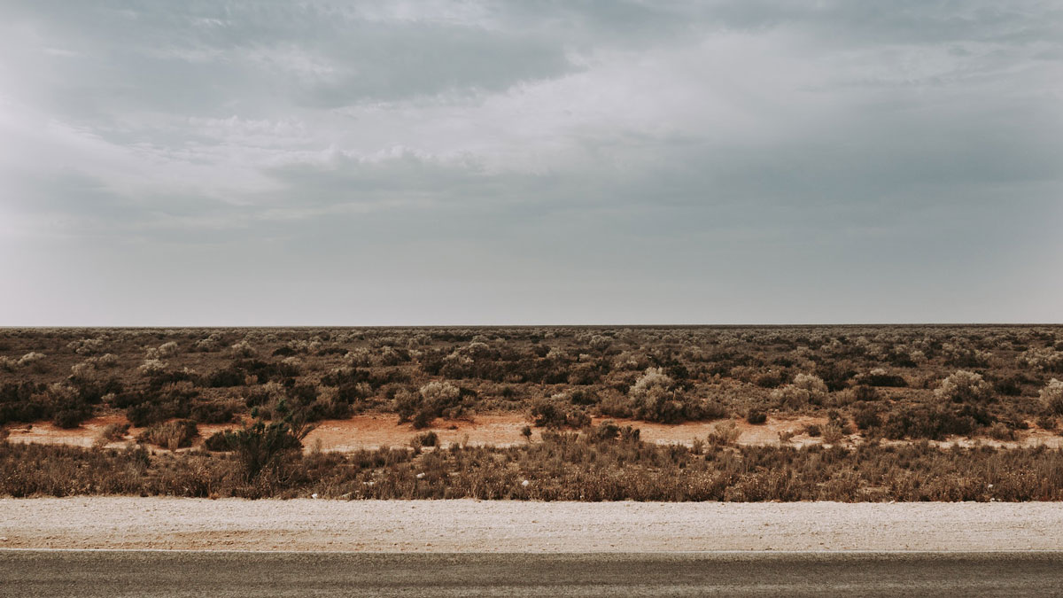
A Mysterious Dome Reveals Clues to Australia’s Miocene History

by Nathaniel Scharping 17 October 202217 February 2023

The Nullarbor Plain has been relatively untouched by geological forces, leaving traces of the continent’s deep past.

A diagram and a graph showing how ocean island eruptions are much more likely to exhibit SO2 degassing and deformation.
Posted inEditors' Highlights

Why Do Arc Volcanoes Deform Less Than Ocean Island Volcanoes?

by Paul Asimow 15 August 202215 November 2022

Volcanic ground deformation is not simply correlated with erupted volume. Researchers propose that high concentrations of magmatic volatiles make systems more compressible and suppress deformation.

Flooding during June 2011 on the Missouri River floodplain near Arrow Rock, Mo.
Posted inResearch Spotlights

Missouri River Floodplain Expansion, Services, and Resiliency

Aaron Sidder, freelance science writer by Aaron Sidder 28 July 202221 September 2022

Benefits might accrue for both wildlife and climate resiliency if more floodplains along the lower Missouri River were allowed to flood.

Satellite view of Brahmaputra River
Posted inNews

Satellite Images Reveal a New View of Ancient Earth’s Rivers

by Joel Goldberg 27 July 202227 July 2022

A new method shows a key relationship between the width and makeup of Earth’s river channels over time. The technique could be applied to other terrestrial bodies, such as Mars.

Series of photographs of North St. Vrain Creek showing changes over time for one specific logjam.
Posted inEditors' Highlights

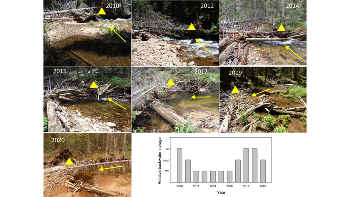
Logjams May Be Transient but Their Effect is Long Lasting

by Patricia Saco 20 May 202215 November 2022

Even though natural logjams in rivers continuously change and maybe short-lived, their effects in terms of geomorphic diversity and habitat can be surprisingly long-lasting.

An aerial view of an Amazonian landscape, colored by elevation
Posted inResearch Spotlights

How Climate Change Shaped the Amazon’s Land and Life

by Rebecca Dzombak 28 January 202228 January 2022

Ice Age climate swings shaped the equatorial basin’s terrain—and possibly its ecology—faster than previously thought.

A black-and-white photograph of a river.
Posted inENGAGE, News

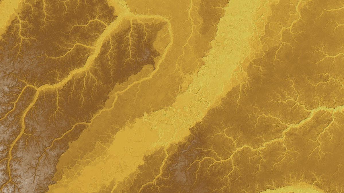
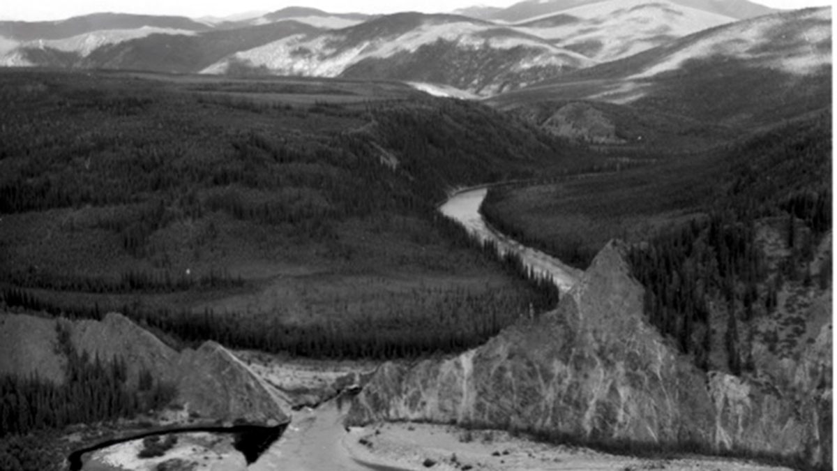
What a Gold Mining Mishap Taught Us About Rivers

Jenessa Duncombe, Staff Writer by Jenessa Duncombe 13 January 202227 March 2023

Miners in Alaska rerouted a river to search for gold. One hundred years later, the new channel is teaching scientists how rivers shape Earth.

Posts pagination

Newer posts 1 … 4 5 6 7 8 … 10 Older posts
Over a dark blue-green square appear the words Special Report: The State of the Science 1 Year On.

Features from AGU Publications

Research Spotlights

As Wildfires Increase in the West, So Does Suppression Spending

10 June 202610 June 2026
Editors' Highlights

Pre-Existing Structure and Stress Shape Geothermal-Induced Seismicity

2 June 20261 June 2026
Editors' Vox

Small-Scale Indian Ocean Dynamics Underpin Marine Ecology and Climate

4 June 20263 June 2026
Eos logo at left; AGU logo at right

About Eos
ENGAGE
Awards
Contact

Advertise
Submit
Career Center
Sitemap

© 2026 American Geophysical Union. All rights reserved Powered by Newspack