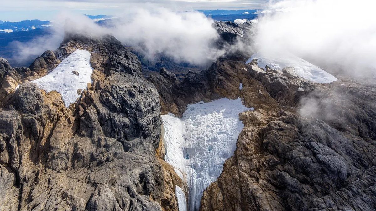
The equatorial glaciers atop Puncak Jaya, Oceania’s tallest peak, have shrunk by about 95% since 2002, according to a new photogrammetry mapping effort.
glaciers & ice sheets

Posted inNews
These “Clumped” Molecules Could Offer Clues About Earth’s Climate
Researchers investigated concentrations of clumped methane isotopes to learn more about how levels of the potent greenhouse gas have changed over the industrial era.
Posted inEditors' Highlights
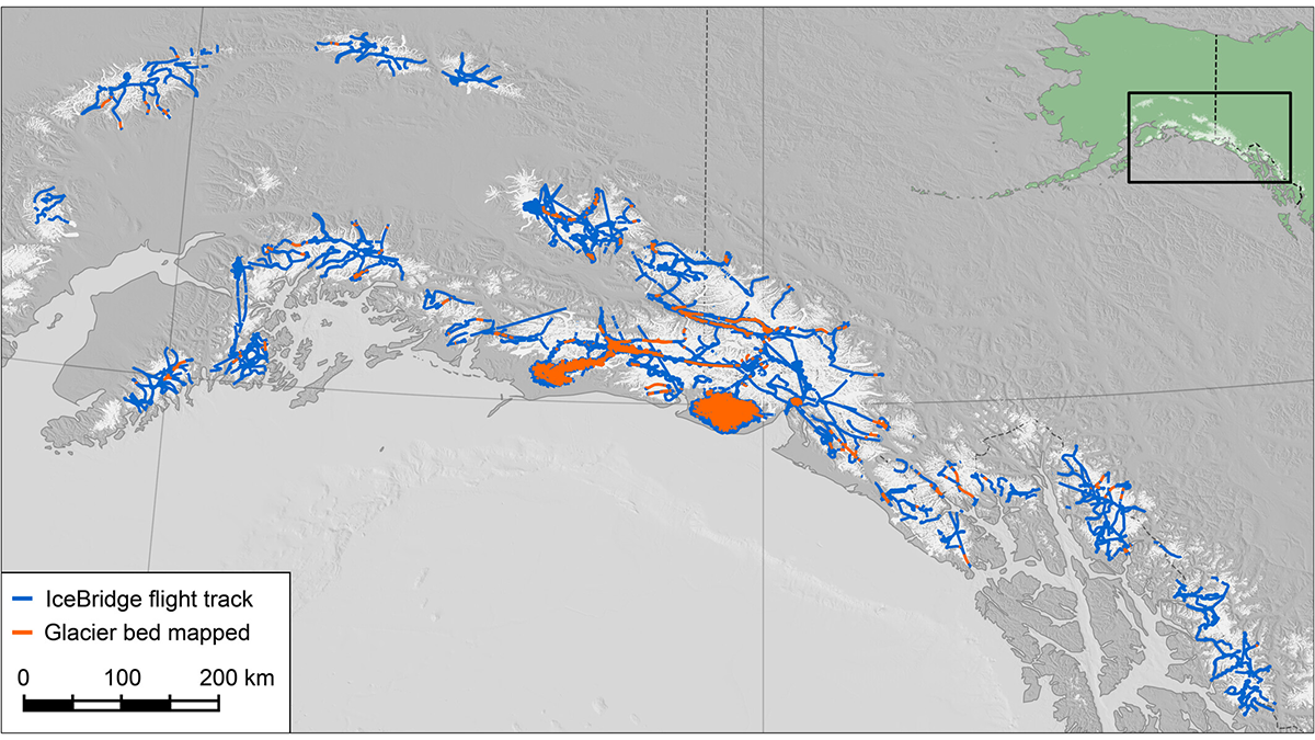
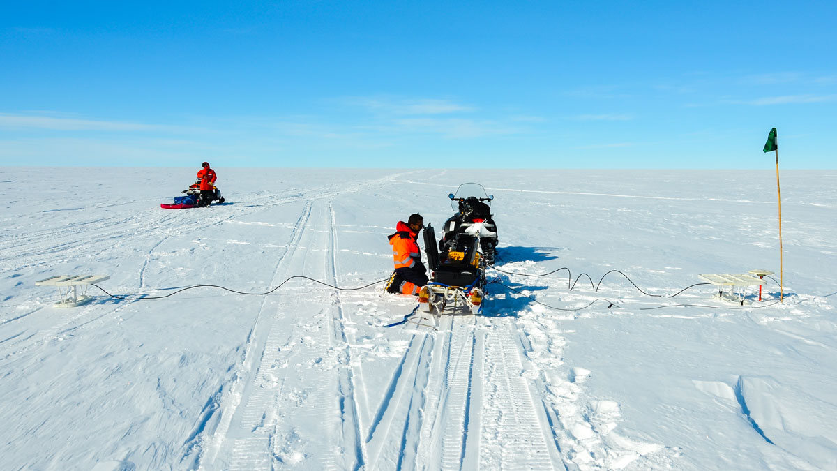
The Largest Ice Thickness Survey of Alaska’s Glaciers
A decade of NASA airborne radar surveys produces the most extensive inventory of glacier ice thickness for Alaska and northwestern Canada to date.
Posted inNews
The Breakup of Gondwana Over 100 Million Years Ago May Be Why Antarctica Has Ice Today
A rift event set off a domino effect of geologic processes that created conditions ripe for Antarctica’s glaciation, a new study suggests.
Posted inNews
Iceberg Scours Reveal Ancient Wind Patterns
Scour marks left by icebergs that ran aground thousands of years ago record the winds blowing off the Laurentide Ice Sheet.
Posted inResearch Spotlights
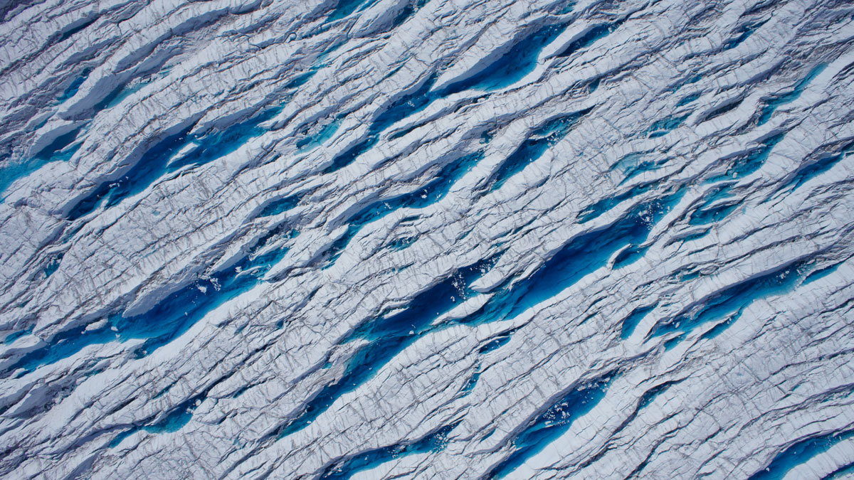
Stretching and Squeezing Release Glacial Meltwater
Seasonal changes in the forces that pull and push ice play a major role in when meltwater runs through glaciers and into the ocean.

Posted inResearch & Developments
Sea Level Rise is Accelerating, Scientists Confirm
New research closes the sea level budget gap and takes account of the drivers of sea level change.

Posted inNews
Changes in Sea Ice Microstructure Could Affect Climate Models
Granular sea ice needs to be twice as porous as columnar ice to allow water to flow through it—up to 10% brine by volume.
Posted inScience Updates
New Directions in Mapping Ice Sheet Fabrics and Flow
Polarimetric radar advances enable scientists to measure orientations of crystals, bubbles, and other properties that affect the flow of glaciers and ice sheets—and their contributions to sea level.
Posted inNews
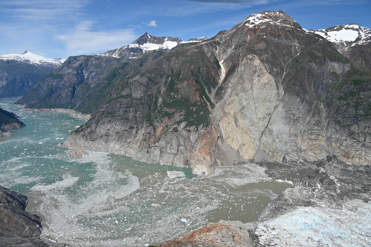
The Forensics of a Skyscraper-Sized Tsunami
A landslide in Tracy Arm Fjord in Alaska created the second-largest tsunami on record. A new analysis links this abrupt event to the retreat of a glacier and, ultimately, to climate change.