Research & Developments is a blog for brief updates that provide context for the flurry of news that impacts science and scientists today.
The Mendenhall River in Juneau, Alaska, reached a record-breaking crest Wednesday morning thanks to a glacial outburst flood (GLOF) from Suicide Basin. At 16.65 feet, the crest exceeded the previous record flood stage of 15.99 feet in 2024.
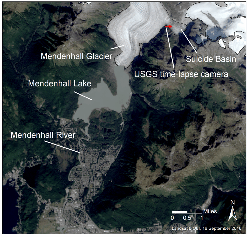
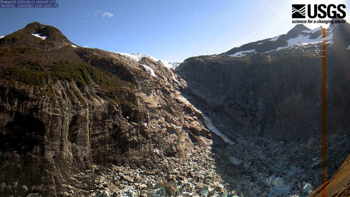
As glaciers melt, they leave behind lakes that rest in valleys. The melting of the Suicide Glacier has created a glacial lake in Suicide Basin, which lies above the Mendenhall Glacier. The Mendenhall Glacier, about 12 miles (19 kilometers) north of Juneau, acts as an ice dam for the lake. But, when enough snowmelt and precipitation occur, the lake drains through and over the glacier into Mendenhall Lake and the Mendenhall River.
The basin has filled and drained at least 39 times since July 2011, according to the National Weather Service.
During the crest on Wednesday morning, a gauge at Mendenhall Lake recorded a peak streamflow of 47,700 cubic feet per second (1,350 cubic meters per second), according to USGS data. In August 2023, the same gauge recorded a streamflow of 25,200 cubic feet per second (714 cubic meters per second), which Andrew Park, a meteorologist at NWS Juneau, called “historic” at the time. The highest recorded streamflow before that was 16,300 cubic feet per second (462 cubic meters per second), in 2016. During the 2023 event, Rick Thoman, Alaska Climate Specialist at the Alaska Center for Climate Assessment and Policy, also told Climate.gov that “Decades worth of erosion happened in one weekend.”
The City and Borough of Juneau installed barriers provided by the United States Army Corps of Engineers earlier in 2025. According to the city and borough’s website, the barriers are intended to be an “interim solution,” but are designed to protect against GLOFs up to 18 feet high (5.4 meters). According to USA Today, the barriers seem to have successfully held back most of the water.
A flood statement issued by the National Weather Service in Juneau urged residents to heed road closures and local emergency management team guidance.
Water levels above 15 feet are considered the “major flood stage.” Zoe Kaplan, a meteorologist at the National Weather Service in Juneau, said the office predicts levels will drop to moderate flood stage (below 12 feet) by early afternoon, and to minor flood stage (below 10 feet) by late afternoon.
GLOFs could grow more common as rising temperatures increase glacier melt around the world. A 2020 study found that the number, total volume, and total area of glacial lakes have each increased by about 50% between 1990 and 2018. And, according to the Environmental Protection Agency, Alaska has warmed faster than any other U.S. state, and faster than the global average, over the past 100 years.
—Emily Dieckman, Associate Editor (@emfurd.bsky.social)
These updates are made possible through information from the scientific community. Do you have a story idea about science or scientists? We’re listening! Send us a tip at [email protected].
