
In a new study, researchers make the case that large-scale glaciation during parts of the Neoproterozoic era led to extensive erosion of Earth’s crust.
glaciers & ice sheets

Posted inResearch Spotlights
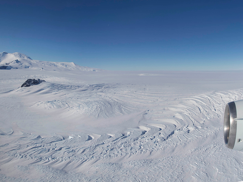
Subglacial Water Can Accelerate East Antarctic Glacier Flow
Airborne radar from the Recovery Glacier system demonstrates the importance of characterizing the underlying causes of ice flow speedup to understand how glacial discharge could change in the future.

Posted inNews
Ice Drove Past Indo-Pacific Climate Variance
Researchers used both terrestrial and marine proxy data to reconstruct the dramatic and dynamic climatic changes.
Posted inResearch Spotlights
What’s Missing from Antarctic Ice Sheet Loss Predictions?
Accurately modeling melt rates in specific ice shelf locations is critical for forecasting how Antarctica’s ice sheet will respond to climate change.
Posted inNews
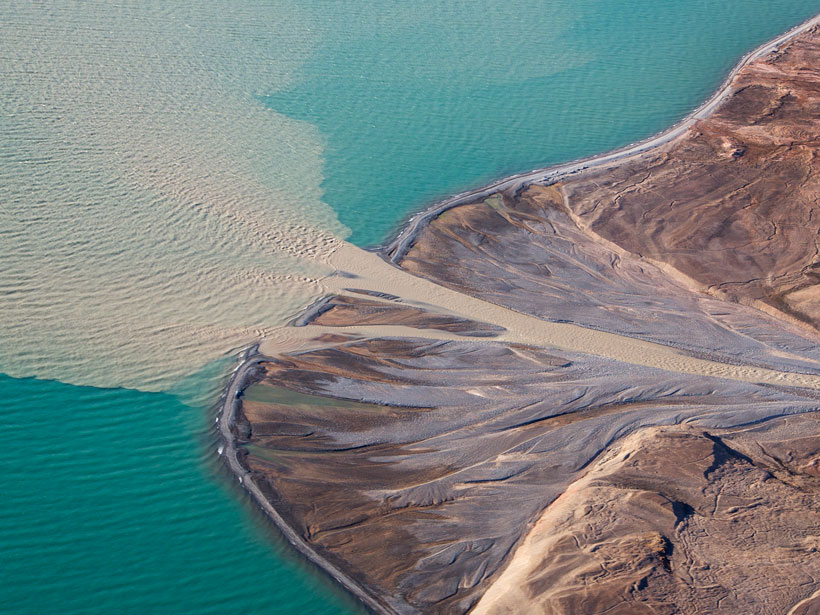
Sand from Greenland’s Melting Ice Sheet Could Bring in Business
The effects of climate change could fuel a new sand mining industry in Greenland.
Posted inNews
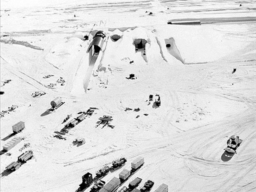
Podcast: Toxic City Under the Ice
In the latest episode of its Centennial series, AGU’s Third Pod from the Sun recounts the history of a top-secret military project with unintended environmental consequences.
Posted inEditors' Highlights
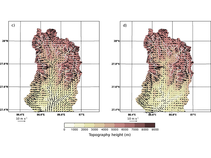
What Drives Surface Winds in a Deep Valley?
Surface winds in a Himalayan valley are found to vary daily and seasonally due to factors including pressure gradient, advection, turbulent vertical mixing, and the presence of glaciers.
Posted inFeatures
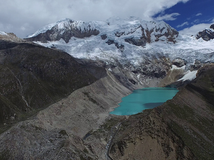
The Dangers of Glacial Lake Floods: Pioneering and Capitulation
During the past 70 years, Peruvian engineers virtually eliminated the risks posed by glacial lake floods. But climate change and a political blind eye are increasing the dangers once again.

Posted inResearch Spotlights
Extending the Record of Surface Melt on the Larsen C Ice Shelf
The first use of Advanced Scatterometer radar data to determine melt duration on an Antarctic ice shelf shows the season has decreased by up to 2 days per year during the extended 21st century record.

Posted inResearch Spotlights
Humming Ice Shelf Changes Its Seismic Tune with the Weather
Seismic waves resonating within the upper layers of the Ross ice shelf could help scientists monitor the Antarctic melt season and understand factors that could lead to sudden ice shelf collapse.