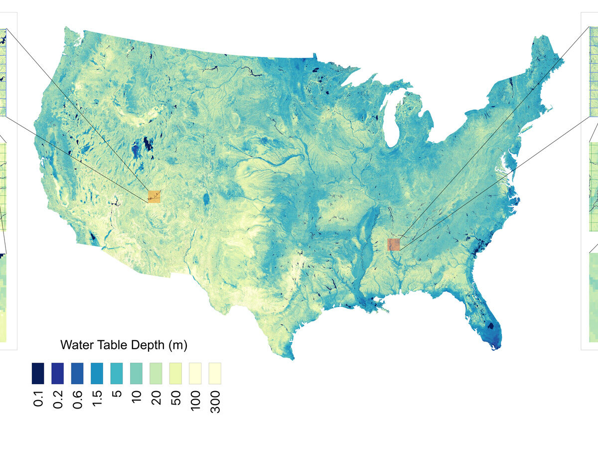
Researchers used 1 million data points and a machine learning algorithm to estimate groundwater stores with higher resolution than ever before.
groundwater
Posted inEditors' Highlights
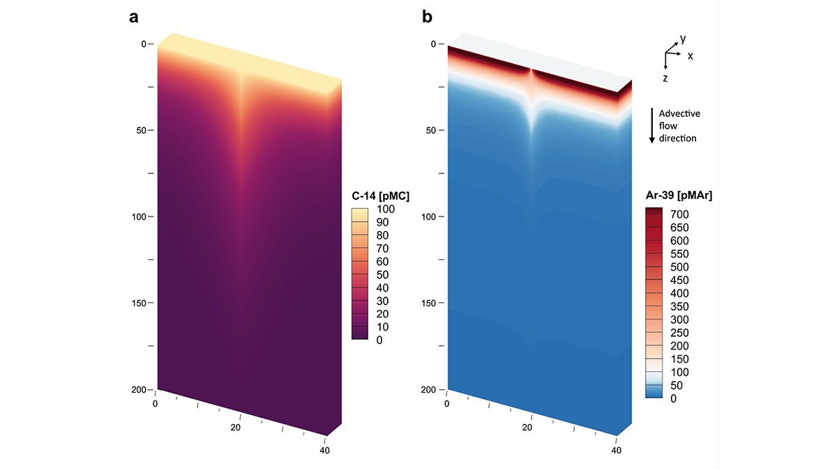
Calibrating the Clocks: Reconciling Groundwater Age from Two Isotopes
A new quantitative model corrects for tracer-based age biases from 39Ar and 14C isotopes leading to more accurate estimates of groundwater residence times.
Posted inResearch & Developments
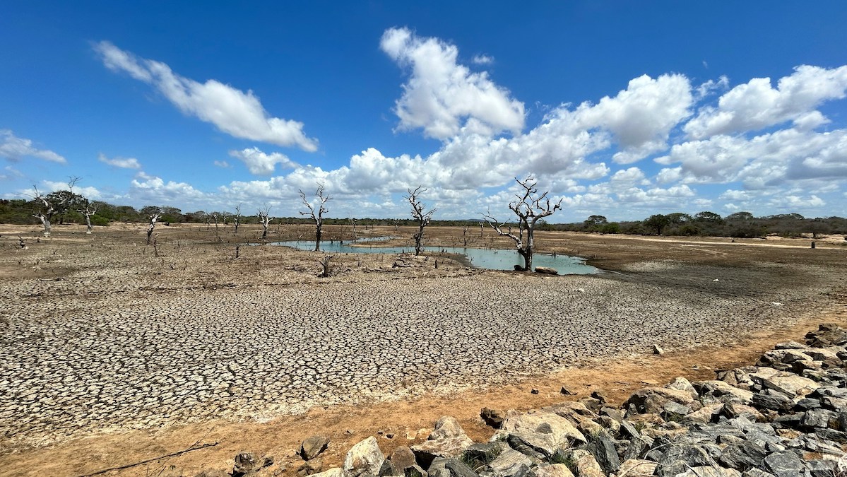
We Are “Living Beyond Our Hydrological Means,” UN Report Warns
Humanity has overspent and depleted freshwater in the world’s aquifers, glaciers, wetlands, and other natural reservoirs to an irreversible degree, according to a new United Nations report.
Posted inResearch Spotlights
Microbial Genes Could Improve Our Understanding of Water Pollution
New research in Germany’s Ammer floodplain examines microbial biomarkers to help improve modeling of denitrification.
Posted inEditors' Highlights
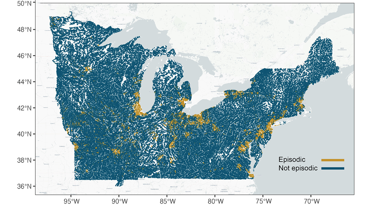
Episodic Tales of Salt
When episodic pulses of road salt hit after a winter storm, the impact can be like a lightning strike for the environment.
Posted inScience Updates
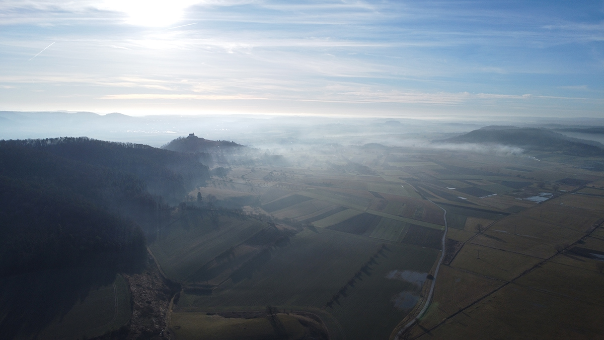
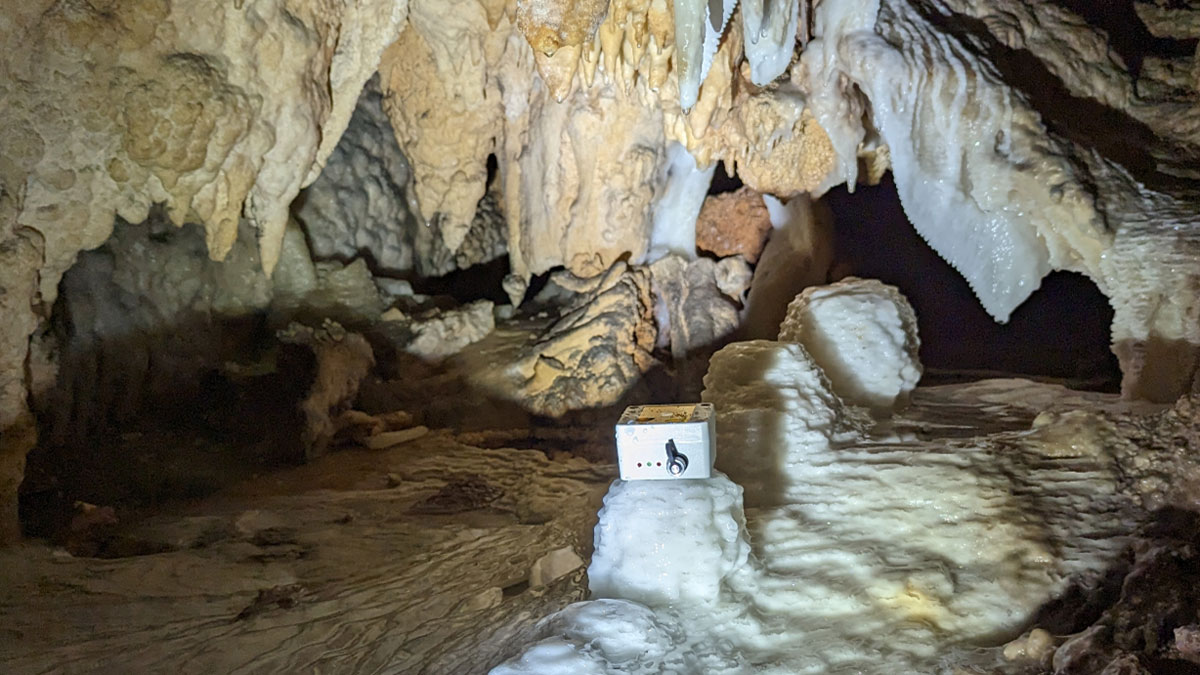
When Does Rainfall Become Recharge?
Counting drips in caves is helping to reveal how much precipitation is needed to start refilling underground aquifers.
Posted inNews
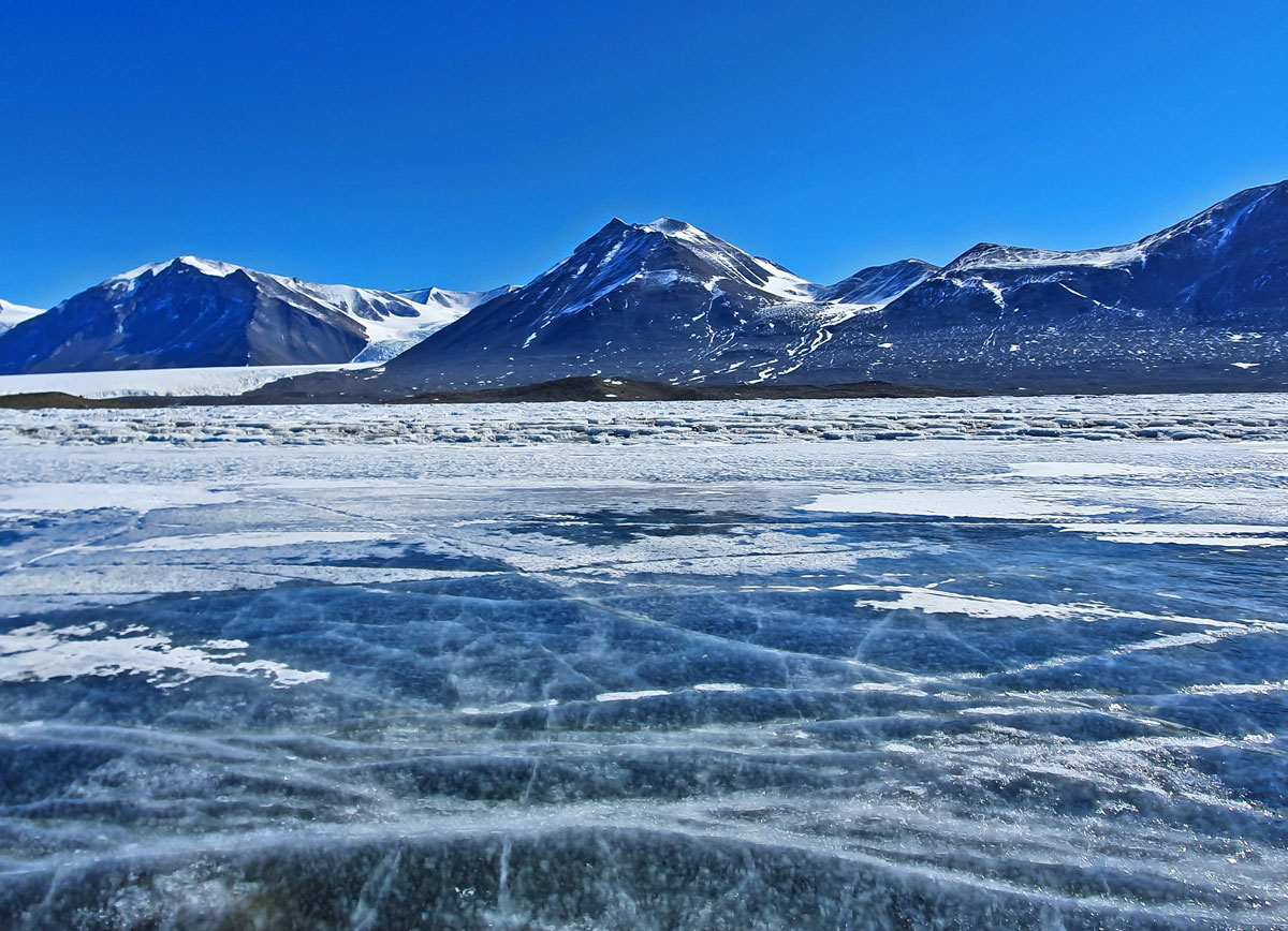
The Land Beneath Antarctica’s Ice Might Be Full of Water
Seismic surveys hint at the extent of a potential groundwater system in the White Continent.
Posted inEditors' Highlights
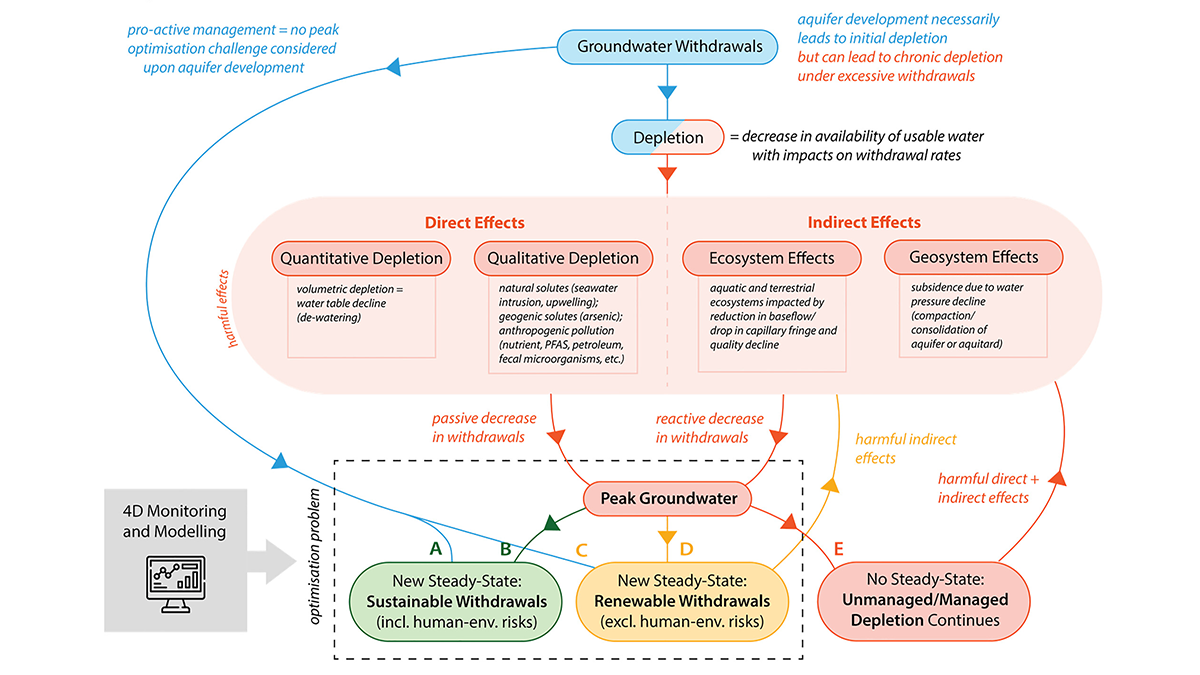
Avoiding and Responding to Peak Groundwater
A new review shows how rising demand, shrinking supplies, and policy decisions together shape when groundwater use peaks and what can be done to avoid long-term depletion.
Posted inEditors' Highlights
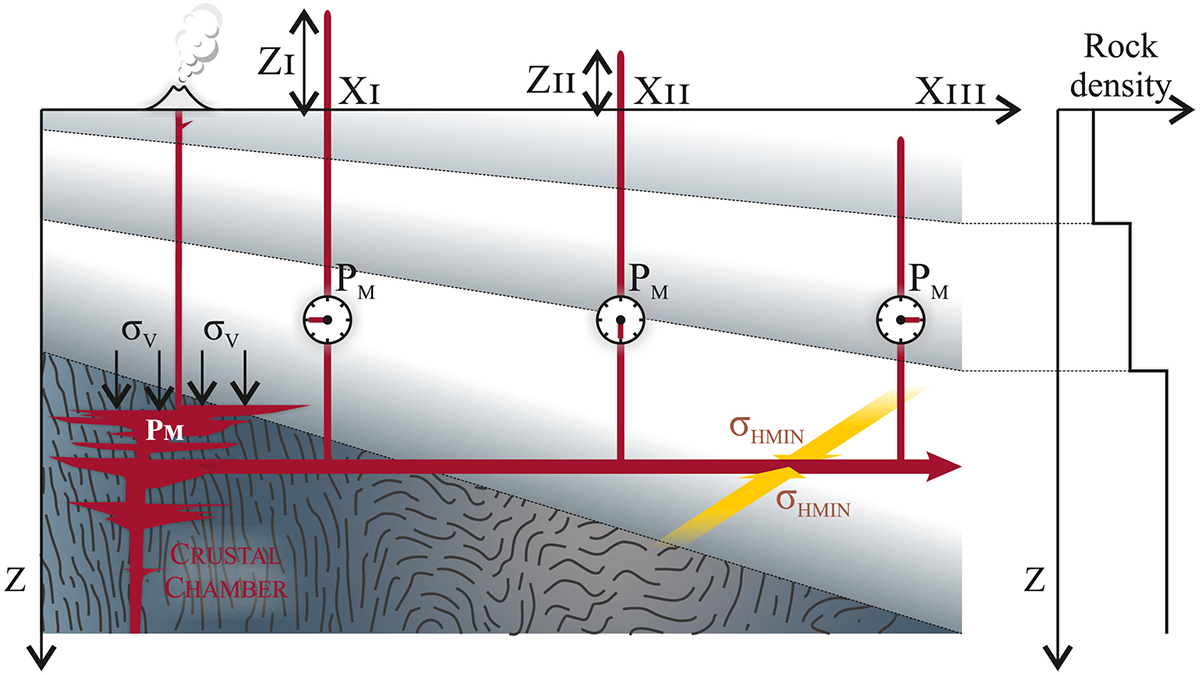
The Invisible Brake: Near‑Surface Cooling Stalls Giant Dyke Swarms
Sill-based pressure reconstructions show Mull’s giant dykes had eruption-capable pressures, but near‑surface groundwater cooling increased magma viscosity and stalled lateral propagation.
Posted inEditors' Highlights
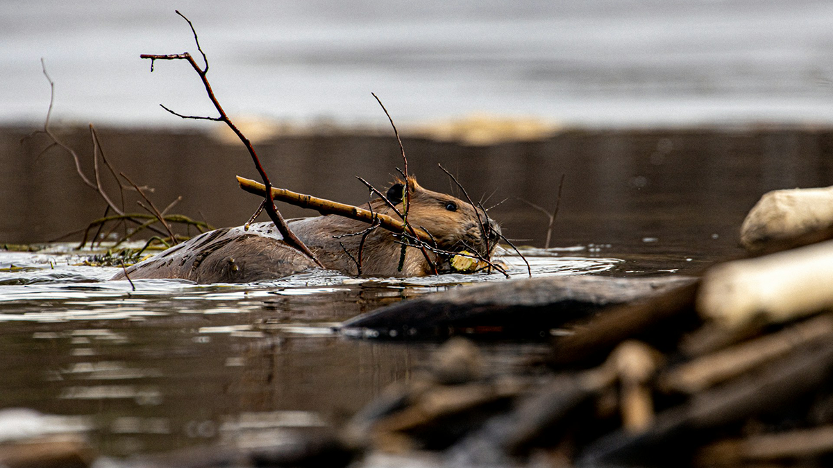
Beavers are Not Concerned About Groundwater
But, scientists are! A new study illuminates the complex interactions of beaver dam induced ponding and floodplain inundation with shallow groundwater storage and flow patterns.