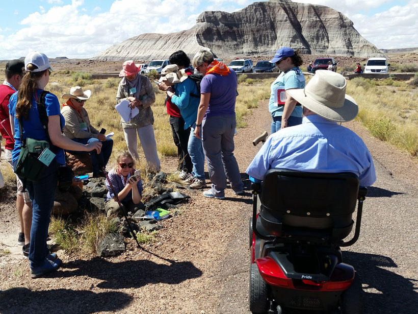
Fieldwork in the geosciences is increasingly relying on groundwork laid by accessibility advocates.
Hazards & Disasters
Posted inNews
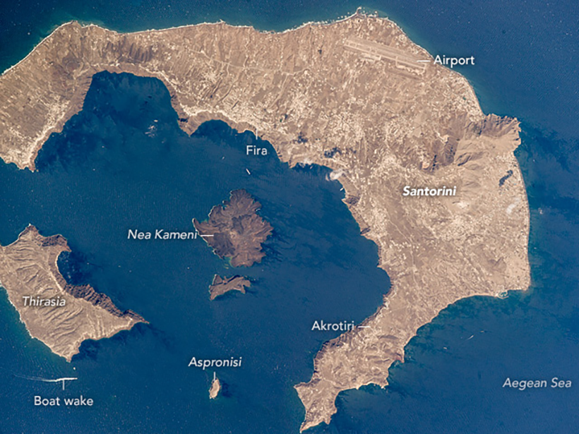
Podcast: Escape from Thera
A colossal volcanic eruption at Santorini, Greece, 3,600 years ago sent the island’s Bronze Age population fleeing for their lives. Where did the people go?
Posted inEditors' Highlights
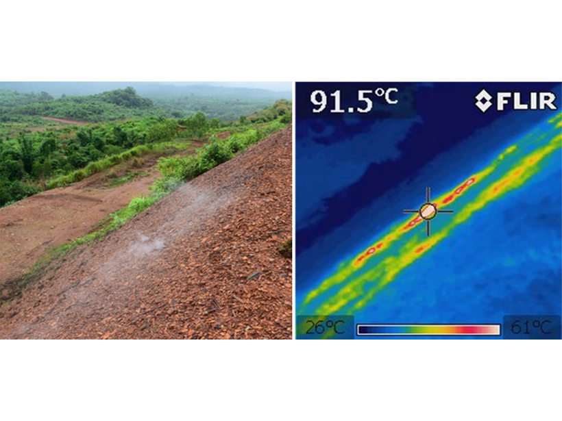
Citizen Science Reduces Risks from Combusting Coal-Mine Wastes
A community-based citizen science study on spontaneously combusting coal-mine waste heaps in Myanmar underpins the development of risk management plans to protect individuals and communities.
Posted inScience Updates
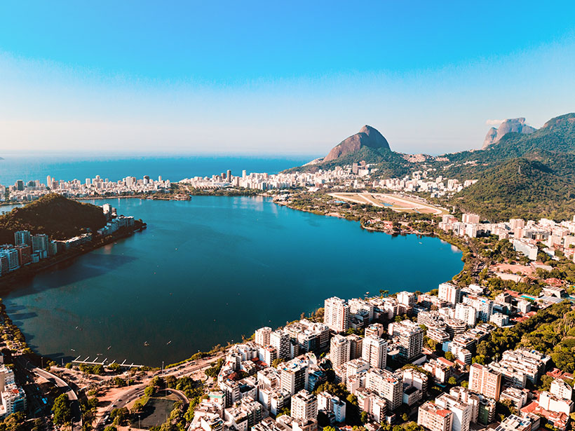
Earth Observations Inform Cities’ Operations and Planning
Rio de Janeiro, Brazil, and Chicago, Ill., are using NASA Earth observations to map, monitor, and forecast water and air quality, urban heat island effects, landslide risks, and more.
Posted inResearch Spotlights
More Warming Means Worse Impacts from Runoff and Drought
New research highlights differences in drought and flood hazards globally under 1.5°C versus 2°C temperature increases and estimates associated human and economic effects.
Posted inNews
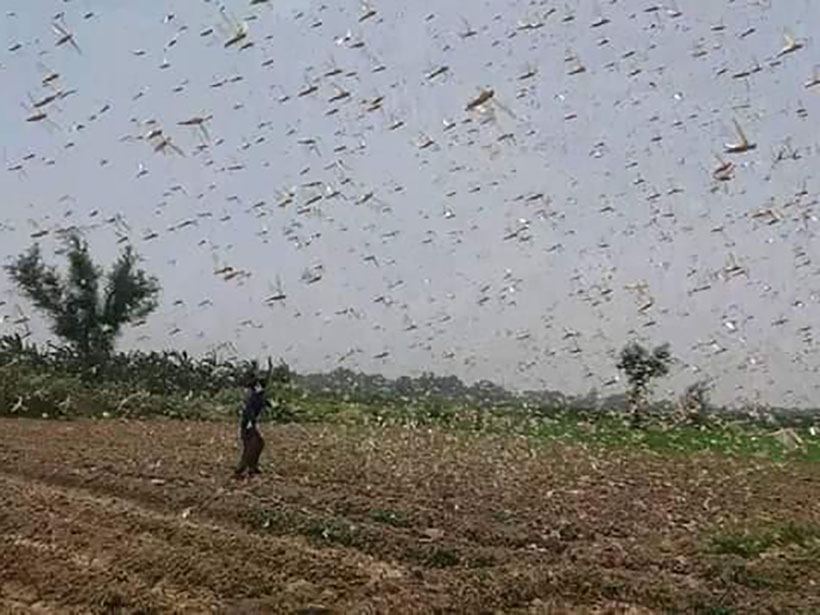
Record Locust Swarms Hint at What’s to Come with Climate Change
Warming oceans that feed cyclones have also bred record-breaking swarms of desert locusts. Such plagues could grow bigger and more widespread with climate change.

Posted inResearch Spotlights
Great Plains Plants Bounce Back After Large Wildfires
An analysis of nearly 1,400 wildfires suggests that some postfire techniques used to help restore vegetation may be unnecessary.
Posted inResearch Spotlights
Land Motion Offers Insights into Cascadia Earthquake Cycle
Comparing recent GPS data with a longer record of sea level along the western coast of North America allows researchers to home in on interseismic deformation above the Cascadia megathrust.

Posted inNews
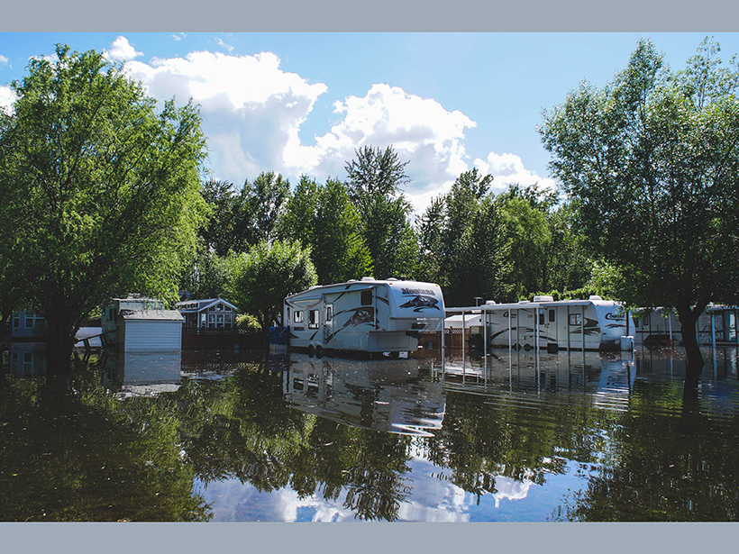
Heavy Rains, Human Activity, and Rising Waters at Lake Victoria
Water levels in Africa’s largest lake have risen over a meter since last fall and continue to increase as land use changes and heavy rains enhance the flow.

Posted inNews
Five Things Spy Satellites Have Taught Us About Earth
Long before we had satellites beaming terabytes of data back to Earth, we had covert spacecraft the size of school buses snapping photos on rolls of film 50 kilometers long.