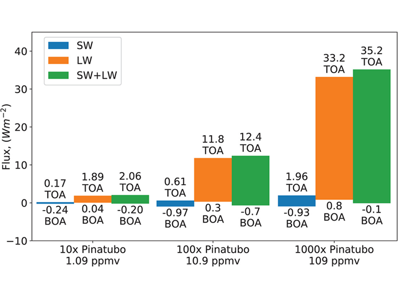
Volcanoes can warm as much as they cool. Prior simulations have neglected the important warming effects of sulfur dioxide emissions, making some results colder than they should be.
Indonesia
Posted inNews
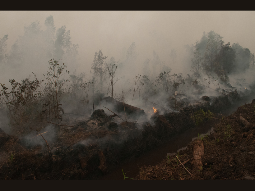
Starting (and Stopping) a Fire to Study It
Fire experiments on peatlands in Southeast Asia have identified previously unknown emissions patterns and could point to ways to detect these smoldering fires before they become too big to fight.

Posted inNews
The Hazard Cascade That Led to the Anak Krakatau Landslide
Researchers used a combination of ground and space-based measures to look for warning signs for the flank collapse at Anak Krakatau in 2018, which triggered a tsunami that killed hundreds.

Posted inEditors' Highlights
CAT Pictures of Internal Solitary Waves in Indonesian Strait
Huge and rapid subsurface temperature changes associated with propagating internal solitary waves were observed from a moored coastal acoustic tomography (CAT) system in Lombok Strait in Indonesia.
Posted inNews
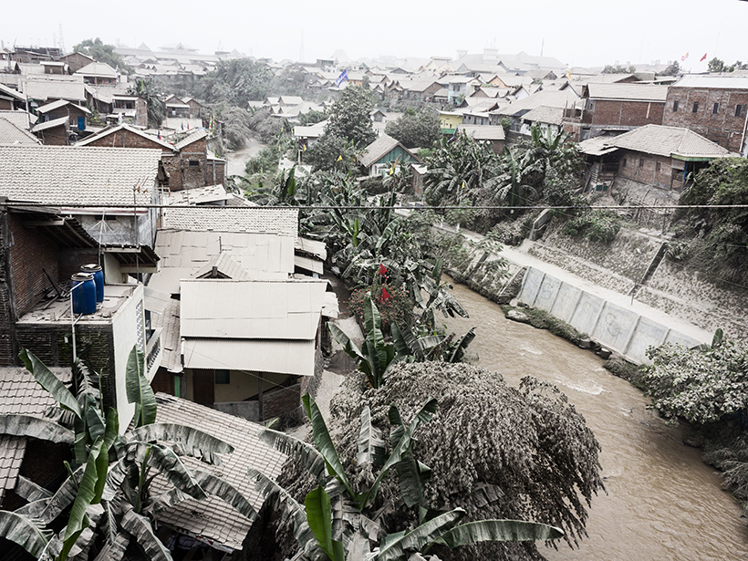
Explosive Volcanic Eruption Powered by Water-Saturated Magma
Little seismic unrest preceded the 2014 eruption of a stratovolcano in Indonesia, which suggests that the eruption was kick-started internally by volatile-triggered overpressure.

Posted inNews
Ceramics Trace a 14th Century Indonesian Tsunami
Archaeological evidence suggests that communities on the northern coast of Sumatra devastated by a tsunami roughly 600 years ago opted to rebuild in the same area, a process repeated in 2004.

Posted inEditors' Highlights
Modeling Tsunamis with Social Media
Video footage gathered from social media is used to reconstruct the timing and likely source(s) of the tsunami generated by the 2018 Palu earthquake.

Posted inScience Updates
Forensic Probe of Bali’s Great Volcano
Evidence from volcanic crystals sheds light on magma storage under Mount Agung and helps explain this giant volcano’s frequent eruptions.
Posted inFeatures
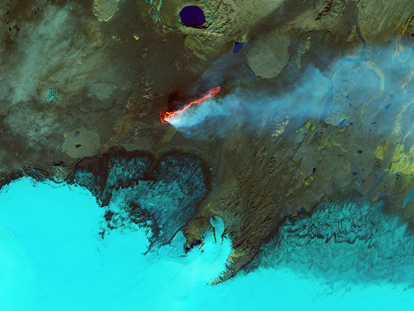
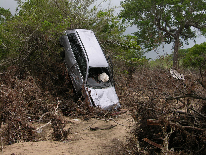
Earth’s Devastating Power, Seen by Satellite
Hurricanes, volcanoes, droughts, floods, fires, tsunamis: Satellites capture some of Earth’s most destructive forces.
Posted inResearch Spotlights
Evidence for Gravity Tectonics After the Great Sumatra Quake
A new method that applies structural geology principles to aftershock analyses suggests that gravity-driven motion may occur during part of the seismic cycle.