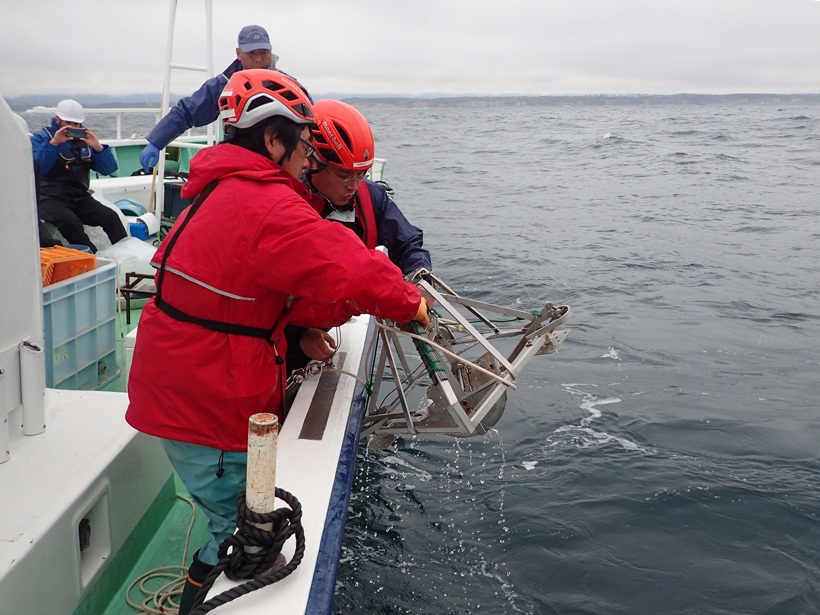
Laboratories outside Japan have validated the results. Marine radioactivity levels from the nuclear disaster have fallen, but questions remain years after the meltdown.
Japan

Posted inNews
Faults off Alaska Look Akin to Those Behind 2011 Japan Disaster
In a seismically quiet segment of Alaska’s subduction zone lie faults with structures similar to those of the system that caused the deadly Tohoku earthquake and tsunami.

Posted inResearch Spotlights
Quiet Volcanic Activity Changes Speed of Ambient Seismic Waves
Seismic data collected continuously for 4 years could improve understanding of geological structures that underlie Japan’s Izu Oshima volcanic island.

Posted inEditors' Vox
Subduction, Stratosphere, Starspots, and Sushi
Highlights from AGU’s joint meeting with the Japan Geophysical Union.

Posted inAGU News
Japan-U.S. Joint Meeting: Geoscience for a Borderless World
The groundbreaking conference included sessions in Japanese, sessions in English, and sessions in which presenters used English language slides but could speak in Japanese.

Posted inResearch Spotlights
What Caused the Fatal 2014 Eruption of Japan's Mount Ontake?
Analysis of the change in the stratovolcano's tilt just prior to the explosion suggests that the cracking of a previously intact fluid barrier caused the country's deadliest eruption since 1926.
Posted inResearch Spotlights
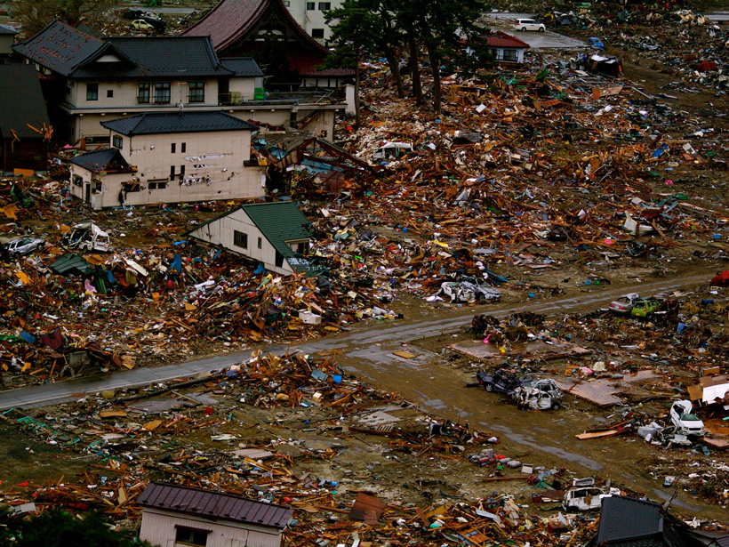
An Up Close Look at the Megaquakes That Cause Tsunamis
Researchers recreate changes in the seafloor during Japan's devastating 2011 tsunami.

Posted inNews
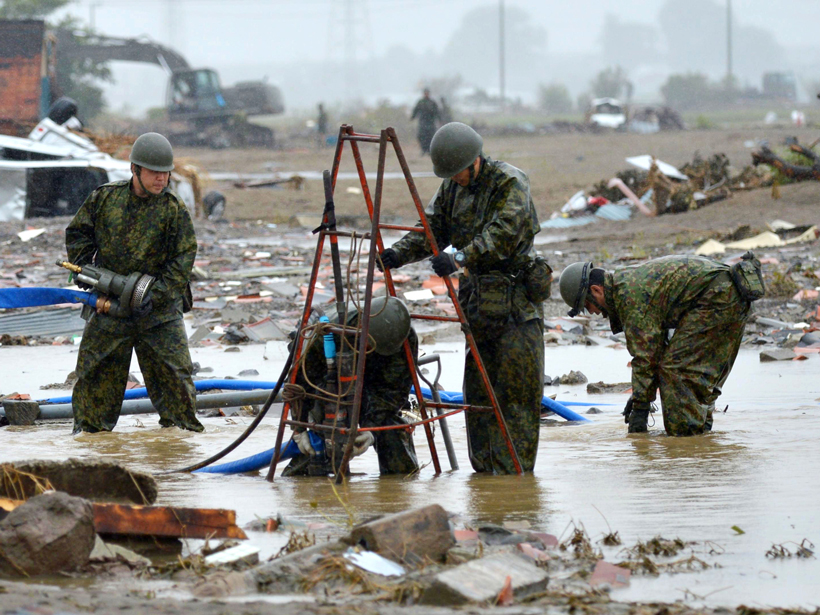
Tsunamis Leave a Telltale Chemical Trail
Researchers follow a trail of organic compounds in soil that reveals the 2011 Tohoku tsunami's path over the Japanese coastline, providing clues to how often tsunamis recur and where they travel.
Posted inNews
Can Data Extracted from Twitter Help Map Flood Hazards?
Tweets, if scrutinized closely, may allow scientists to map hazards in real time, helping to guide emergency response.

Posted inResearch Spotlights
East of Japan, Upper Ocean Waves Follow a Seasonal Cycle
The seasonality of fine-scale, near-surface ocean dynamics raises important considerations for an upcoming satellite mission to measure global sea surface height.