For the past thousand years, devastating megathrust earthquakes, sometimes accompanied by huge tsunamis, have occurred repeatedly along the Nankai trough off southwestern Japan [e.g., Ando, 1975]. To help us prepare for such earthquakes in the future, we have developed oceanic observation networks to monitor seismotectonic activities in this region.
In 2011, a permanent ocean floor observation network called the Dense Oceanfloor Network System for Earthquakes and Tsunamis (DONET1) was deployed above the Kumano fore-arc basin to monitor crustal activities in the Nankai trough (Figure 1) [Kaneda et al., 2015; Kawaguchi et al., 2015]. Construction of a new array—DONET2—started in 2013, and it now covers the ocean floor between the Nankai trough and the cities of Shiono-misaki and Muroto.

In 2015, the DONET2 stations deployed close to the trough axis observed something rarely seen: tiny bursts of shallow very low frequency (VLF) earthquakes. These earthquakes, which shook directly below the stations, occurred intermittently. Their hypocenters—the point where an earthquake rupture starts—are in the accretionary wedge, a jumble of oceanic sediments scraped from the Philippine Sea Plate as it dives below the Eurasian continent.
Shallow very low frequency earthquakes indicate crustal deformation in the subduction zone.
Shallow VLF earthquakes indicate crustal deformation in the subduction zone, but the generation mechanism of these peculiar earthquakes has not been clarified yet. Because no regular earthquakes occur in the sedimentary wedge, VLF earthquakes are the only useful indicators of the deformation. Revealing the source process of these earthquakes as well as other earthquake activity will improve our understanding of plate motion at subduction zones where megathrust earthquakes occur.
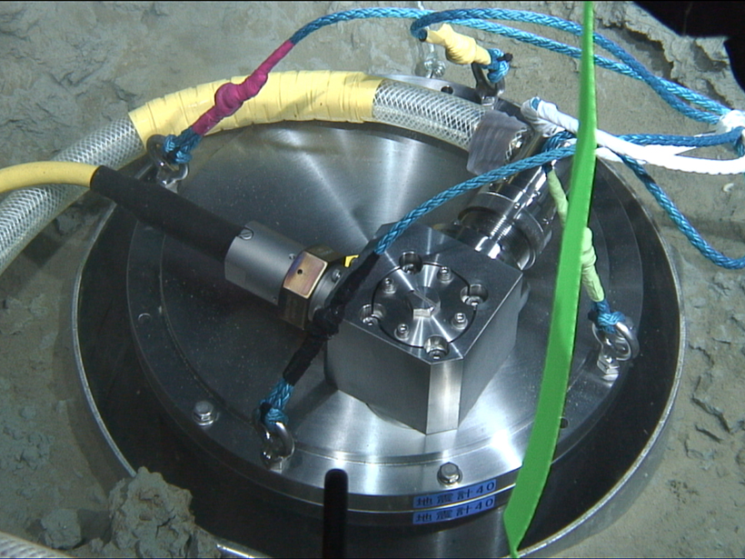
DONET: A Permanent Ocean Floor Observation Network
The DONET arrays are different from ordinary in-line cable observation networks because clusters of DONET stations, like bunches of grapes, are deployed around nodes, to which they are linked with optical fiber cables. Each node is similarly linked to a backbone cable [Kaneda et al., 2015; Kawaguchi et al., 2015]. With this geometry, the arrays are able to densely cover the seafloor.

Each DONET station is equipped with a strong-motion seismometer, which can measure ground accelerations and is important to understanding how earthquakes affect man-made structures onshore. The stations also have a high-sensitivity broadband seismometer that can record signals at a broad range of wavelengths, including those with periods as long as 360 seconds. This capability is useful for detecting small and large earthquakes. Stations are also equipped with pressure gauges, which can detect tsunamis as well as crustal deformation—uplift or subsidence of the seafloor.
With these instruments, we can detect and issue earlier warnings for large earthquakes and tsunamis than we could by relying on land observations alone. We can also monitor other seismotectonic activities such as slow earthquakes and slow-slip crustal deformation. Intensive study of these crustal activities may help us make better preparations for the next large earthquakes.
In addition, we have installed a vertical array of seismometers, strain meters, pore-pressure gauges, and tiltmeters in boreholes that we drilled into the ocean floor within the DONET1 network area. These instruments monitor crustal deformation and movement of pore fluid in the accretionary prism. This sensor array, which is linked by fiber-optic cable to the DONET backbone, transmits data in real time. The DONET arrays and these borehole stations together form a three-dimensional observation network along the Nankai trough.
Characteristics of VLF Earthquakes

Recently, we have observed slow earthquakes and crustal deformation with durations lasting from 1 second to as long as 1 year (reviewed by Beroza and Ide [2011]). Like regular earthquakes, slow earthquakes are caused by shear slip on a fault plane, but the slip velocity is slow and lasts for a longer duration. Rupture of regular earthquakes continues at most for several minutes.
Shallow VLF earthquakes are characterized by the dominance of seismic signals longer than 10 seconds, unlike regular earthquakes of similar ground velocity (Figure 2). Shallow VLF earthquakes are the least studied among slow earthquakes because their activity affects only a limited area. Also, because they originate below the ocean floor, observations close to the source are difficult to obtain.
Shallow VLF earthquake activity along the Nankai trough was first observed in 2002 [Ishihara, 2003], and activity was observed again in 2004, 2009, and 2011. This activity along the Nankai trough occurred in six spatial clusters—studies showed that the shallow VLF earthquakes were caused by shear failure in the accretionary prism or plate boundary [Obara and Ito, 2005; Sugioka et al., 2012; To et al., 2015].
Burst of VLF Earthquakes in 2015
From August to November 2015, the DONET1 and DONET2 networks both detected swarms of VLF earthquakes (Figure 1). On 10 August 2015, just after DONET2 stations were deployed along the trough axis, VLF earthquake activity started south of Kii channel (Figure 3). One week later, a burst of activity was observed off Shiono-misaki, and a swarm started south of Kii channel that continued for about 1 month. Three weeks later, the DONET1 stations observed VLF activity in the Kumano fore-arc basin.

It is not clear whether activity continued south of Kii channel and off Shiono-misaki in October, when DONET2 observations were interrupted for system maintenance, but by November 2015 all activity along the Nankai trough had ceased. This sequence of activity, in which bursts off Shiono-misaki were followed by bursts south of Kii channel and in the Kumano fore-arc basin, is very similar to that observed in 2009 [Obara and Ito, 2005].
The densely distributed DONET stations directly above the source enabled us to determine precise source distribution of VLF local clusters even for small events [Sugioka et al., 2012]. The sources were in the accretionary prism or the oceanic crust at depths shallower than 10 kilometers below sea level, and the magnitudes of the VLF earthquakes were less than 4. These magnitudes are rather small compared with those during previous periods of VLF earthquake activity, when magnitudes as high as about 5 were recorded.
Further Studies
Together, DONET1, DONET2, and the borehole stations constitute an observation network that extends over 300 kilometers along the Nankai trough and covers more than half of the region in which clusters of shallow VLF earthquakes have been observed. Continuous monitoring of VLF activity immediately above the source clusters will reveal the spatiotemporal variations of the source characteristics, including stress levels. By comparing differences and similarities among the clusters and periods of VLF activity, we will gain further understanding of VLF earthquakes.
Observations will thus provide the data needed to understand how very low frequency earthquakes are related to other slow earthquakes and to plate motion.
Shallow VLF earthquakes in a cluster at Hyuga-nada, west of the DONET2 observation area, may have been synchronous with slow-slip events along the plate boundary [Asano et al., 2015]. Observations of crustal deformation and pore pressure changes made by our oceanic observation network will thus provide the data needed to understand how VLF earthquakes are related to other slow earthquakes and to plate motion. With this understanding, we will extend our knowledge of seismotectonic activity in the Nankai trough subduction zone.
DONET1 and borehole observation data are publicly available, and DONET2 data will also be available once the network has been completed.
Acknowledgments
We used data obtained from the Hi-net and F-net operated by Japan’s National Research Institute for Earth Science and Disaster Resilience and the Japan Meteorological Agency for the hypocenter determinations of regular earthquakes.
References
Ando, M. (1975), Source mechanisms and tectonic significance of historical earthquakes along the Nankai trough, Japan, Tectonophysics, 27, 119–140.
Asano, Y., K. Obara, T. Matsuzawa, H. Hirose, and Y. Ito (2015), Possible shallow slow slip events in Hyuga-nada, Nankai subduction zone, inferred from migration of very low frequency earthquakes, Geophys. Res. Lett., 42, 331–338, doi:10.1002/2014GL062165.
Beroza, G. C., and S. Ide (2011), Slow earthquakes and nonvolcanic tremor, Annu. Rev. Earth Planet. Sci., 39, 271–296, doi:10.1146/annurev-earth-040809-152531.
Ishihara, Y. (2003), Major existence of very low frequency earthquakes in background seismicity along subduction zone of southwestern Japan, Eos Trans. AGU, 84(46), Fall Meet. Suppl., Abstract S41C-0107.
Kaneda, Y., K. Kawaguchi, E. Araki, H. Matsumoto, T. Nakamura, S. Kamiya, K. Ariyoshi, T. Hori, T. Baba, and N. Takahashi (2015), Development and application of an advanced ocean floor network system for megathrust earthquakes and tsunamis, in Seafloor Observatories, pp. 643–66, Springer, Heidelberg, Germany, doi:10.1007/978-3-642-11374-1_252.
Kawaguchi, K., S. Kaneko, T. Nishida, and T. Komine (2015), Construction of the DONET real-time seafloor observatory for earthquakes and tsunami monitoring, in Seafloor Observatories, pp. 211–228, Springer, Heidelberg, Germany, doi:10.1007/978-3-642-11374-1_10.
Obara, K., and Y. Ito (2005), Very low frequency earthquakes excited by the 2004 off the Kii peninsula earthquakes: A dynamic deformation process in the large accretionary prism, Earth Planets Space, 57, 321–326.
Sugioka, H., T. Okamoto, T. Nakamura, Y. Ishihara, A. Ito, K. Obana, M. Kinoshita, K. Nakahigashi, M. Shinohara, and Y. Fukao (2012), Tsunamigenic potential of the shallow subduction plate boundary inferred from slow seismic slip, Nat. Geosci., 5, 414–418, doi:10.1038/NGEO1466.
To, A., K. Obana, H. Sugioka, E. Araki, N. Takahashi, and Y. Fukao (2015), Small size very low frequency earthquakes in the Nankai accretionary prism, following the 2011 Tohoku-Oki earthquake, Phys. Earth Planet. Inter., 245, 40–51, doi:10.1016/j.pepi.2015.04.007.
Author Information
Masaru Nakano, Takane Hori, and Eiichiro Araki, Japan Agency for Marine-Earth Science and Technology, Yokohama, Japan; email: [email protected]; Narumi Takahashi, Japan Agency for Marine-Earth Science and Technology, Yokohama, Japan; and National Research Institute for Earth Science and Disaster Resilience, Tsukuba, Japan; and Shuichi Kodaira, Japan Agency for Marine-Earth Science and Technology, Yokohama, Japan
Correction, 25 May 2016: An earlier version of this project update misstated the affiliation of Narumi Takahashi. This has been corrected.
Citation:
Nakano, M.,Hori, T.,Araki, E.,Takahashi, N., and Kodaira, S. (2016), Ocean floor networks capture low-frequency earthquake event, Eos, 97, https://doi.org/10.1029/2016EO052877. Published on 25 May 2016.
Text © 2016. The authors. CC BY-NC-ND 3.0
Except where otherwise noted, images are subject to copyright. Any reuse without express permission from the copyright owner is prohibited.