
Researchers zero in on the large-scale meteorological processes driving extreme precipitation events in the hot, arid desert region.
Journal of Geophysical Research: Atmospheres
Posted inEditors' Highlights
Continental Convection Reaches New Highs
Ten years of high-resolution gridded NEXRAD radar data provide a new data set to quantify tropopause-overshooting convection over the continental United States.

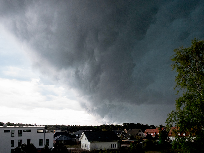
Posted inEditors' Highlights
New Estimates of Ozone Transport in Extratropical Cyclones
Cross-tropopause ozone transport in midlatitude cyclones, coincident with dry air intrusions, is derived from satellite and reanalysis data organized in cyclone-centric coordinates.

Posted inResearch Spotlights
How Does Snow Affect the Intensity of Mountain Precipitation?
A new investigation into the sensitivity of extreme precipitation in a changing climate indicates that more winter rainfall and protracted snowmelt may require local adaptations to winter flooding impacts.
Posted inEditors' Highlights
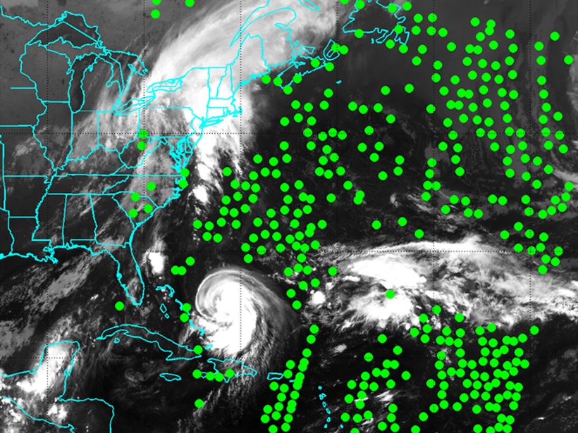
Listening to the Clouds
The assimilation of cloud-cleared infrared data improves numerical weather forecasting, especially for hurricanes, by providing thermodynamic information in cloudy atmosphere.
Posted inEditors' Highlights
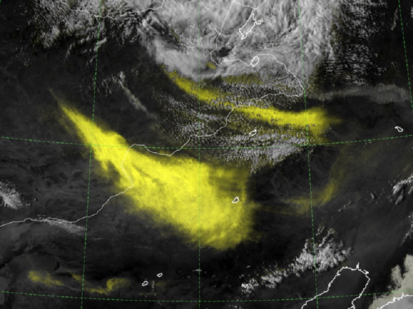
Addition by Subtraction: Raising the Bar for Satellite Imagery
When it comes to forecaster analysis of complex satellite imagery, less can be more, and a new technique aims to simplify imagery interpretation by suppressing the background noise.
Posted inEditors' Highlights
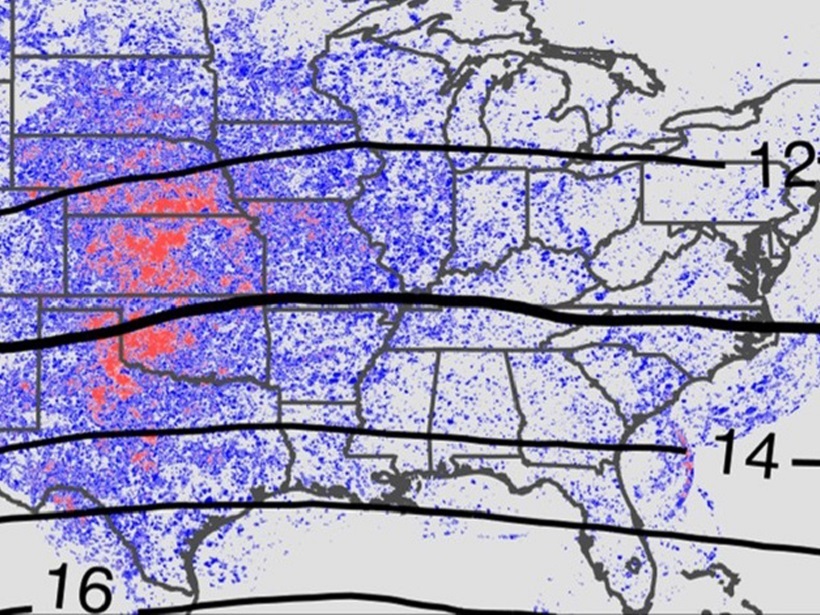
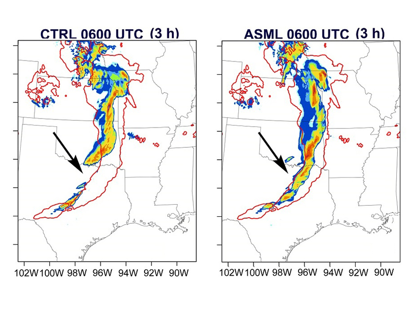
Lightning Data Improves Precipitation Forecasts
Short-term forecasts of precipitation and convection can be improved when lightning data are assimilated in the Weather Research and Forecasting system.

Posted inResearch Spotlights
Atmospheric Particles Aren’t the Same Cloud Seeds They Once Were
Still, more than half of the seeds required for cloud droplets to form in both the present-day and preindustrial atmospheres are made by trace gases that condense to form minute aerosol particles.

Posted inResearch Spotlights
Ocean Showers Power the Global Electric Circuit
Satellite measurements confirm hundred-year-old observations collected by boat.
Posted inResearch Spotlights
The Microphysics of Squall Lines
Scientists tracked the distribution of raindrops of different sizes as a row of thunderstorms formed by a cold front developed and intensified over eastern China.