
Using GRACE satellite data, researchers discovered anomalous gravimetric signals that occurred before a seismic event that started deep within Earth.
Journal of Geophysical Research: Solid Earth
Posted inEditors' Highlights
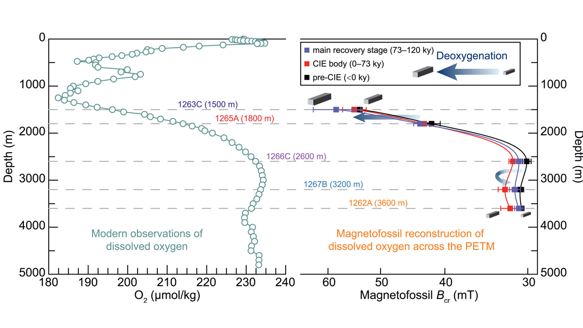
Magnetofossils Unveil Paleoredox Conditions in Extreme Climate
The Paleocene-Eocene Thermal Maximum, a thermal pulse about 56 million years ago, is an analog for future global warming. A new magnetofossil study shows progressive ocean deoxygenation.
Posted inResearch Spotlights
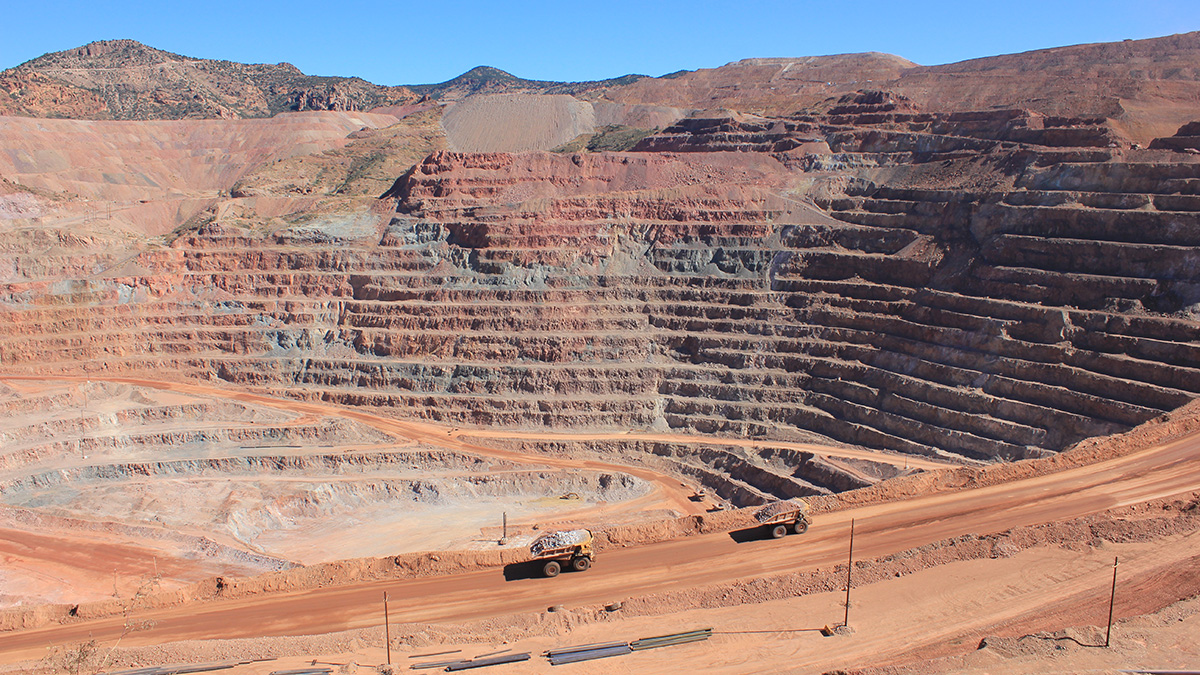
Machine Learning Could Revolutionize Mineral Exploration
Using a global data set of zircon trace elements, new research demonstrates the power of machine learning algorithms to accurately identify and locate porphyry copper deposits.

Posted inEditors' Highlights
Aftershocks Reveal Coseismic Rupture of Megathrust Earthquakes
More accurate aftershock zones reveal that the rupture areas of megathrust Aleutian–Alaska earthquakes are larger than we thought and partly overlap, in contradiction with the seismic gap hypothesis.

Posted inEditors' Highlights
Western US Adjoint Tomography Reproduces Waveform Complexity
Adjoint tomography employing 3D wavefield simulations for 72 well recorded regional earthquakes in the western U.S. yields spectacular improvements to waveform fits.

Posted inEditors' Highlights
Volcanic Creation and Destruction of Temporary Tephra Storage
Pyroclastic density currents (PDCs) are a major threat during an explosive volcanic eruption. A new study shows that loose tephra accumulations on volcanic slopes tend to re-mobilize rapidly.
Posted inEditors' Highlights
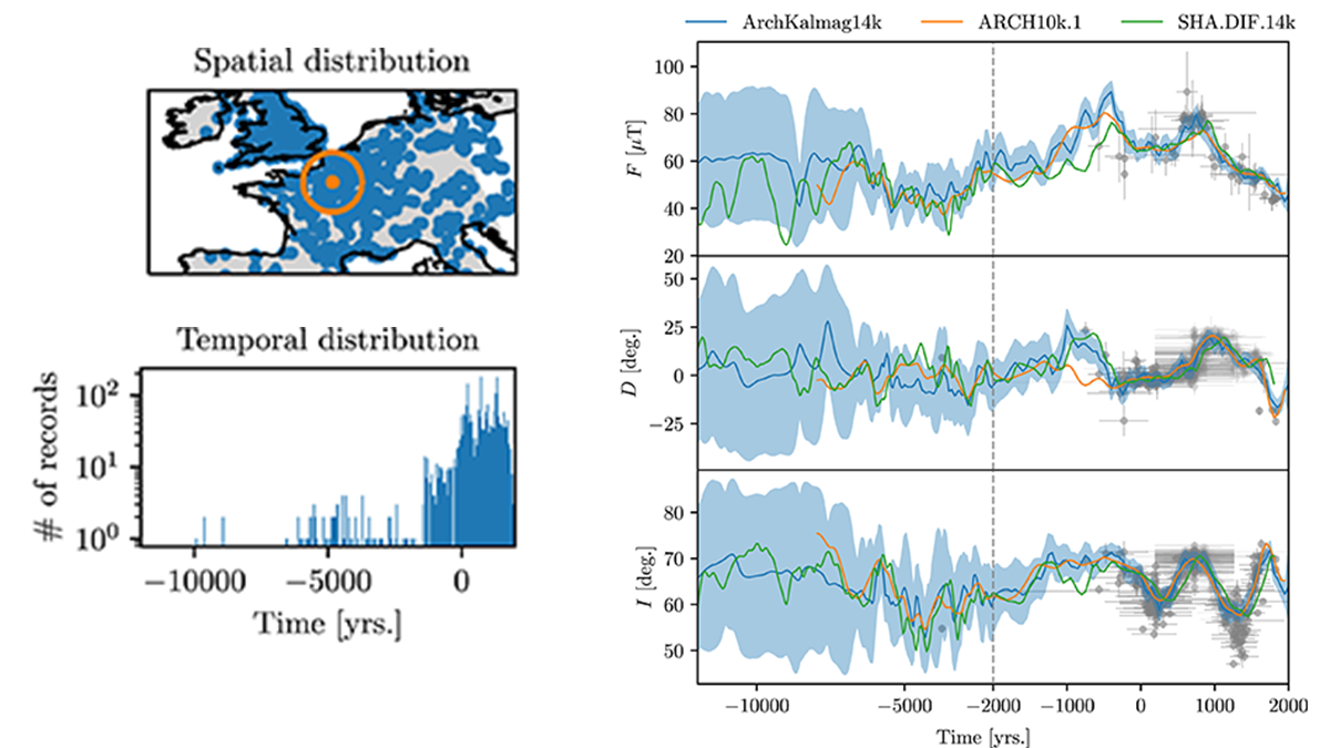
Time-Step Filtering in Holocene Global Magnetic Field Models
Through a local fixed time-step filter, global Holocene magnetic field models remain mathematically tractable refining our insight into field variability and improving archeological dating.
Posted inEditors' Highlights
Mesurer les oscillations d’un lac de lave depuis l’espace
Les images satellite permettent de mesurer les oscillations du lac de lave du Nyiragongo (RD Congo). Ces mesures renseignent sur la dynamique du volcan et aident à anticiper ses éruptions futures.

Posted inEditors' Highlights
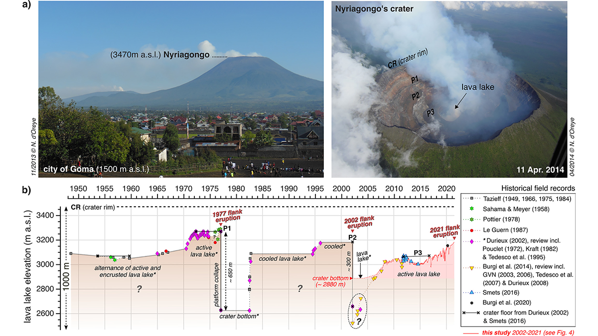
Tracking Lava Lake Levels at an African Volcano from Space
Satellite data from Nyiragongo Volcano, Democratic Republic of Congo, track changes in summit-crater lava levels that provide a window into eruption dynamics and aid in forecasting future activity.
Posted inEditors' Highlights
Probabilistic Tomography Delivers Answers to Basic Questions
Fundamental questions on subsurface properties are robustly addressed through probabilistic assessment of multiple forward/inverse modelling formalisms using interrogation theory.