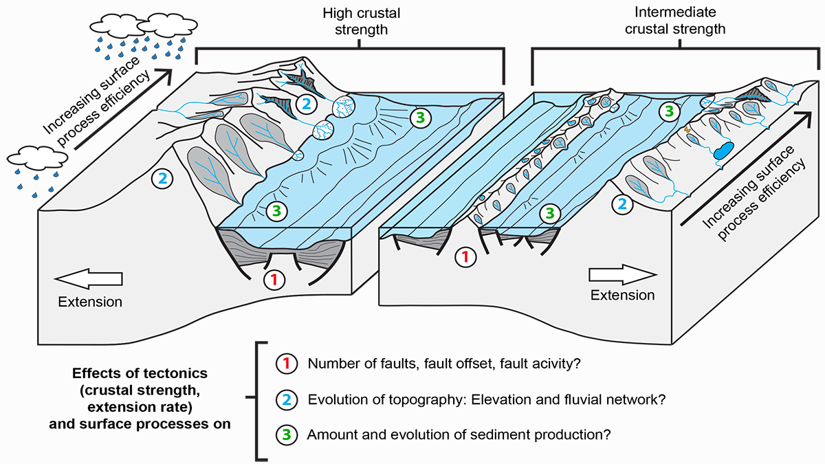
Numerical models provide quantitative constraints on topography lost to erosion, showing how the sediment influx in a sedimentary basin reflects its tectonic and topographic evolution.
Journal of Geophysical Research: Solid Earth

Posted inResearch Spotlights
卫星激光揭示地球水运动的变化
GRACE-FO卫星上基于激光的仪器可以扩展到其他地球物理应用,用来收集地球系统中月内时间尺度上的质量变化的数据。
Posted inEditors' Highlights
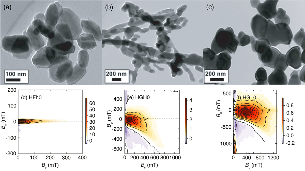
A Step Towards Understanding the Magnetic Properties in Hematite
Scientists present the most comprehensive available magnetic domain state and anisotropy study for synthetic and natural hematite from first-order reversal curve diagrams.
Posted inEditors' Highlights
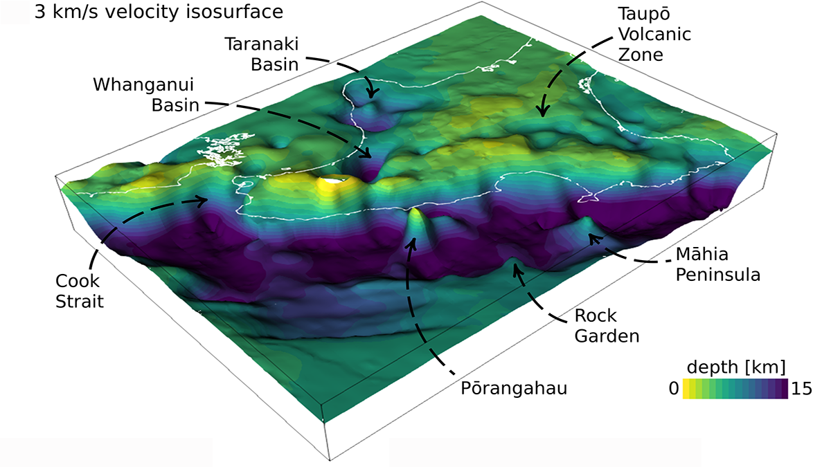
Adjoint Tomography Illuminates Hikurangi Margin Complexity
Waveform inversion of regional earthquakes reveals velocity anomalies interpreted as subducting seamounts that control an enigmatic segmentation in plate coupling along the Hikurangi margin.

Posted inResearch Spotlights
Testing a Machine Learning Approach to Geophysical Inversion
Variational autoencoders can be leveraged to provide an effective method of inversion that is both accurate and computationally efficient.
Posted inResearch Spotlights
Fresh Approaches to Processing GRACE Data
Two studies showcase new methods for analyzing GRACE data that better match the land surface, producing clearer estimates of mass variations.

Posted inResearch Spotlights
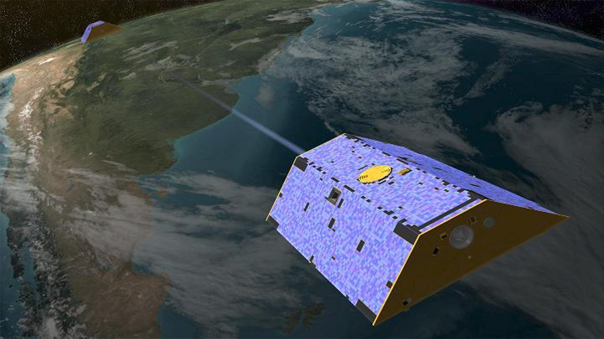
Satellites’ Lasers Reveal Changes in Earth’s Water Movement
The laser-based instruments aboard the GRACE-FO satellites may be extended to other geophysical applications to collect data on other submonthly mass changes in Earth’s system.
Posted inResearch Spotlights
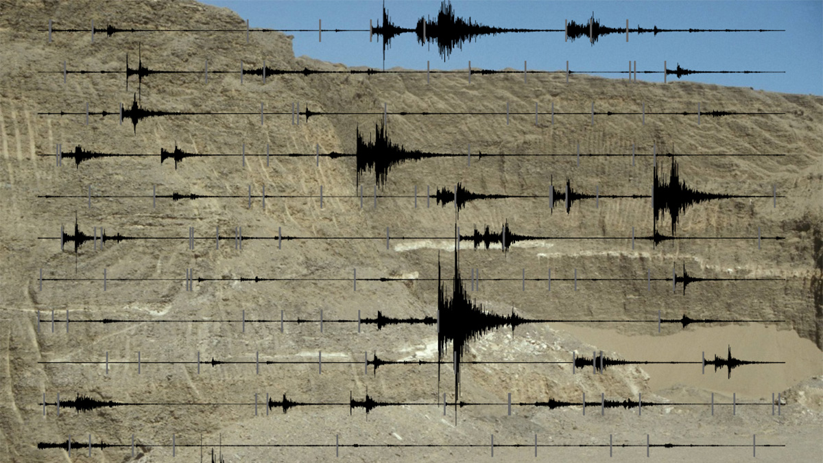
Comparing Machine Learning Models for Earthquake Detection
A new study evaluated the performance of emerging deep learning models for earthquake detection, phase identification, and phase picking.
Posted inEditors' Highlights
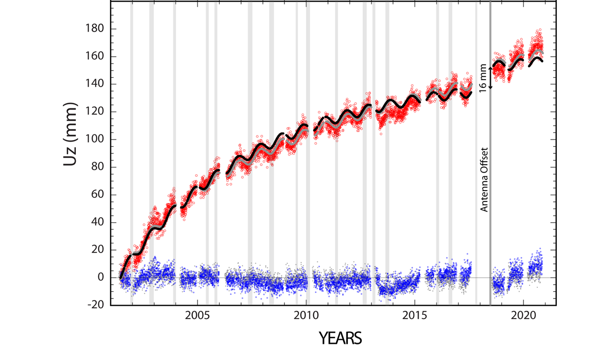
Continuity is the Father of Success
Geodetic measurements indicate that Three Sisters Volcano uplifted by almost 300 millimeters in the past 25 years without significant anomalies at the surface.

Posted inEditors' Highlights
Clay Type, Not Just Content, Crucial for Fault Zone Permeability
Faults containing clays are often considered as barriers to fluid flow but new work shows that fault processes leading to the formation of clays can increase permeability relative to the host rock.