Using artificial intelligence, researchers can now identify zircons derived from valuable copper deposits.
Journal of Geophysical Research: Solid Earth
Posted inResearch Spotlights
Small-Scale Convection Shuffles the Oceanic Lithosphere
Seafloor spreading organized lithospheric minerals into a lattice, but small-scale convection jumbled up the innermost layer.
Posted inEditors' Highlights
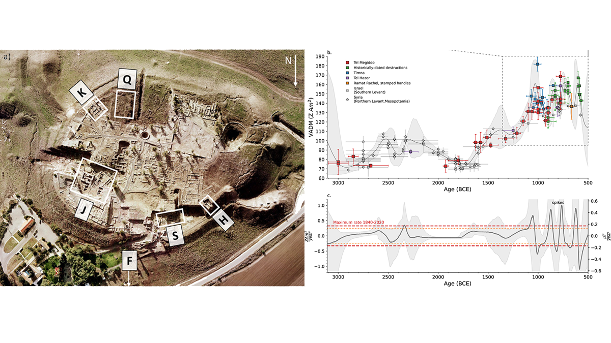
Large Geomagnetic Field Changes Recorded by Archeomagnetism
A rare case of absolute paleointensity data in sub-centennial resolution from an archeological site provide much higher values than predicted by existing magnetic field models.
Posted inEditors' Highlights
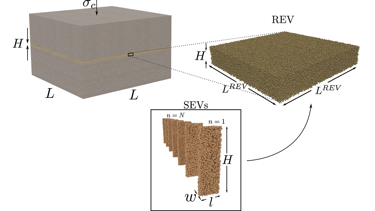
Upscaling Slip and Friction From Grains to the Fault Core
Numerical simulations demonstrate how averaging deformations at the grain scale may unravel the macroscopic friction and unstable slip behavior of a fault core.
Posted inEditors' Highlights
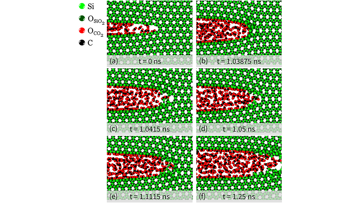
CO2 Reduces the Onset of Fracturing at the Nanoscale in Quartz
Large scale molecular dynamics simulations unravel the coupled processes at work during fracturing and flow of carbon dioxide and water in quartz grains at the nanoscale.

Posted inResearch Spotlights
A New Measure of Roughness Could Advance Earthquake Geophysics
Scientists recently developed an alternative way to measure a rock’s roughness. It might help them understand the physics of faults.


Posted inResearch Spotlights
New Tectonic Plate Model Could Improve Earthquake Risk Assessment
A new model of tectonic plates in New Zealand may identify areas of increased earthquake likelihood.

Posted inEditors' Highlights
Coseismic Displacement of 1987 Earthquake from Aerial Images
Differencing digital surface topography models constructed from historical aerial photographs reveal the coseismic surface displacement field of the 1987 earthquake in northern New Zealand.

Posted inResearch Spotlights
Enhancing Earthquake Detection from Orbit
A new application of machine learning boosts scientists’ ability to use data from satellite navigation systems to detect and warn of earthquakes.