
New findings show that underwater mountains may increase friction along subduction zones, building up stress and making larger ruptures more likely.
Journal of Geophysical Research: Solid Earth

Posted inEditors' Vox
Announcing New AGU Journal Editors-in-Chief Starting in 2024
AGU is excited to welcome new Editors-in-Chief for seven of our journals in 2024, including the founding Editor of JGR: Machine Learning and Computation.
Posted inEditors' Highlights
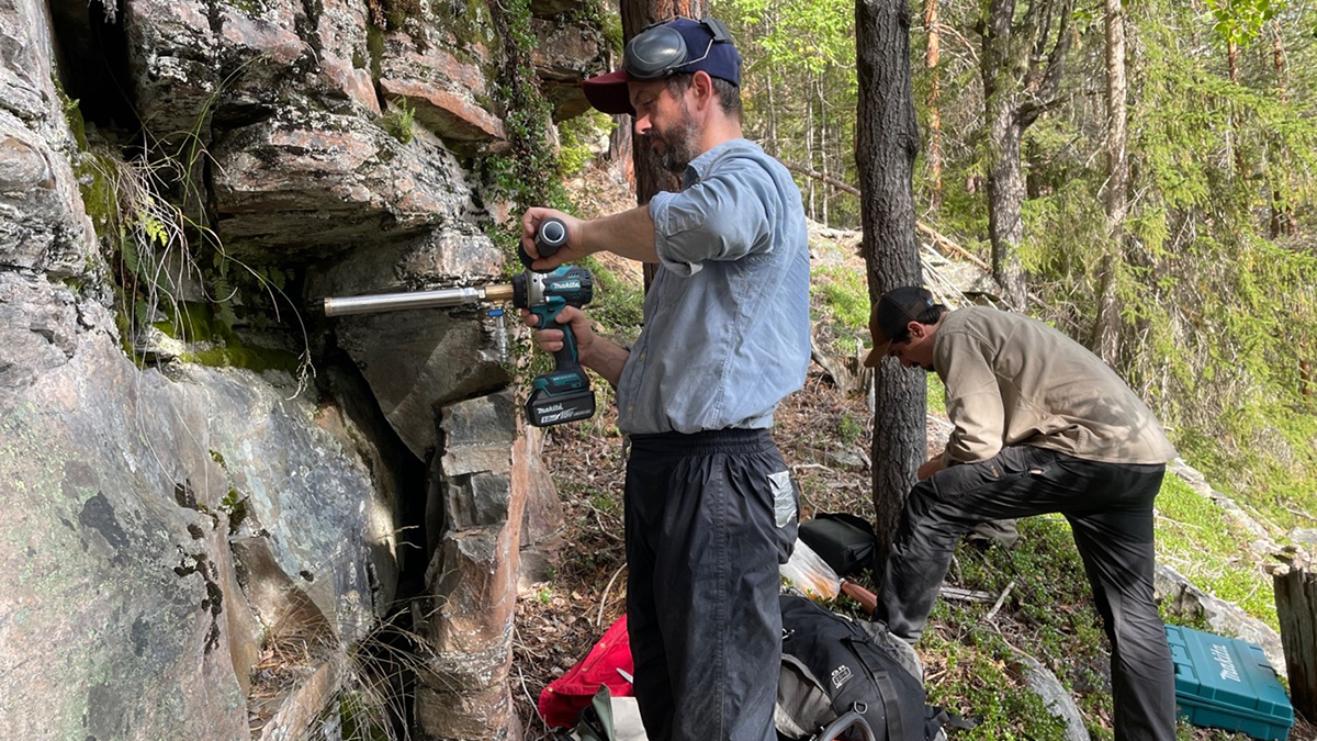
Should I Stay or Should I Go…To Another Paleomagnetic Site?
When collecting a finite number of paleomagnetic samples, having more sites, each with only one sample, achieves superior results compared to sites with multiple samples.

Posted inEditors' Highlights
Rift-to-Ridge: Mid-Atlantic Ridge Segments Imprinted During Rifting
A new seismic study shows that magmatism along the eastern North American rift margin was segmented, and that rift discontinuities influence formation of fracture zones along the Mid-Atlantic Ridge.

Posted inEditors' Highlights
Illuminating the Complex Structural Fabric Beneath the European Alps
A new study investigates the dynamics of the complex continental collision that formed the European Alps and reveals how structural alignments change with depth.
Posted inEditors' Highlights
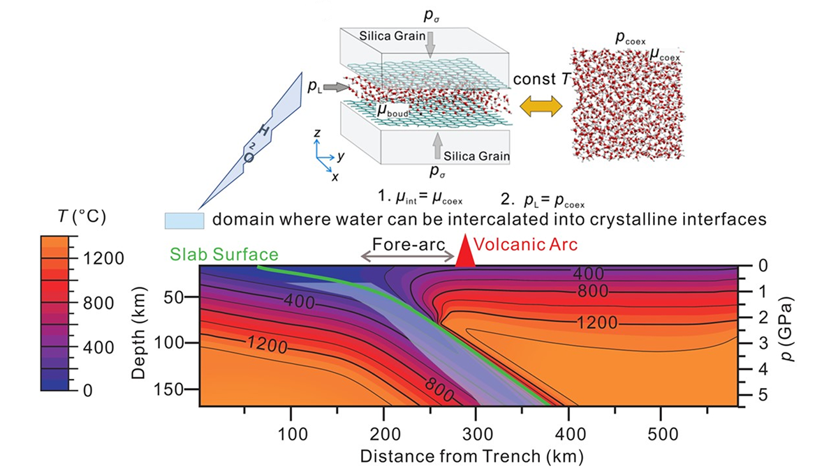
Fluid Release from Subducted Slabs Without Percolation Flow
A new study demonstrates the absorption mechanism of H2O release out of subducting slabs, making the previous hypothesis of dehydration embrittlement unnecessary.
Posted inEditors' Highlights
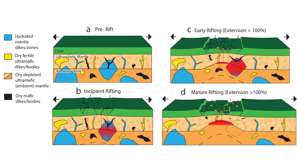
Uncovering Mantle Heterogeneities Beneath Drifting Continents
Computational models of the composition and volumes of magmas during continental rifting evolution provide clues on the heterogeneities of the deep melting mantle.
Posted inEditors' Highlights
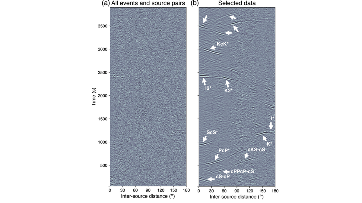
Source Selection Essential to Inter-Source Cross-Correlation
Inter-source correlograms yield coherent signals upon careful consideration of source mechanisms and source-receiver geometry, affording new means of characterizing planetary interiors.

Posted inEditors' Vox
The Art of Promoting Scientific Results
AGU has various avenues for promoting noteworthy research published in our journals and books, which increases visibility, downloads, and citations.

Posted inEditors' Highlights
Deciphering the History of a Rock’s Crystallization
By combining a phase field function approach with bulk thermodynamics of mineral phases, the thermal history of a rock can now be deciphered from its distribution of mineral phases.