
A laboratory study assesses thermochemical remanence as a reliable paleointensity recorder, which could open new venues for studying Earth’s ancient magnetic field.
Journal of Geophysical Research: Solid Earth
Posted inResearch Spotlights
Distant Quake Triggered Slow Slip on Southern San Andreas
A high-resolution map of surface displacements indicates that the 2017 Chiapas earthquake caused substantial creep along a segment of the San Andreas Fault, located 3,000 kilometers away.

Posted inNews
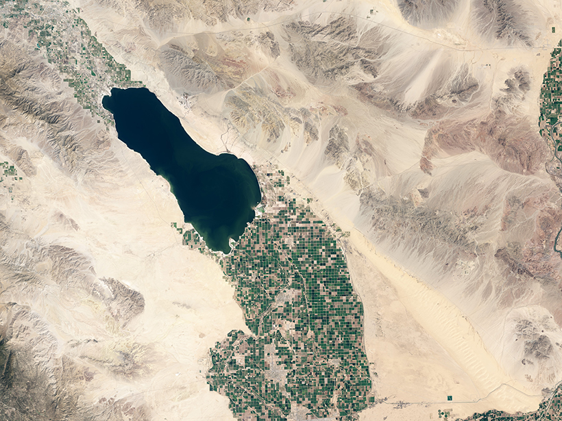
Scientists Rescue Historical Data Taken on Floating Ice Island
A never-before-published data set from the Cold War could help scientists unravel the mysterious western Arctic Ocean.
Posted inEditors' Highlights
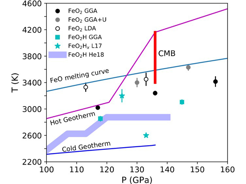
The Lower Mantle May Have a Wet Bottom
Molecular dynamics calculations suggest that molten hydrogen-bearing iron peroxide (FeO2Hx) may produce the ultra-low velocity zones that occur at the core-mantle boundary.

Posted inEditors' Highlights
Finessing Granular Flows
Granular flows are important in geophysics to the pyroclastic flow, debris flow, and avalanches. Understanding their complex and rich physics is therefore important in simulating their dynamics.
Posted inResearch Spotlights
An Integrated History of the Australian-Antarctic Basin
The first basin-wide compilation of seismic and geologic data shows that both margins experienced similar sedimentation patterns prior to the onset of Antarctic glaciation.
Posted inEditors' Highlights
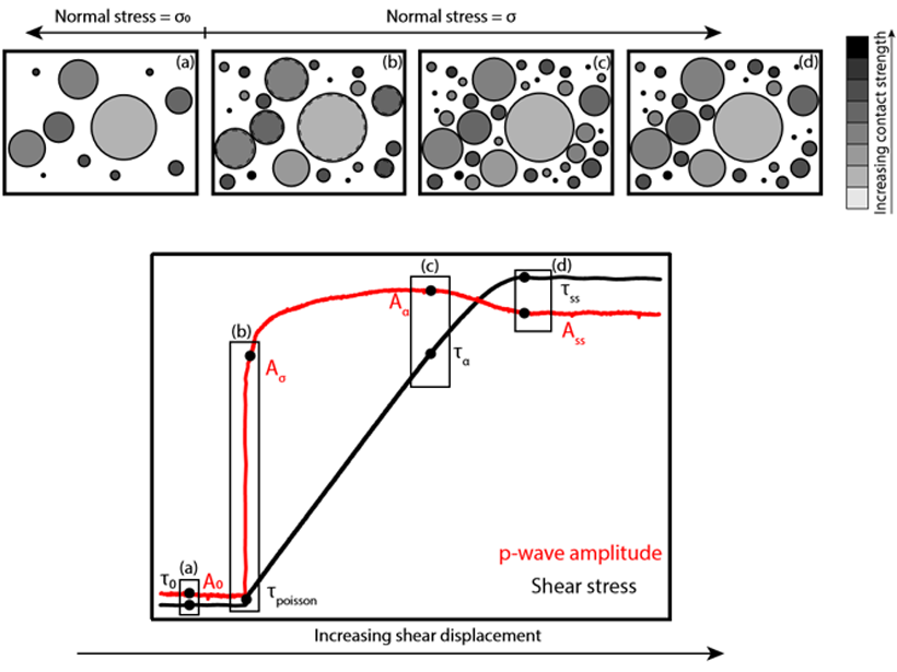
Laboratory Study Probes Triggering Mechanisms of Earthquakes
A new experimental technique traces the state of a shearing fault gouge and shows for the first time how friction of a fault surface can change as a function of varying normal stress.
Posted inResearch Spotlights
Variations in Creep Along One of Earth’s Most Active Faults
Satellite-based radar images of motion along Turkey’s North Anatolian Fault are helping scientists understand when, where, and how creep occurs and its implications for seismic hazard.

Posted inResearch Spotlights
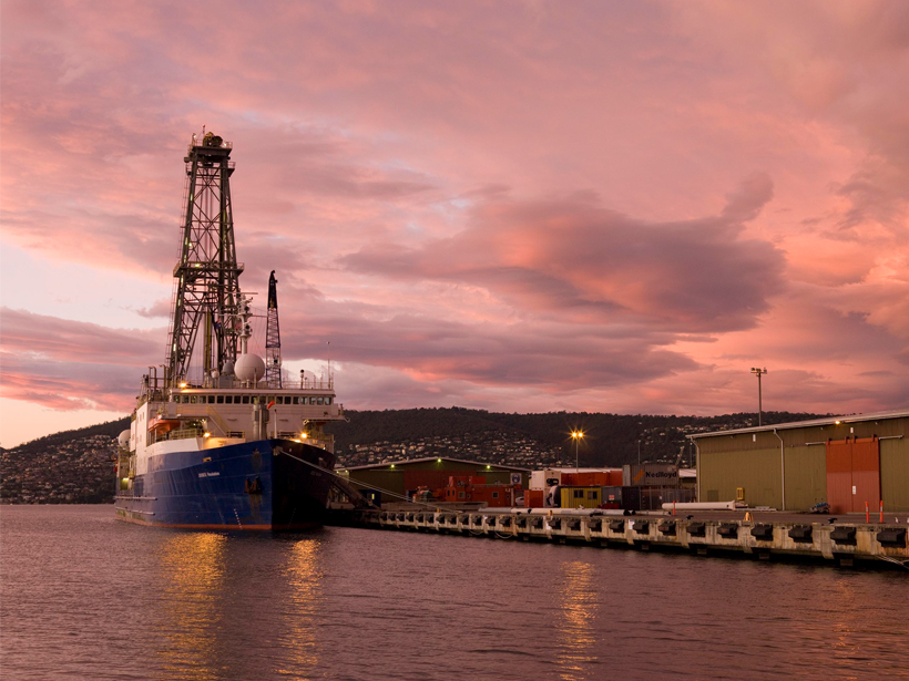
Déjà Vu: Understanding Subduction Zones’ Cycle of Seismicity
A unique geodetic data set from Japan’s Nankai subduction zone offers an unparalleled opportunity to study surface deformation spanning almost an entire seismic cycle.
Posted inEditors' Highlights
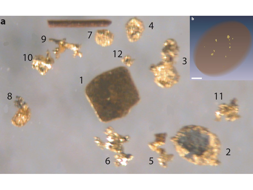
X-Ray Computed Tomography Detects Resolution Scale Gold Grains
A method combining partial-volume and blurring effects can be used to measure small features in computed tomography data volumes.