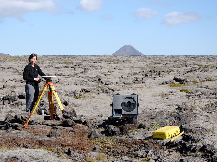
A novel method of calculating strain rates from GPS data shows the South Iceland Seismic Zone is experiencing rapid deformation, including inflation near the island’s most active volcano.
Journal of Geophysical Research: Solid Earth

Posted inResearch Spotlights
All Types of Large Earthquakes Produce Prompt Gravity Signals
New observations of recently discovered gravity perturbations that precede seismic waves have the potential to improve earthquake early-warning systems in California and other tectonic settings.
Posted inEditors' Highlights
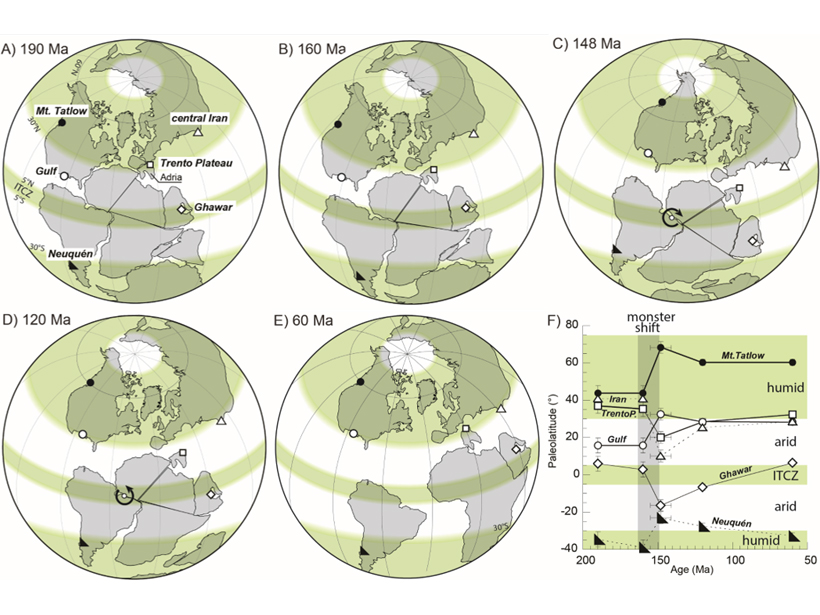
Extraordinary Polar Wander During the Late Jurassic?
Small amounts of polar wander have occurred during geological history, but whether larger amounts occurred is still controversial. Did a truly large polar wander event really happen?
Posted inEditors' Highlights
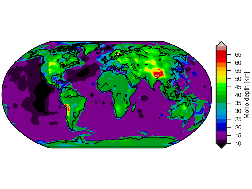
New Global Crustal Model Built as Foundation for Future Studies
A new global crustal model and its corresponding uncertainty were obtained using minimum a priori information and a geostatistical approach.

Posted inEditors' Highlights
Seismic Anisotropy Due to a Compositionally Layered Mantle
Investigating the role of layered rocks and compositional banding on mineral scale in generating seismic anisotropy in the mantle.

Posted inResearch Spotlights
Observing Volcanoes from Space
The first multidecadal, satellite-based study of Latin America’s most active volcanoes could help researchers better predict eruptions.

Posted inEditors' Highlights
Real Time Probing of Shale Cracks in Double Torsion Experiments
Imaging crack propagation in shales using twin optical cameras and fast X-ray radiograph acquisition.
Posted inResearch Spotlights
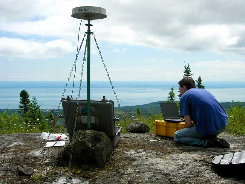
Ancient Faults Amplify Intraplate Earthquakes
A comparison of deformation rates from Canada’s Saint Lawrence Valley offers compelling evidence that strain in the region is concentrated along ancient structures from previous tectonic cycles.

Posted inResearch Spotlights
Unraveling the Origin of Slow Earthquakes
Different nucleation styles detected in five slow-slip events in the same area of Japan’s Ryukyu subduction zone suggest the physical properties along this tectonic plate interface change over time.
Posted inEditors' Highlights
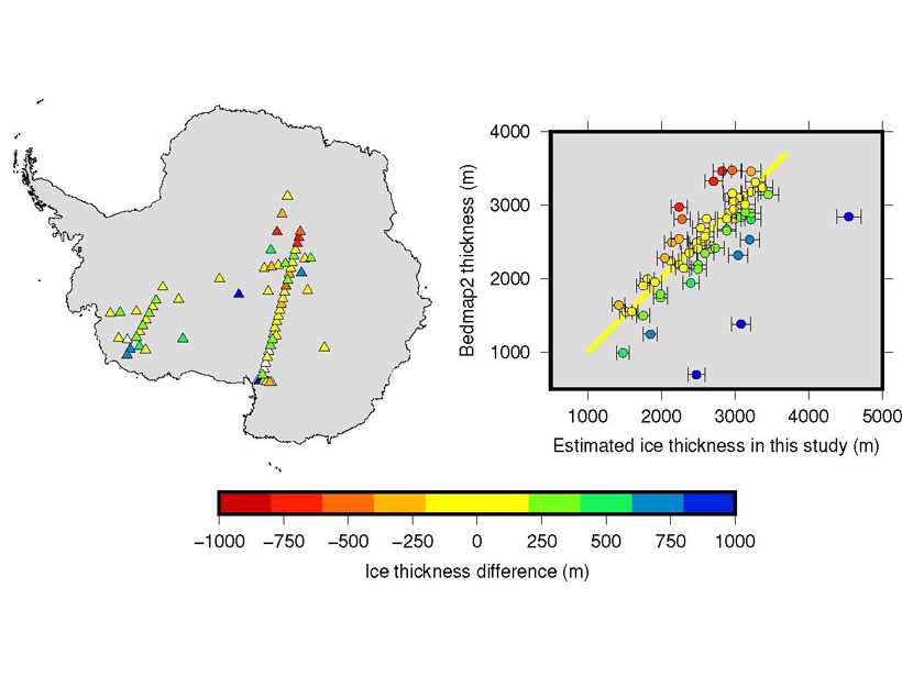
New Method to Measure Ice Cap Thickness
Naturally generated seismic waves bouncing up and down through an ice sheet can be used to determine the thickness of the ice and monitor future changes in ice thickness.