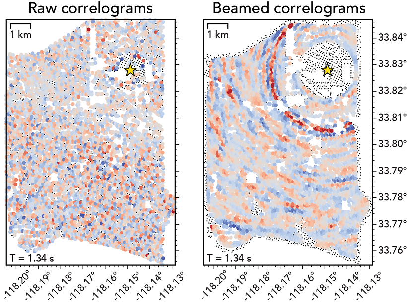
A novel processing scheme was used to extract refracted body waves from ambient seismic noise and investigate the small-scale structure around a fault at Long Beach, California.
Journal of Geophysical Research: Solid Earth

Posted inEditors' Highlights
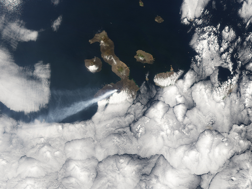
The Ability of Pyroclastic Flows to Generate Tsunamis
Lab experiments of fluidized granular flows entering the water shed light on the dynamics of tsunami generation by fast-moving, pyroclastic density currents at volcanic islands or coastal volcanoes.
Posted inEditors' Highlights
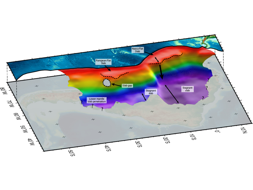
The Other, Deeper, South American Flat Slab
Tomographers trace the slab subducting beneath South America into the lower mantle, providing the most complete picture of structure beneath the continent to date.
Posted inEditors' Highlights
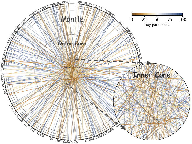
Earthquake-coda Tomography Boosts Illumination of the Deep Earth
A new tomographic method based on correlations of seemingly chaotic earthquake coda waves yields otherwise unobservable arrivals, thus greatly improving illumination of the deep Earth.

Posted inEditors' Highlights
Volcano Monitoring Goes Offshore
Offshore observations by cabled ocean-bottom pressure recorders have revealed details of the 2015 eruption of Axial Seamount submarine volcano in the Pacific Ocean.

Posted inEditors' Highlights
Ultrahigh Speed Movies Catch Growing Earthquake Ruptures
Comparing successive frames from ultrahigh speed videos of propagating fractures allowed laboratory researchers for the first time to capture the fine details of of a propagating earthquake rupture.
Posted inEditors' Vox
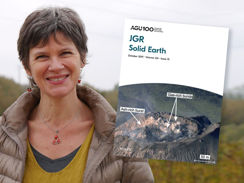
Introducing the New Editor in Chief of JGR: Solid Earth
Find out about the person taking the helm of Journal of Geophysical Research: Solid Earth and her vision for the coming years.

Posted inEditors' Vox
Growth and Challenges for JGR: Solid Earth
The outgoing Editor in Chief of JGR: Solid Earth reflects on his tenure and expresses appreciation to all those who contributed to the success of the journal over recent years.
Posted inResearch Spotlights
Forecasting Volcanic Eruptions with Artificial Intelligence
A machine learning algorithm automatically detects telltale signs of volcanic unrest.
![Figure 4 from paper by Preuss et al. [2019]](https://eos.org/wp-content/uploads/2019/09/2019JB017324-Figure-4-sized.png)
Posted inEditors' Highlights
Can We Tell If Faults Grew During or Between Earthquakes?
Numerical simulations of earthquake cycle deformation reveal that co-seismic and interseismic fault propagation can produce distinct propagation angles that may be recorded in the crust.