• About
  • Sections
  • Topics
    • Climate
    • Earth Science
    • Oceans
    • Space & Planets
    • Health & Ecosystems
    • Culture & Policy
    • Education & Careers
    • Opinions
  • Projects
    • ENGAGE
    • Editors’ Highlights
    • Editors’ Vox
    • Eos en Español
    • Eos 简体中文版
    • Print Archive
  • Science Policy Tracker
  • Blogs
    • Research & Developments
    • The Landslide Blog
  • Newsletter
  • Submit to Eos
  • AGU.org
  • Career Center
  • Join AGU
  • Give to AGU
  • About
  • Sections
  • Topics
    • Climate
    • Earth Science
    • Oceans
    • Space & Planets
    • Health & Ecosystems
    • Culture & Policy
    • Education & Careers
    • Opinions
  • Projects
    • ENGAGE
    • Editors’ Highlights
    • Editors’ Vox
    • Eos en Español
    • Eos 简体中文版
    • Print Archive
  • Science Policy Tracker
  • Blogs
    • Research & Developments
    • The Landslide Blog
  • Newsletter
  • Submit to Eos
Skip to content
  • AGU.org
  • Career Center
  • Join AGU
  • Give to AGU
Eos

Eos

Science News by AGU

Support Eos
Sign Up for Newsletter
  • About
  • Sections
  • Topics
    • Climate
    • Earth Science
    • Oceans
    • Space & Planets
    • Health & Ecosystems
    • Culture & Policy
    • Education & Careers
    • Opinions
  • Projects
    • ENGAGE
    • Editors’ Highlights
    • Editors’ Vox
    • Eos en Español
    • Eos 简体中文版
    • Print Archive
  • Science Policy Tracker
  • Blogs
    • Research & Developments
    • The Landslide Blog
  • Newsletter
  • Submit to Eos

lidar

Photo of a forest floor with several downed trees. Exposed roots and dirt from a large tree are in the center.
Posted inNews

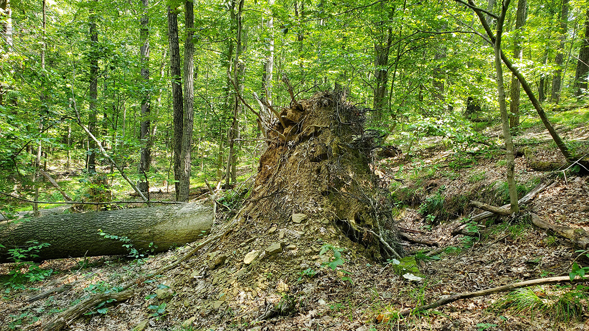
Roughed-Up Hillsides Reveal Tree-Toppling Winds

by Carolyn Wilke 7 February 20237 February 2023

Researchers are reading pockmarks in the forest floor to study the uprooting of trees in southern Indiana and estimate how fast winds howled through the forest in the past.

Woods and wetlands in the Chequamegon-Nicolet National Forest.
Posted inResearch Spotlights

How Forest Structure Drives Productivity

by Jack Lee 20 July 202227 September 2022

Data from northern Wisconsin forest sites uncovered that vertical heterogeneity metrics are the most influential factors underlying rates of photosynthesis.

Aerial view created of a forest with lidar—with trees artificially colored in many colors—as well as buildings and open spaces in part of Yosemite National Park
Posted inFeatures

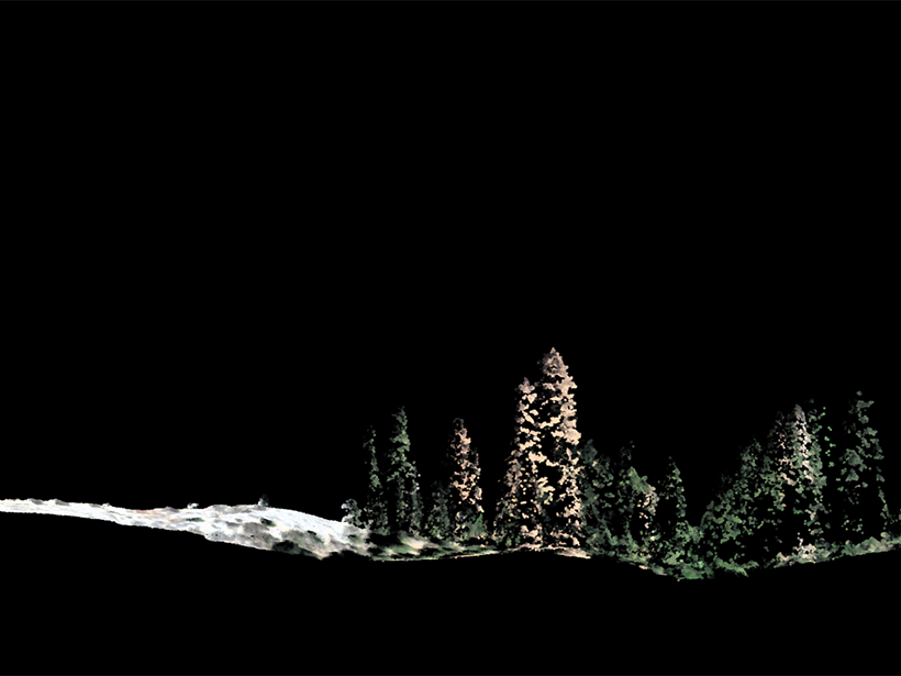
A Lidar’s-Eye View of How Forests Are Faring

by Van R. Kane, Liz Van Wagtendonk and Andrew Brenner 29 April 202222 December 2022

Success in Yosemite is driving the wider use of lidar surveys to support forest health and wildfire resilience, study wildlife habitats, and monitor water resources.

Comparison of channels extracted from a high-resolution Digital Elevation Model using a traditional flow routing method and using the new method based on a Riverlab flow simulation (Elder Creek catchment, California, USA).
Posted inEditors' Highlights

Running Water on Topographic Data to Better Delineate Channels

by Mikaël Attal 25 April 202227 April 2022

Two-dimensional hydraulic simulations are a powerful tool to identify process domains such as channels, hillslopes, and floodplains in high-resolution topographic data.

In the foreground, the GEDI instrument appears as a large white box. In the background, an astronaut climbs along the space station’s external scaffolding.
Posted inNews

Scientists Fight to Keep Lidar on the Space Station

by Saima May Sidik 6 April 20226 July 2022

Remote sensing experts may lose a key tool in the fight against climate change.

La pirámide del Sol en Teotihuacan al frente con un cerro y el cielo despejado detrás.
Posted inNews

Mapeando el pasado, presente y futuro de Teotihuacan

by Humberto Basilio 14 March 202227 March 2023

Un nuevo proyecto con tecnología lidar revela cómo la minería y la expansión urbana han puesto en riesgo a uno de los sitios del patrimonio cultural más icónicos de México.

The Pyramid of the Sun at Teotihuacan
Posted inNews

Mapping Teotihuacan’s Past, Present, and Future

by Humberto Basilio 6 January 20229 May 2023

A new lidar project reveals how mining and urban expansion have put one of Mexico’s most iconic cultural heritage sites at risk.

Side view of individual trees generated in a lidar image
Posted inNews

The Bigger They Are, the Harder They Fall

Richard Sima, freelance science writer by Richard J. Sima 18 October 201924 March 2023

New research tracking 1.8 million trees found that tall trees died at more than twice the rate of smaller ones toward the end of extreme and persistent drought.

Seated man in a hard hat assesses sediment patterns in a dug trench
Posted inNews

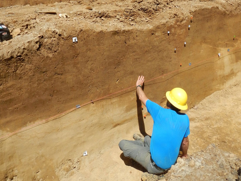
Secrets from the New Madrid Seismic Zone’s Quaking Past

Rachel Crowell, Science Writer by Rachel Crowell 9 April 20198 December 2022

High-resolution lidar topography reveals a long history of ancient earthquakes.

Posted inEditors' Highlights

New Lidar Comparisons of Temperatures Near the Mesopause

by William J. Randel 22 October 201816 March 2023

For the first time, simultaneous measurements of upper atmosphere temperatures over altitudes 80 to 110 kilometers have been made by two complementary lidar techniques.

Posts pagination

Newer posts 1 2 3 Older posts
A view of a Washington, D.C., skyline from the Potomac River at night. The Lincoln Memorial (at left) and the Washington Monument (at right) are lit against a purple sky. Over the water of the Potomac appear the text “#AGU24 coverage from Eos.”

Features from AGU Publications

Research Spotlights

Webb Telescope Spies Io’s Volcanic Activity and Sulfurous Atmosphere

4 November 20254 November 2025
Editors' Highlights

Marine Heatwaves Reshape Precipitation Patterns

6 November 20256 November 2025
Editors' Vox

Publishing Participatory Science: The Community Science Exchange

20 October 202517 October 2025
Eos logo at left; AGU logo at right

About Eos
ENGAGE
Awards
Contact

Advertise
Submit
Career Center
Sitemap

© 2025 American Geophysical Union. All rights reserved Powered by Newspack