Artificial intelligence can be used to analyze massive amounts of data from climate simulations, but more training data are needed.
machine learning & AI

Posted inResearch Spotlights
Improving Atmospheric Forecasts with Machine Learning
An efficient, low-resolution machine learning model can usefully predict the global atmospheric state as much as 3 days out.
Posted inNews
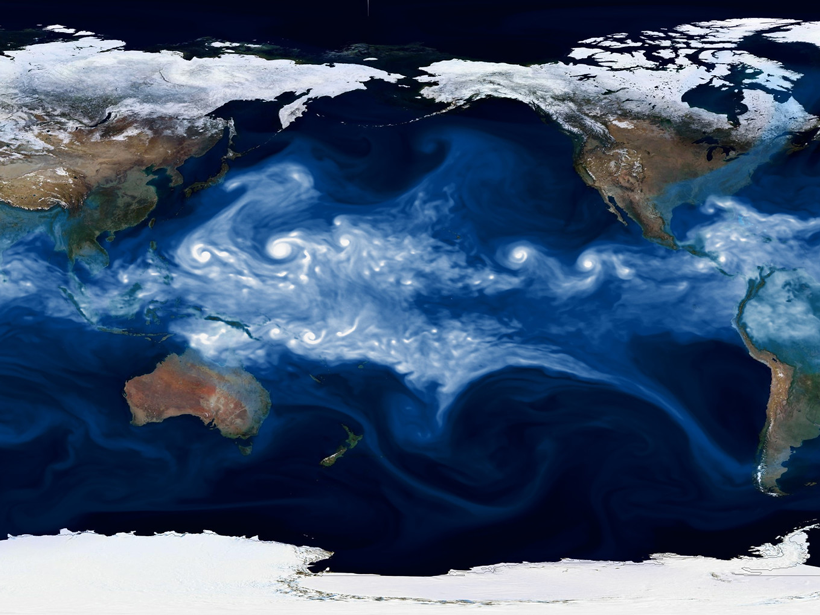
How Machine Learning Redraws the Map of Ocean Ecosystems
Using an unsupervised learning algorithm, scientists can create new maps of ecosystem provinces in the ocean, opening the possibility of sharper data collection and monitoring.
Posted inFeatures
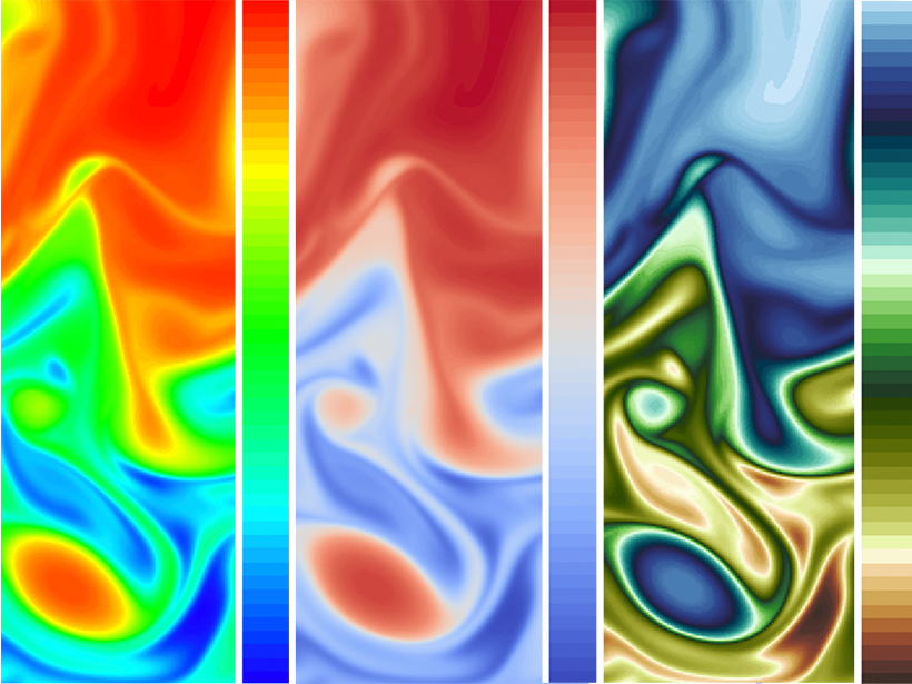
Visualizing Science: How Color Determines What We See
Color plays a major role in the analysis and communication of scientific information. New tools are helping to improve how color can be applied more accurately and effectively to data.

Posted inScience Updates
Creating Data Tool Kits That Everyone Can Use
Earth scientists outline challenges to making the growing wealth of available data more accessible and to using data services for interdisciplinary research and applications.

Posted inNews
Are Cosmic Rays a Key to Forecasting Volcanic Eruptions?
A combination of relativistic particles and artificial intelligence may provide a new way to forecast when a volcano could erupt.

Posted inEditors' Highlights
A New Global Map of Seafloor Fluid Expulsion Anomalies
The first open-source database of SEAfloor FLuid Expulsion Anomalies (SEAFLEASs) at a global scale reveals their distribution and physical parameters.
Posted inResearch Spotlights
Machine Learning Improves Weather and Climate Models
New research evaluates the performance of generative adversarial networks for stochastic parameterizations.

Posted inNews
Combining AI and Analog Forecasting to Predict Extreme Weather
New deep learning technique brings an obsolete forecasting method “back to life” to predict extreme weather events.

Posted inEditors' Highlights
Representing Estuaries and Braided Rivers as Channel Networks
The human eye is quite good at identifying channel networks among the rich patterns exhibited by estuaries and braided rivers, but computers have a harder time doing so. Could they do better?