
Researchers call for an extensive monitoring network to quantify carbon dioxide and methane released by China’s rivers, lakes, reservoirs, and ponds.
monitoring networks

Posted inThe Landslide Blog
Reactivating ancient landslides through reservoir construction – the Hoseynabad-e Kalpush landslide in Iran
The Landslide Blog is written by Dave Petley, who is widely recognized as a world leader in the study and management of landslides. A known potential issue with the construction of reservoirs is the reactivation of ancient landslides that have lain dormant in the landscape. There are literally hundreds of documented examples, but as dam […]

Posted inNews
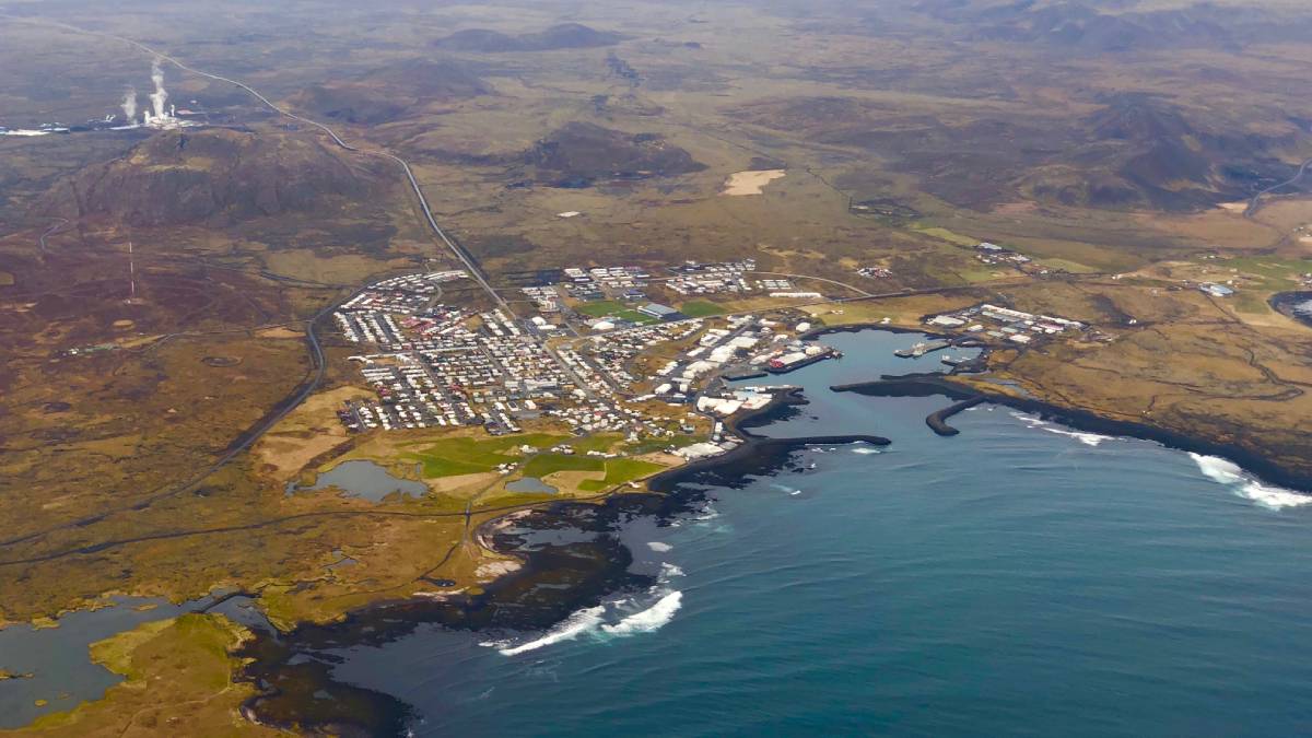
Iceland’s Recent Eruptions Driven by Tectonic Stress
Magma flow in the magmatic dike near Grindavík was among the fastest recorded. The processes driving that flow could be at play at volcanoes in Hawaii, off the African coast, and anywhere crustal plates split apart.
Posted inScience Updates
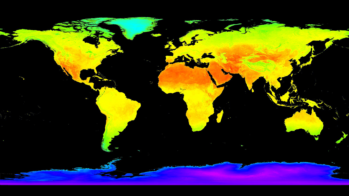
Trustworthy Satellite Earth Observations for Science and Society
Enhancing confidence in satellite observations of terrestrial properties like land surface temperature and soil moisture requires advances in validation and data quality assessment practices.

Posted inFeatures
Oceanic Cacophony
The ocean is a pretty loud place, and anthropogenic noise is adding another layer to the soundscape.

Posted inScience Updates
Ecosystem Observations from Every Angle
Proximal remote sensing provides a bridge between ecosystem flux data at Earth’s surface and optical data from satellite sensors, improving our grasp of feedbacks between terrestrial ecosystems and climate.
Posted inNews
Eruption Now Unlikely Near Icelandic Town
Scientists and local authorities had been tracking the eruption’s precursors for weeks and evacuated residents. Then the magma stalled.

Posted inNews
Thunderquakes Map the Subsurface
Researchers have figured out how rumbling thunder turns to seismic waves and how this shaking could be used to reveal subsurface geology.
Posted inResearch Spotlights
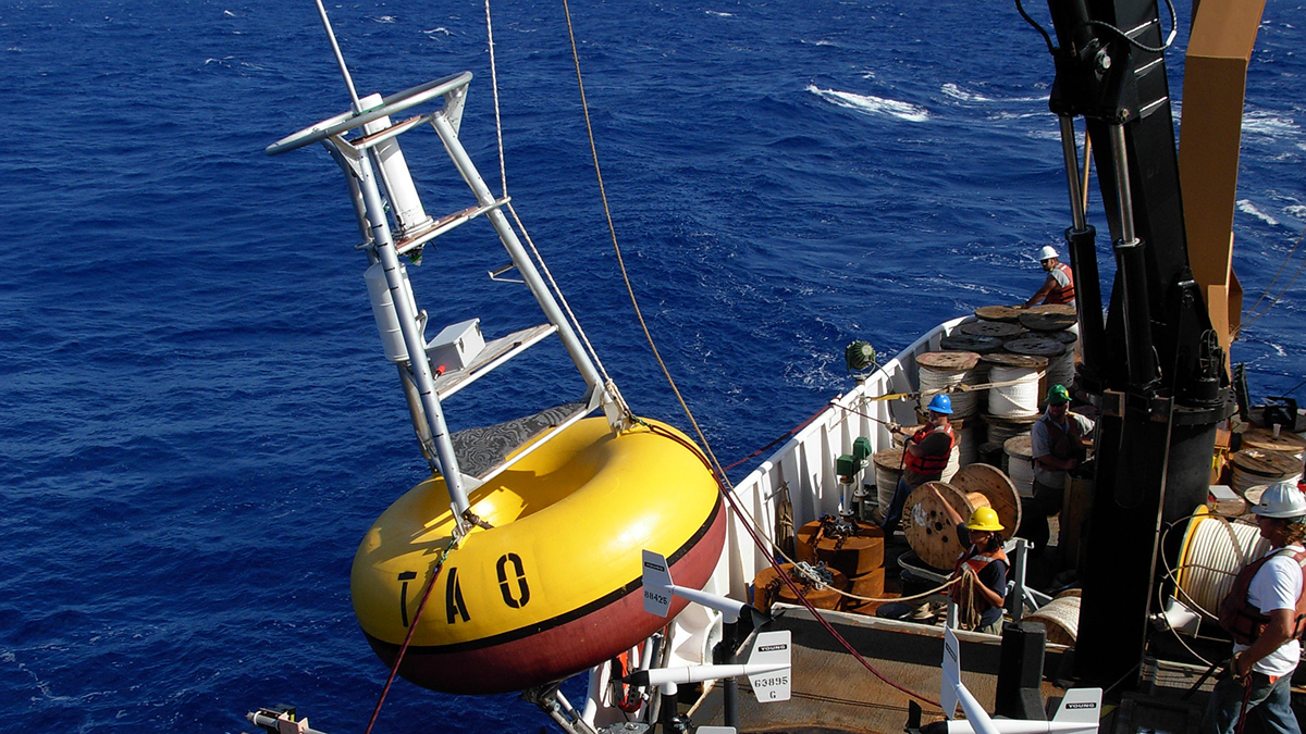
Bolstered by Buoys: Predicting El Niño
Scientists investigate the importance of a Pacific buoy network in monitoring and predicting the El Niño–Southern Oscillation.

Posted inResearch Spotlights
Los primeros eventos de deslizamiento lento observados en el sur de Costa Rica
Cinco eventos observados en la Península de Osa revelan nueva información sobre el papel que estos pequeños y lentos terremotos pueden desempeñar en la acumulación de tensión y riesgos de tsunami a lo largo de las zonas de subducción.