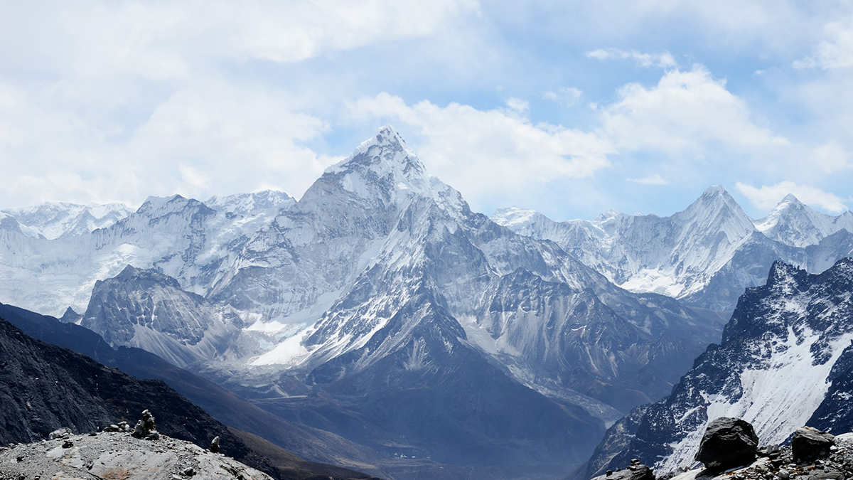
A constructive debate on Himalayan tectonics shows how respectful scientific dialogue helps test competing ideas about how Earth’s highest plateau formed.
plate tectonics
Posted inEditors' Vox
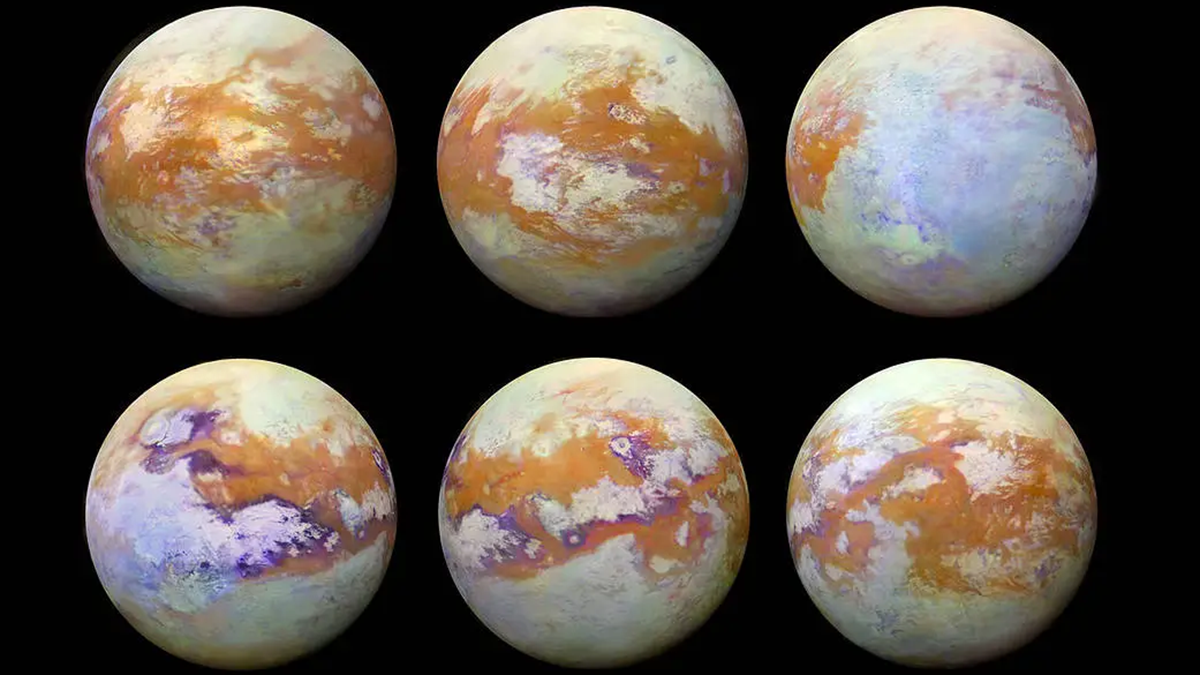
Distant Cousins? How Field Work on Earth Could Help Us to Better Understand Titan
What do Saturn’s moon Titan and the Earth have in common? Quite a lot as it turns out, from hydrocarbon deposits to polar clouds, lakes and rivers, craters and canyons, and more.
Posted inEditors' Highlights
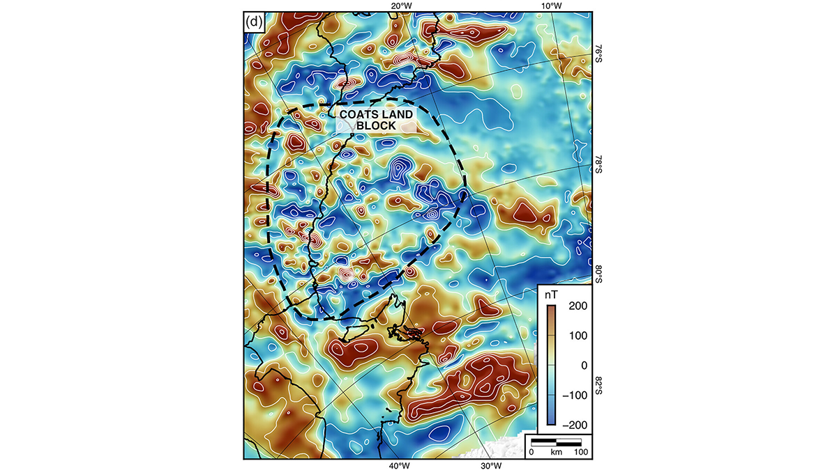
An Ancient Landscape Beneath the East Antarctic Ice Sheet
Geophysical observations of the subglacial topography of Coats Land reveal a landscape formed by tectonics and fluvial erosion that influenced the formation of the East Antarctic Ice Sheet.
Posted inFeatures
Drilling Down to Open Up New Understanding of Earth’s Continents
Scientists have drilled into Earth’s crust for decades to understand natural hazards, past climates, energy resources, and more. They’ve only scratched the surface of what we can learn.
Posted inEditors' Vox
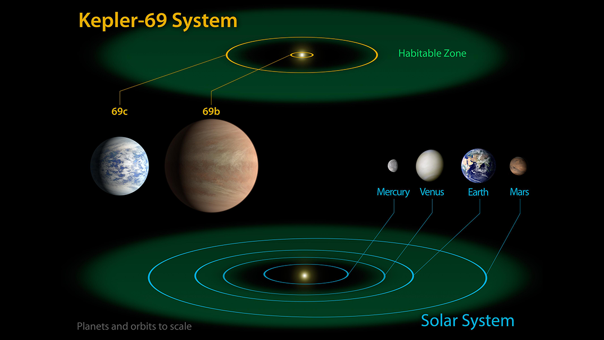
Terrestrial Planets Guide Our Search for Habitable Exoplanets
Earth and its rocky neighbours reveal how planetary processes—core-mantle differentiation, crust formation, tectonics, and geochemical cycling—between interior and surficial reservoirs shape habitability.
Posted inEditors' Vox
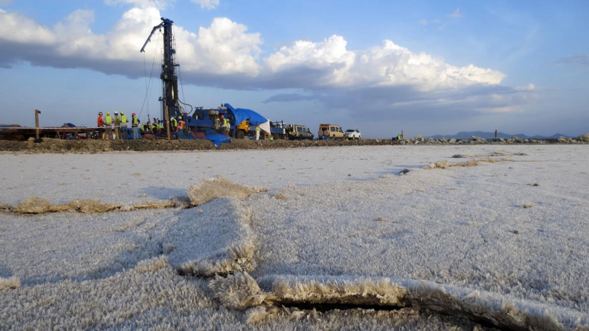
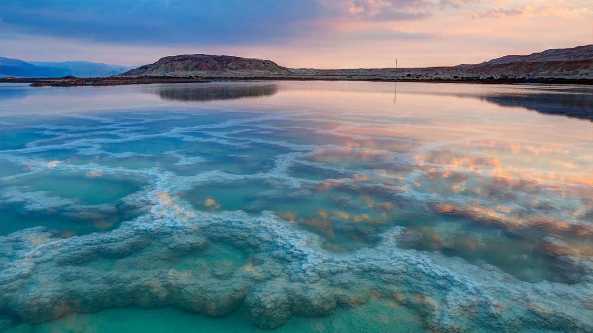
Salt: A Vital Compound for Science and Society
From salt basins in the Persian Gulf to lithium reserves in Chile, evaporite minerals accumulate in sedimentary basins under tectonic and climatic processes of significance to scientists worldwide.
Posted inEditors' Highlights
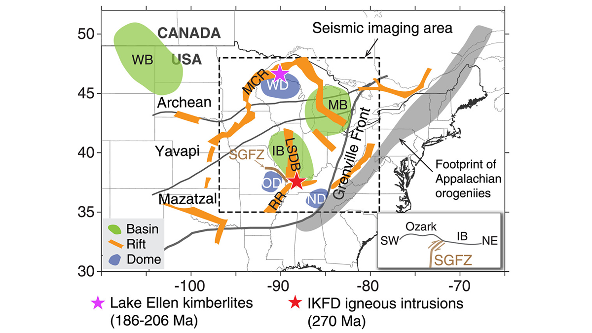
Tectonic Modifications Shape Surface Environment and Landscape
Earth observation through ambient noise tomography explains links between tectonic modification, ancient geological records, and landscape evolution.
Posted inEditors' Highlights
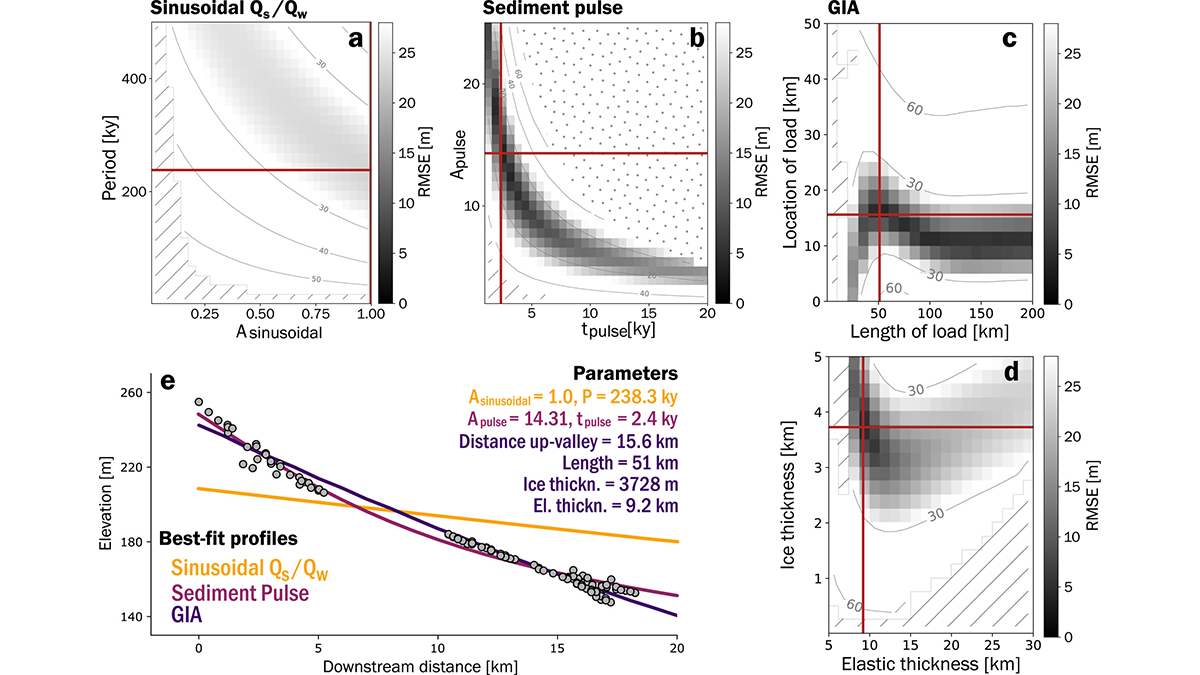
Models Reveal Imprint of Tectonics and Climate on Alluvial Terraces
Mechanistic models are used to show how different drivers, including sediment and water supply, uplift and subsidence, and sea-level variations, affect the shapes and formation of extensive terraces.
Posted inEditors' Highlights
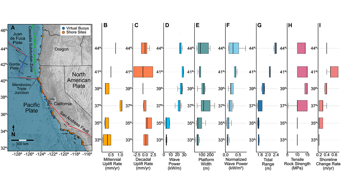
Rocky Shore Erosion Shaped by Multi-Scale Tectonics
Statistical analysis of western United States shore evolution provides hints of long-term tectonic and seismic cycle effects on modulating coastal erosion.
Posted inNews
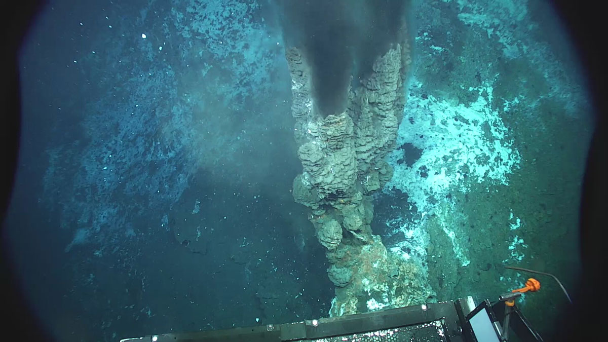
A Mid-Ocean Ridge in the Norwegian Sea Pumps Out Hydrogen
Vent fluids collected from the Knipovich Ridge contain unexpectedly high concentrations of hydrogen, potentially produced by the degradation of organic matter.