
Researchers have analyzed precipitation patterns in the 50th state to define a long-overdue data set that brings Hawaii into the fold of modern-day climate analyses.
precipitation

Posted inNews
Forever Chemicals Are Raining Down on the Great Lakes
PFAS levels are growing in some of the Great Lakes, and precipitation is a big contributor.
Posted inNews
Climate Change Is Likely to Slash Global Income
A new study estimates that climate change could cost $38 trillion per year, but emissions mitigation and adaptation strategies could limit future damages.

Posted inEditors' Highlights
A Powerful New Model for U.S. Climate–Air Quality Interactions
NOAA’s Geophysical Fluid Dynamics Laboratory has developed a new variable-resolution global chemistry-climate model for research at the nexus of U.S. climate and air quality extremes.

Posted inNews
Changing Snowpack Inspires New Measurement
Climate change is bringing increased variability to annual snowfall, which affects how much water is stored for ecosystem and human use.
Posted inNews
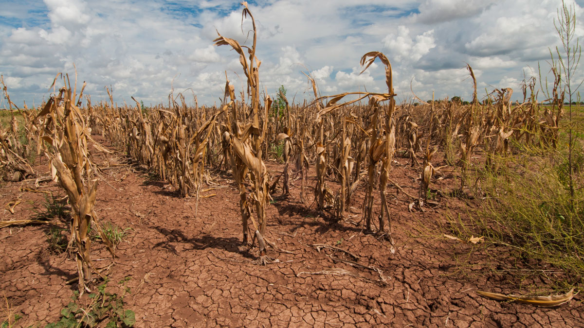
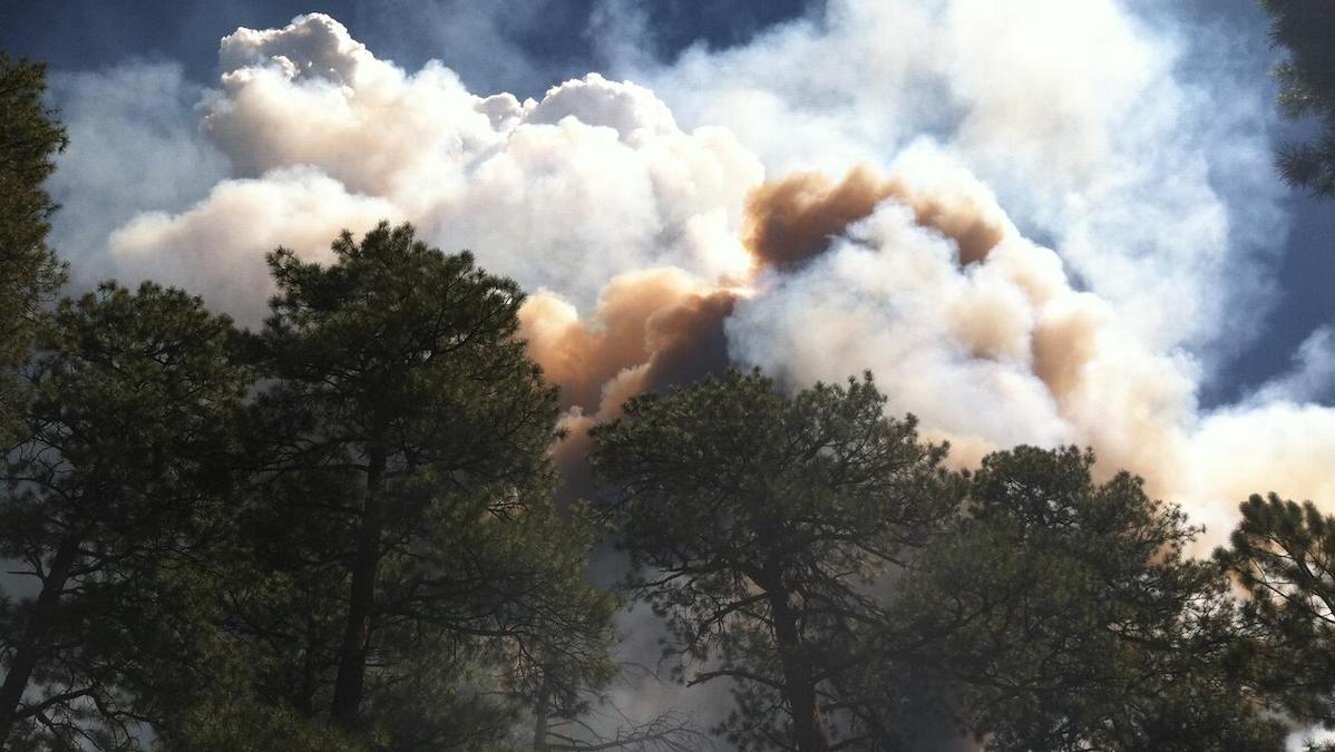
Forecasters Expect Slow Start to U.S. Wildfire Season
A wet spring in the United States will dampen early fires, but some regions will see elevated risk this summer.

Posted inEditors' Highlights
When It Rains, It Pours!
Water that falls on a forest canopy during rainfall events reaches the ground at focused locations called “pour points”. This insight has a major impact on how we view hydrologic processes on the ground.

Posted inEditors' Highlights
Tuning Improves High-Resolution Climate Simulations
Tuning parameterizations of turbulent mixing and of the fall velocity of precipitation and cloud ice alleviates long-standing biases in climate simulations.

Posted inNews
Air Pollution Has Masked Climate Change’s Influence on U.S. Rainfall
A study suggests that high levels of aerosol pollution have offset higher precipitation levels caused by a warming climate.
Posted inEditors' Highlights
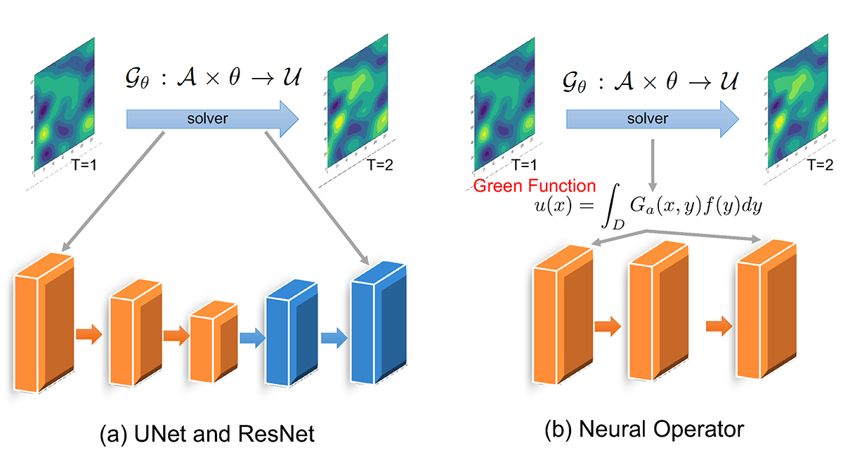
Machine Learning Accelerates the Simulation of Dynamical Fields
Fourier neural operator solvers accurately emulate particle-resolved direct numerical simulations and significantly reduce the computational time by two orders of magnitude.