• About
  • Special Reports
  • Topics
    • Climate
    • Earth Science
    • Oceans
    • Space & Planets
    • Health & Ecosystems
    • Culture & Policy
    • Education & Careers
    • Opinions
  • Projects
    • Postcards From the Field
    • ENGAGE
    • Editors’ Highlights
    • Editors’ Vox
    • Eos en Español
    • Eos 简体中文版
    • Print Archive: 2015–2025
  • Policy Tracker
  • Blogs
    • Research & Developments
    • The Landslide Blog
  • Newsletter
  • Submit to Eos
  • AGU.org
  • Career Center
  • Join AGU
  • Give to AGU
  • About
  • Special Reports
  • Topics
    • Climate
    • Earth Science
    • Oceans
    • Space & Planets
    • Health & Ecosystems
    • Culture & Policy
    • Education & Careers
    • Opinions
  • Projects
    • Postcards From the Field
    • ENGAGE
    • Editors’ Highlights
    • Editors’ Vox
    • Eos en Español
    • Eos 简体中文版
    • Print Archive: 2015–2025
  • Policy Tracker
  • Blogs
    • Research & Developments
    • The Landslide Blog
  • Newsletter
  • Submit to Eos
Skip to content
  • AGU.org
  • Career Center
  • Join AGU
  • Give to AGU
Eos

Eos

Science News by AGU

Support Eos
Sign Up for Newsletter
  • About
  • Special Reports
  • Topics
    • Climate
    • Earth Science
    • Oceans
    • Space & Planets
    • Health & Ecosystems
    • Culture & Policy
    • Education & Careers
    • Opinions
  • Projects
    • Postcards From the Field
    • ENGAGE
    • Editors’ Highlights
    • Editors’ Vox
    • Eos en Español
    • Eos 简体中文版
    • Print Archive: 2015–2025
  • Policy Tracker
  • Blogs
    • Research & Developments
    • The Landslide Blog
  • Newsletter
  • Submit to Eos

risk perception

Dirt, rocks, and tree debris block one lane of a mountain highway.
Posted inResearch Spotlights

Mapping Landslide Risk in the United States and Puerto Rico

by Rebecca Owen 22 October 202422 October 2024

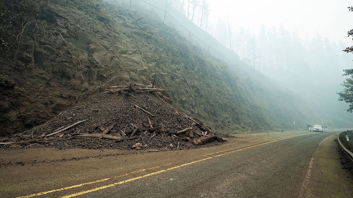
A new method provides highly accurate continental-scale landslide susceptibility maps that are being used in the aftermath of Hurricane Helene.

An extreme heat warning sign in Death Valley National Park in California
Posted inResearch Spotlights

Expecting the Unexpected Could Help Us Prepare for Climate Extremes

Aaron Sidder, freelance science writer by Aaron Sidder 12 June 202413 June 2024

A new paper argues that too little consideration of high-impact, low-likelihood events has left us unprepared for the worst of climate change.

A satellite image of Hurricane Edouard over the Atlantic Ocean
Posted inNews

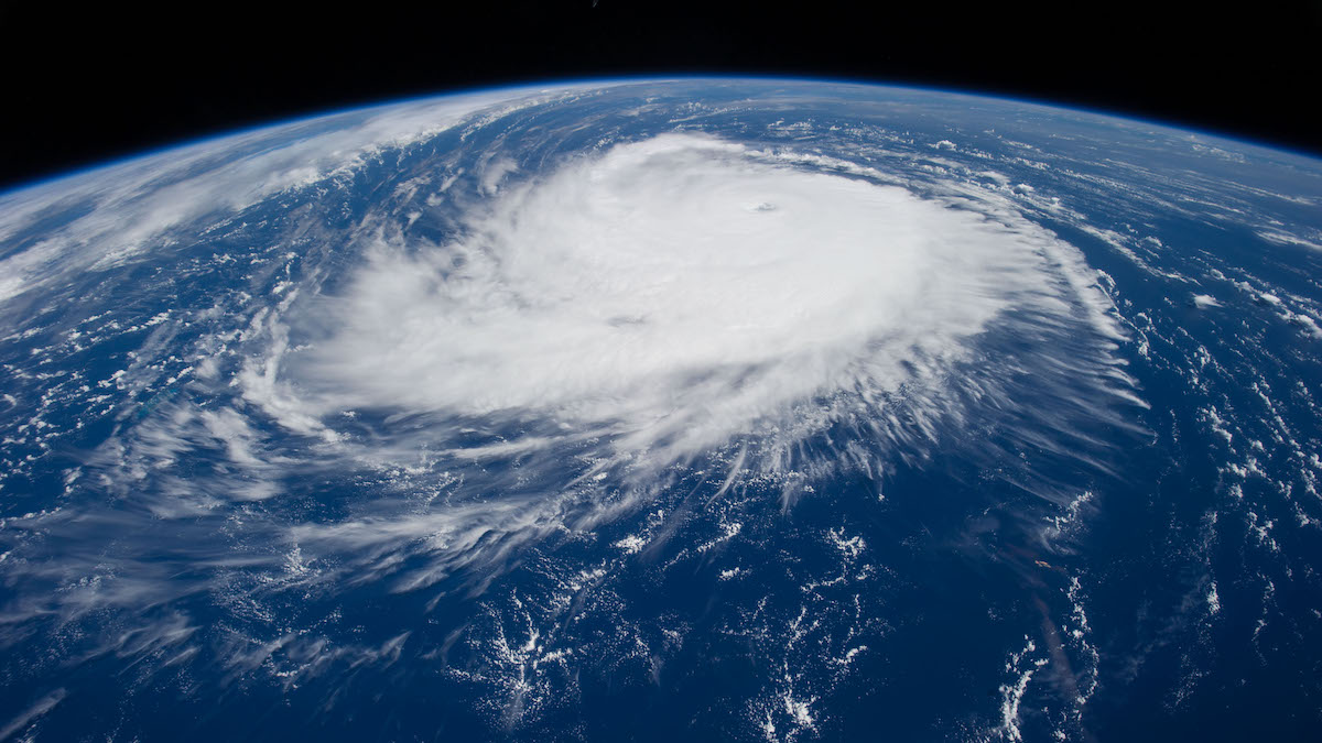
2024 Could Be Among Most Active Hurricane Seasons Ever

by Grace van Deelen 23 May 202423 May 2024

A new NOAA report predicts an extraordinarily active Atlantic hurricane season spurred by record ocean temperatures and a shift to La Niña conditions.

The active stratovolcano Popocatépetl is seen from the city of Puebla in central Mexico.
Posted inAGU News

Perceiving Risk

by Caryl-Sue Micalizio 25 April 20243 May 2024

“Risk” means different things to different people, and effective science communication must recognize and respect that.

On 30 December 2021, a grass fire sparked outside Boulder, Colo.
Posted inFeatures

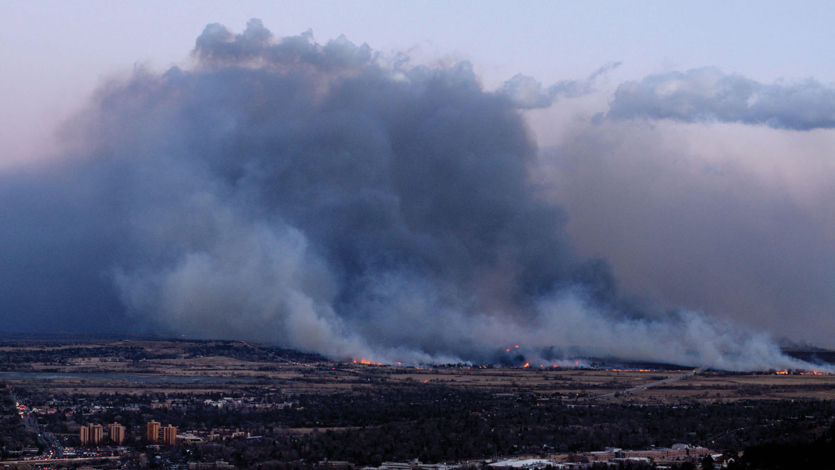
When Fieldwork Comes Home

by Grace van Deelen 25 April 202425 April 2024

The impacts of the 2021 Marshall Fire rippled through a community of Colorado geoscientists, spurring them to action.

El Popocatépetl hace erupción con volutas de gas volcánico, como se observa desde Puebla, México.
Posted inFeatures

¿Qué tan peligroso es el volcán Popocatépetl? Depende a quién le preguntes

Katherine Kornei, Science Writer by Katherine Kornei 8 April 20248 April 2024

El estratovolcán en el centro de México presenta un interesante caso de estudio sobre la percepción del riesgo, la comunicación de la ciencia y la preparación en torno a los peligros naturales.

A snow-capped mountain against a blue sky.
Posted inNews

No Canadian Volcanoes Meet Monitoring Standards

by Grace van Deelen 29 March 202429 March 2024

A new analysis reveals serious monitoring gaps at even the highest-threat volcanoes.

Shallow landslides in New Zealand
Posted inThe Landslide Blog

GNS Science Landslide Planning Guidance

by Dave Petley 21 March 202421 March 2024

The Landslide Blog is written by Dave Petley, who is widely recognized as a world leader in the study and management of landslides. New Zealand is a country with a severe level of landslide hazard, resulting from a combination of the tectonic setting, the geology, the climate and the impact of human activities. It is […]

The Swiss Alps, in which mountaineers face rockfall hazards.
Posted inThe Landslide Blog

Rockfalls as a hazard to mountaineers in high mountain areas

by Dave Petley 5 March 20245 March 2024

The Landslide Blog is written by Dave Petley, who is widely recognized as a world leader in the study and management of landslides. Rockfalls are a key risk to climbers in high mountains, potentially causing injury or even loss of life. We regularly record such events in our fatal landslide research, although I have always […]

Popocatépetl erupts with wisps of volcanic gas, as seen from Puebla, Mexico.
Posted inFeatures

How Dangerous Is Mexico’s Popocatépetl? It Depends on Who You Ask

Katherine Kornei, Science Writer by Katherine Kornei 29 January 202425 April 2024

The stratovolcano in central Mexico presents a rich case study of risk perception, science communication, and preparedness surrounding natural hazards.

Posts pagination

Newer posts 1 2 3 Older posts
Over a dark blue-green square appear the words Special Report: The State of the Science 1 Year On.

Features from AGU Publications

Research Spotlights

Making a Map to Make a Difference

11 February 202611 February 2026
Editors' Highlights

Rocky Shore Erosion Shaped by Multi-Scale Tectonics

16 February 202613 February 2026
Editors' Vox

A Double-Edged Sword: The Global Oxychlorine Cycle on Mars

10 February 202610 February 2026
Eos logo at left; AGU logo at right

About Eos
ENGAGE
Awards
Contact

Advertise
Submit
Career Center
Sitemap

© 2026 American Geophysical Union. All rights reserved Powered by Newspack