
The skies over U.S. cities are cloudier than their surrounding areas.
satellite imagery


Posted inENGAGE, News
As the Arctic Warms, These Rivers Are Slowing Down
The Arctic is warming up, but instead of large rivers migrating faster, they’re actually slowing down because of shrubification.
Posted inResearch Spotlights
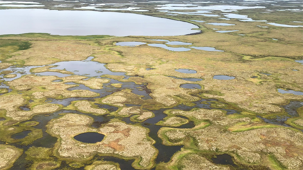
Neural Networks Map the Ebb and Flow of Tiny Ponds
Ponds play an outsized role in carbon emissions, but their size makes them hard to track. Enter machine learning.

Posted inNews
Newly Discovered Salts May Exist on Icy Moons
For the first time in more than a century, scientists have identified new sodium chloride crystals. The discovery may reconcile puzzling spectroscopic images of Europa’s surface.
Posted inNews
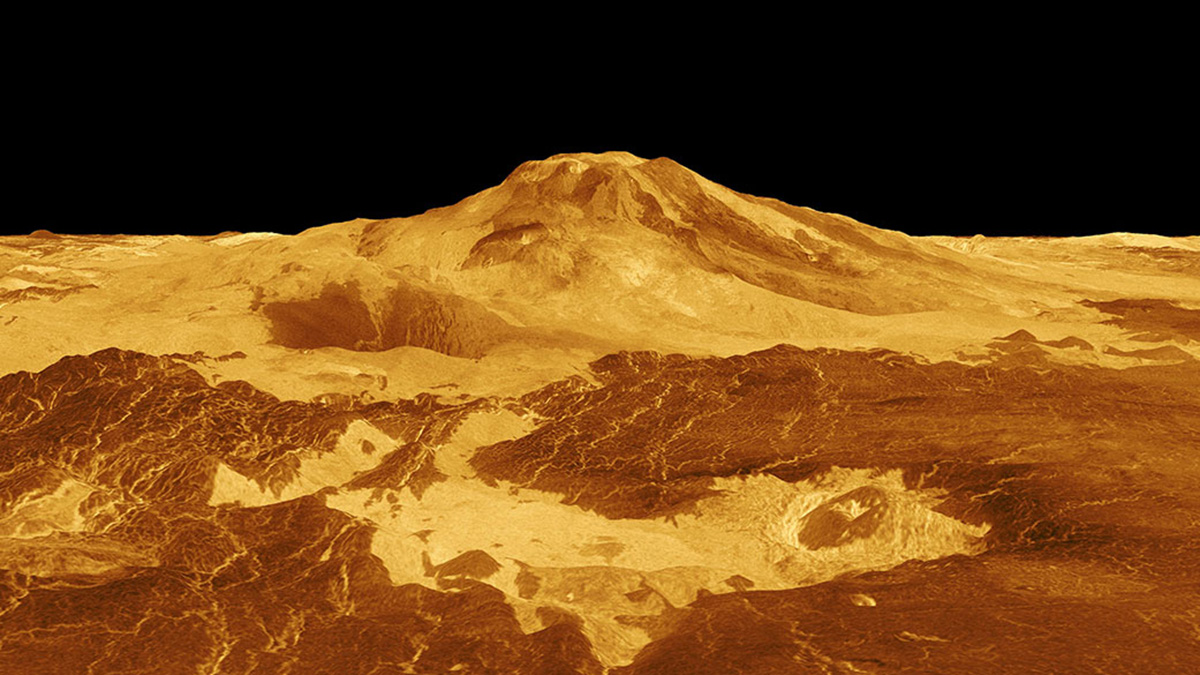
Active Volcanoes on Venus?
With a new look at old imagery, scientists may have found evidence of volcanic activity on Venus.

Posted inNews
Las hojas están brotando más temprano en el Sendero de los Apalaches
Imágenes satelitales de nuevas y brillantes hojas revelan cambios que producirán un efecto de cascada en diversos ecosistemas al este de los Estados Unidos.

Posted inNews
Mapping Rwanda’s Trees from Above
Researchers used both aerial and satellite imagery, as well as machine learning, to map the carbon stock of every overstory tree in Rwanda—the first such inventory in the world.
Posted inNews
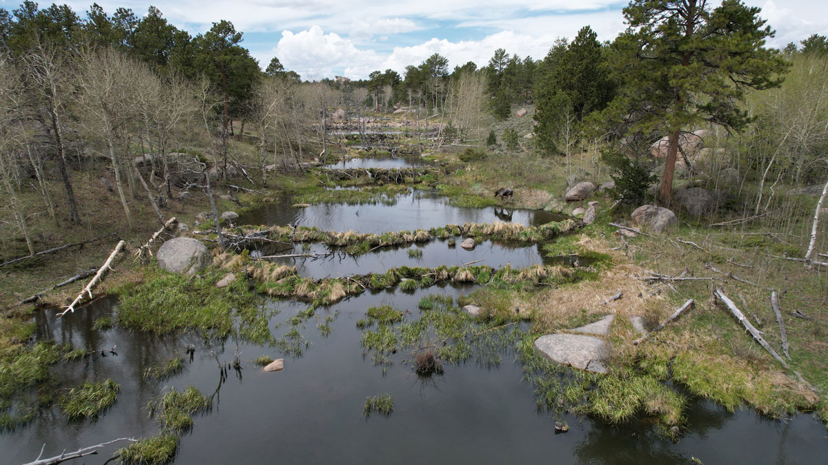
Scientists EEAGER-ly Track Beavers Across Western United States
Efficiently tracking nature’s engineers—beavers—at the scale of entire watersheds over time is now possible, thanks to a new artificial intelligence–trained model called EEAGER.
Posted inNews
Leaves Are Springing Up Earlier Along the Appalachian Trail
Satellite images of lustrous new leaves reveal changes that will have cascading effects on diverse ecosystems in the eastern United States.