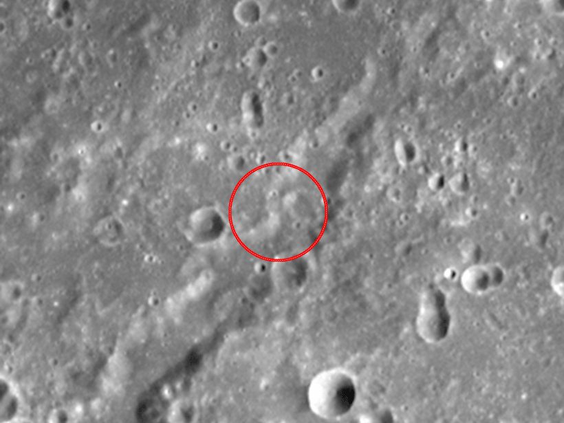
Image pairs indicate that 99% of the planet’s surface could be altered in the next 25 million years.
satellite imagery

Posted inNews
Tracking Climate Through Ship Exhaust
International regulations have reduced aerosol pollutants released from ships. Now, researchers want to use ship tracks to better understand the ambiguous effects that cleaner air has on climate.
Posted inNews
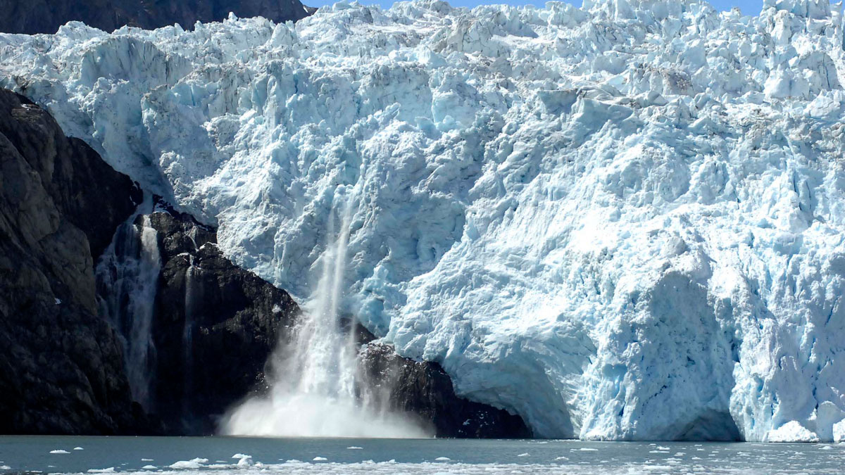
Alaskan Glaciers Advance and Retreat in Satellite Imagery
Researchers tracked 19 maritime glaciers in Kenai Fjords National Park over several decades and found that tidewater glaciers tended to experience less ice loss than other types of glaciers.

Posted inNews
Gigantic Jet of Lightning Mapped over Oklahoma
The most powerful gigantic jet ever recorded fortuitously appeared over a sensor array in Oklahoma, enabling scientists to map the structure of the phenomenon for the first time.

Posted inENGAGE, News
Caves Offer Temperate Hope for Future Moon Exploration
Large caves near the Moon’s equator maintain a temperate, stable daily temperature around 17°C.

Posted inENGAGE, News
Ninety Percent of the World’s Oil Slicks Are Caused by Humans, Not Nature
Researchers were surprised to find exactly how many oil slicks were due to human activity, highlighting the need for people to pay attention to runoff and leaks.

Posted inFeatures
Seeing Through Turbulence to Track Oil Spills in the Ocean
After oil and tar washed up on eastern Mediterranean beaches in 2021, scientists devised a way to trace the pollution back to its sources using satellite imagery and mathematics.

Posted inNews
Satellite Images Reveal a New View of Ancient Earth’s Rivers
A new method shows a key relationship between the width and makeup of Earth’s river channels over time. The technique could be applied to other terrestrial bodies, such as Mars.

Posted inNews
Satellites Show Magnitude of Human Influence on River Sediment Flux
Dam-building has decreased the amount of sediment transported by rivers, while land use changes have increased the amount.

Posted inEditors' Highlights
Volcanic Creation and Destruction of Temporary Tephra Storage
Pyroclastic density currents (PDCs) are a major threat during an explosive volcanic eruption. A new study shows that loose tephra accumulations on volcanic slopes tend to re-mobilize rapidly.