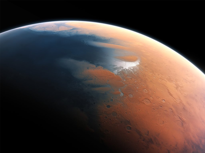
Mars’s aqueous past holds the answers to many questions about the Red Planet. A new study provides a tool for scouring planetary surfaces for ancient shorelines.
satellite imagery

Posted inNews
Pluto’s and Charon’s Craters Reveal a Solar System Deficit
The New Horizons spacecraft recorded images of craters that imply an unexpected dearth of small objects in the Kuiper Belt.

Posted inNews
Varying Impact of Earthquake- and Monsoon-Induced Landslides
Using nearly 50 years of satellite data and records stretching back millennia, scientists determine the relative frequency—and the erosional power—of monsoon- and earthquake-induced landslides in Nepal.
Posted inFeatures
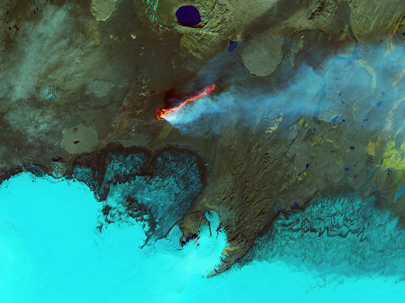
Earth’s Devastating Power, Seen by Satellite
Hurricanes, volcanoes, droughts, floods, fires, tsunamis: Satellites capture some of Earth’s most destructive forces.
Posted inNews
One-Pixel Views of Earth Reveal Seasonal Changes
By averaging satellite images of the Earth down to a single pixel, researchers trace how the planet’s mean color varies over time, results that inform observations of distant exoplanets.

Posted inOpinions
Wireless Frequency Sharing May Impede Weather Satellite Signals
The delivery of weather satellite imagery is reliable today, but will it stay that way in the future?
Posted inResearch Spotlights
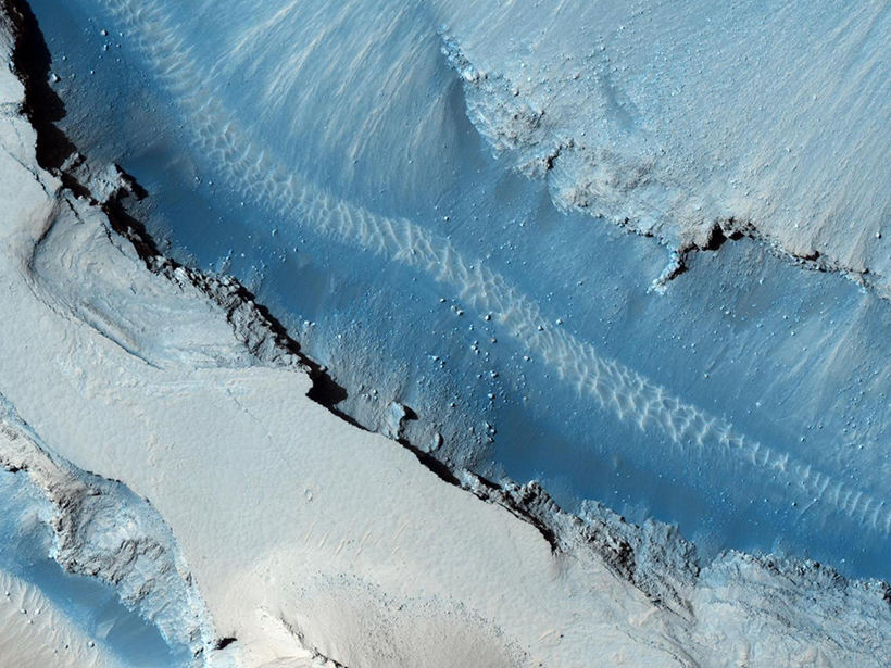
Searching for Signs of Marsquakes
Researchers use high-resolution images of Mars’s surface to look for signals of coseismic displacement.

Posted inResearch Spotlights
Evidence of Extensive Ice Deposits Near Mercury’s South Pole
New radar observations and refined illumination maps reveal uneven water ice deposits twice the size of those found around the planet’s north pole, suggesting the source may be a recent comet impact.
Posted inEditors' Highlights
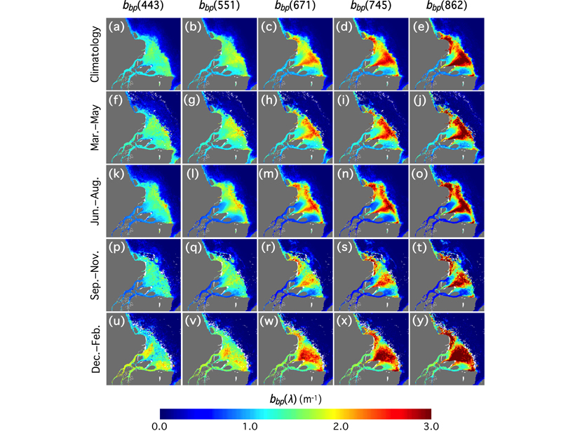
Advancing Satellite Ocean Color Observations
A new derived algorithm for particle backscattering and multi-year VIIRS climatology improves ocean color parameterization in highly turbid coastal and inland waters.

Posted inNews
Eyes in the Sky Look Closer at Under-Surveyed Northern Forests
Spaceborne images give scientists a detailed picture of the boreal forests’ tree heights, which help scientists estimate their contribution to carbon budgets.