
Offshore observations by cabled ocean-bottom pressure recorders have revealed details of the 2015 eruption of Axial Seamount submarine volcano in the Pacific Ocean.
seafloor
Posted inNews
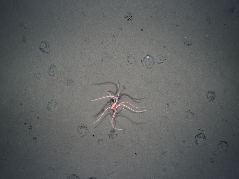
The Long-Lasting Legacy of Deep-Sea Mining
New research reveals a deep-sea mining experiment that took place 26 years ago still has significant and persistent impacts on benthic life.

Posted inEditors' Highlights
A New Global Map of Seafloor Fluid Expulsion Anomalies
The first open-source database of SEAfloor FLuid Expulsion Anomalies (SEAFLEASs) at a global scale reveals their distribution and physical parameters.

Posted inNews
Sediments May Support the Mediterranean Megaflood Hypothesis
Millions of years ago, the Mediterranean Sea may have evaporated. A newly identified body of sediments could have been deposited by the giant flood that refilled the basin.
Posted inNews
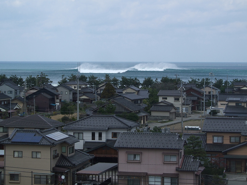
Submarine Canyons Breed Megawaves in Japan
The canyons act like a prism, focusing waves into mammoths of destruction.
Posted inResearch Spotlights
Investigating Rates of Microbial Methane Munching in the Ocean
Analyses of microbial activity in seawater samples help clarify the fate of methane released from the seafloor.

Posted inNews
Bikini Seafloor Hides Evidence of Nuclear Explosions
Seafloor mapping has revealed a crater and several shipwrecks persisting 73 years after the world’s first underwater nuclear test.

Posted inNews
Momentum Grows for Mapping the Seafloor
Initiatives like the Nippon Foundation-GEBCO Seabed 2030 Project can help us better understand the ocean.

Posted inNews
Scientists Rescue Historical Data Taken on Floating Ice Island
A never-before-published data set from the Cold War could help scientists unravel the mysterious western Arctic Ocean.
Posted inNews
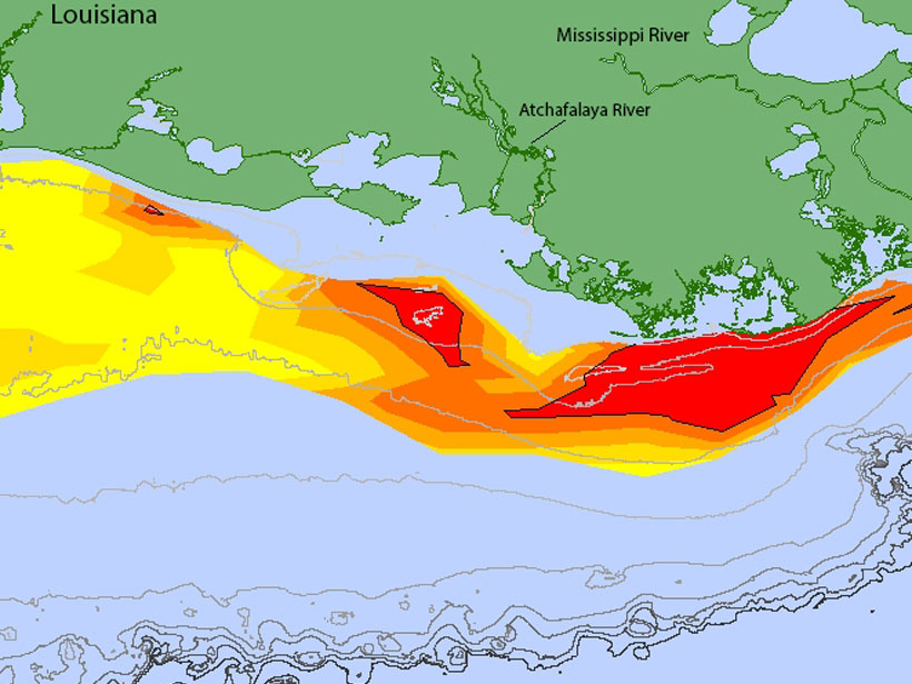
Gulf Dead Zone Looms Large in 2019
A new forecast predicts widespread hypoxia after a wet Midwest spring.